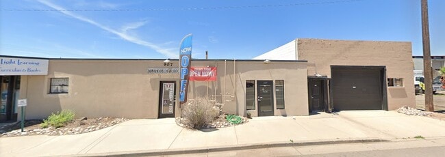
Property Record
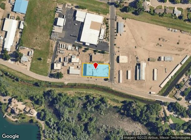
1905 W 8Th St, Loveland, CO 80537
NEARBY LISTINGS FOR SALE OR LEASE
Property Detail
1905 W 8Th St
Fort Collins, CO
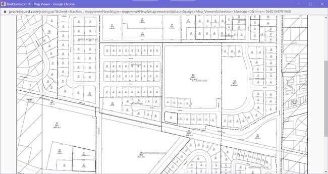
West Industrial Addtn
95151-41-002
LOT 2, BLK 1, AMENDED LOTS 2 AND 3, WEST INDUSTRIAL ADDITION, LOV (20170034924)
Warehouse
Larimer
X
Colorado
08069C1188F
2,3
2024
0.75 AC
2025
Fort Collins/Loveland
001901
Denver
28,177 SF
DEMOGRAPHICS near 1905 W 8Th St
1 Mile
3 Mile
5 Mile
2024 Total Population
7,855
61,746
90,233
2029 Population
8,191
64,581
95,153
Pop Growth 2024-2029
+ 4.28%
+ 4.59%
+ 5.45%
Average Age
43
43
43
2024 Total Households
3,376
26,160
37,566
HH Growth 2024-2029
+ 4.53%
+ 4.87%
+ 5.69%
Median Household Inc
$64,275
$72,084
$77,026
Avg Household Size
2.30
2.30
2.40
2024 Avg HH Vehicles
2.00
2.00
2.00
Median Home Value
$380,627
$401,587
$430,798
Median Year Built
1974
1981
1990
Nearby Places
Map Layers
Map Styles
 Street
 Aerial
- Restaurants
- Banks
- Shops
- Fitness
- Groceries
SALE & LEASE HISTORY
LISTING DATE
SALE/LEASE

May 14, 2020
For Lease
Nearby Properties
Address
Land Use
TOTAL SIZE
Lot Size
Zoning
Address
Land Use
TOTAL SIZE
Lot Size
Zoning
366,684 SF
29.44 AC
R3
Address
Land Use
TOTAL SIZE
Lot Size
Zoning
201,500 SF
28.43 AC
R1E
Address
Land Use
TOTAL SIZE
Lot Size
Zoning
200,420 SF
41.52 AC
R1
Address
Land Use
TOTAL SIZE
Lot Size
Zoning
117,434 SF
29.34 AC
R1
Address
Land Use
TOTAL SIZE
Lot Size
Zoning
147,663 SF
5.01 AC
R3E
Address
Land Use
TOTAL SIZE
Lot Size
Zoning
96,723 SF
9.16 AC
I
Address
Land Use
TOTAL SIZE
Lot Size
Zoning
115,599 SF
13.15 AC
P38
Address
Land Use
TOTAL SIZE
Lot Size
Zoning
125,566 SF
8.27 AC
R3E
Address
Land Use
TOTAL SIZE
Lot Size
Zoning
137,225 SF
25.76 AC
R1
Address
Land Use
TOTAL SIZE
Lot Size
Zoning
137,432 SF
12.89 AC
B
Address
Land Use
TOTAL SIZE
Lot Size
Zoning
75,000 SF
2.96 AC
B
Address
Land Use
TOTAL SIZE
Lot Size
Zoning
296,360 SF
11.88 AC
B
Address
Land Use
TOTAL SIZE
Lot Size
Zoning
123,130 SF
4.17 AC
Address
Land Use
TOTAL SIZE
Lot Size
Zoning
165,709 SF
10.52 AC
Address
Land Use
TOTAL SIZE
Lot Size
Zoning
83,954 SF
5.79 AC
FA
Address
Land Use
TOTAL SIZE
Lot Size
Zoning
269,696 SF
1.97 AC
Address
Land Use
TOTAL SIZE
Lot Size
Zoning
93,908 SF
28.86 AC
R1
Address
Land Use
TOTAL SIZE
Lot Size
Zoning
118,788 SF
14.01 AC
B
Address
Land Use
TOTAL SIZE
Lot Size
Zoning
137,950 SF
10.16 AC
Address
Land Use
TOTAL SIZE
Lot Size
Zoning
162,703 SF
14.92 AC
B
Address
Land Use
TOTAL SIZE
Lot Size
Zoning
48,952 SF
6.38 AC
FA
Address
Land Use
TOTAL SIZE
Lot Size
Zoning
101,362 SF
4.80 AC
Address
Land Use
TOTAL SIZE
Lot Size
Zoning
117,496 SF
6.24 AC
Address
Land Use
TOTAL SIZE
Lot Size
Zoning
43,646 SF
2.01 AC
Address
Land Use
TOTAL SIZE
Lot Size
Zoning
114,864 SF
0.71 AC
Address
Land Use
TOTAL SIZE
Lot Size
Zoning
41,580 SF
1.83 AC
B
Address
Land Use
TOTAL SIZE
Lot Size
Zoning
62,966 SF
0.83 AC
Address
Land Use
TOTAL SIZE
Lot Size
Zoning
48,000 SF
10 AC
P58
Address
Land Use
TOTAL SIZE
Lot Size
Zoning
139,289 SF
23.55 AC
I
Address
Land Use
TOTAL SIZE
Lot Size
Zoning
164,619 SF
11.54 AC
The World's #1 Commercial Real Estate Marketplace
Connect with us
© 2026 CoStar Group
The information above has been obtained from sources believed reliable. While we do not doubt its accuracy we have not verified it and make no guarantee, warranty or representation about it. It is your responsibility to independently confirm its accuracy and completeness. Any projections, opinions, assumptions, or estimates used are for example only and do not represent the current or future performance of the property. The value of this transaction to you depends on tax and other factors which should be evaluated by your tax, financial, and legal advisors. You and your advisors should conduct a careful, independent investigation of the property to determine to your satisfaction the suitability of the property for your needs.