Property Record
19050 Fuller Heights Rd, Triangle, VA 22172
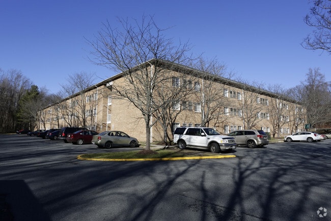

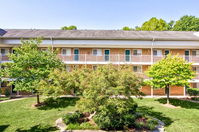
Property Detail
19050 Fuller Heights Rd
8188-90-5039
SCELZI SD P B 3-1-11A
Apartment
Prince William
R16
Virginia
AE The base floodplain where base flood elevations are provided. AE Zones are now used on new format FIRMs instead of A1-A30 Zones.
5039
2024
5.50 AC
2025
Triangle
900905
Washington, DC
35,276 SF
Washington-Arlington-Alexandria, DC-VA-MD-WV
NEARBY LISTINGS FOR SALE OR LEASE
DEMOGRAPHICS near 19050 Fuller Heights Rd
1 mile
3 mile
5 mile
2025 Total Population
6,305
36,075
77,966
2030 Population
6,581
38,200
81,723
Pop Growth 2025-2030
+ 4.38%
+ 5.89%
+ 4.82%
Average Age
34
33
35
2025 Total Households
1,890
11,516
25,352
HH Growth 2025-2030
+ 4.23%
+ 7.13%
+ 5.36%
Median Household Inc
$127,809
$89,959
$115,596
Avg Household Size
3.20
2.90
3.00
2025 Avg HH Vehicles
2.00
2.00
2.00
Median Home Value
$562,612
$476,825
$515,309
Median Year Built
1999
2000
2001
Nearby Places
Map Layers
Map Styles
 Street
 Aerial
Layers
 Traffic
 Biking
Places
Listings with unknown addresses are not visible on the map
- Restaurants
- Banks
- Shops
- Fitness
- Groceries
PUBLIC TRANSPORTATION
COMMUTER RAIL
1 (Fredericksburg Line - Virginia Railway Express)
Drive
Walk
Distance
1 (Fredericksburg Line - Virginia Railway Express)
9 min
4.3 mi
AIRPORT
Ronald Reagan Washington Ntl
Drive
Walk
Distance
Ronald Reagan Washington Ntl
46 min
31.1 mi
Washington Dulles International
Drive
Walk
Distance
Washington Dulles International
67 min
39.4 mi
Freight Ports
Port of Baltimore
Drive
Walk
Distance
Port of Baltimore
104 min
72.3 mi
Nearby Properties
Address
Land Use
TOTAL SIZE
Lot Size
Zoning
Address
Land Use
TOTAL SIZE
Lot Size
Zoning
470,850 SF
22,970.24 AC
A1
Address
Land Use
TOTAL SIZE
Lot Size
Zoning
13,253.84 AC
NZ
Address
Land Use
TOTAL SIZE
Lot Size
Zoning
1,063,690 SF
27.98 AC
PBD
Address
Land Use
TOTAL SIZE
Lot Size
Zoning
122,323 SF
134.63 AC
A1
Address
Land Use
TOTAL SIZE
Lot Size
Zoning
207,924 SF
52.53 AC
PMR
Address
Land Use
TOTAL SIZE
Lot Size
Zoning
25,264 SF
0.12 AC
R4
Address
Land Use
TOTAL SIZE
Lot Size
Zoning
153,432 SF
40 AC
A1
Address
Land Use
TOTAL SIZE
Lot Size
Zoning
262,175 SF
13.77 AC
DR4
Address
Land Use
TOTAL SIZE
Lot Size
Zoning
103,737 SF
18.62 AC
A1
Address
Land Use
TOTAL SIZE
Lot Size
Zoning
148,160 SF
10.02 AC
R16
Address
Land Use
TOTAL SIZE
Lot Size
Zoning
143,136 SF
7.50 AC
M1
Address
Land Use
TOTAL SIZE
Lot Size
Zoning
17,551 SF
642.15 AC
A1
Address
Land Use
TOTAL SIZE
Lot Size
Zoning
140,976 SF
8.63 AC
M1
Address
Land Use
TOTAL SIZE
Lot Size
Zoning
102,809 SF
5.24 AC
PBD
Address
Land Use
TOTAL SIZE
Lot Size
Zoning
86,420 SF
18.49 AC
R4
Address
Land Use
TOTAL SIZE
Lot Size
Zoning
48,996 SF
8.01 AC
R16
Address
Land Use
TOTAL SIZE
Lot Size
Zoning
103,034 SF
21.89 AC
A1
Address
Land Use
TOTAL SIZE
Lot Size
Zoning
270,475 SF
32.75 AC
M1
Address
Land Use
TOTAL SIZE
Lot Size
Zoning
54,000 SF
17.55 AC
R4
Address
Land Use
TOTAL SIZE
Lot Size
Zoning
90,000 SF
7.83 AC
M1
Address
Land Use
TOTAL SIZE
Lot Size
Zoning
81,000 SF
7.58 AC
M1
Address
Land Use
TOTAL SIZE
Lot Size
Zoning
57,128 SF
2.70 AC
B2
Address
Land Use
TOTAL SIZE
Lot Size
Zoning
46,537 SF
10 AC
DR2
Address
Land Use
TOTAL SIZE
Lot Size
Zoning
90,844 SF
8.52 AC
DB1
Address
Land Use
TOTAL SIZE
Lot Size
Zoning
14.41 AC
B1
Address
Land Use
TOTAL SIZE
Lot Size
Zoning
47,520 SF
6.24 AC
R16
Address
Land Use
TOTAL SIZE
Lot Size
Zoning
34.47 AC
PMR
Address
Land Use
TOTAL SIZE
Lot Size
Zoning
39,498 SF
3.64 AC
B2
Address
Land Use
TOTAL SIZE
Lot Size
Zoning
49,910 SF
2.39 AC
B1
The World's #1 Commercial Real Estate Marketplace
Connect with us
© 2026 CoStar Group
The information above has been obtained from sources believed reliable. While we do not doubt its accuracy we have not verified it and make no guarantee, warranty or representation about it. It is your responsibility to independently confirm its accuracy and completeness. Any projections, opinions, assumptions, or estimates used are for example only and do not represent the current or future performance of the property. The value of this transaction to you depends on tax and other factors which should be evaluated by your tax, financial, and legal advisors. You and your advisors should conduct a careful, independent investigation of the property to determine to your satisfaction the suitability of the property for your needs.