Property Record
1906 E Minnesota St, Saint Joseph, MN 56374

Property Detail
1906 E Minnesota St
St. Cloud, MN
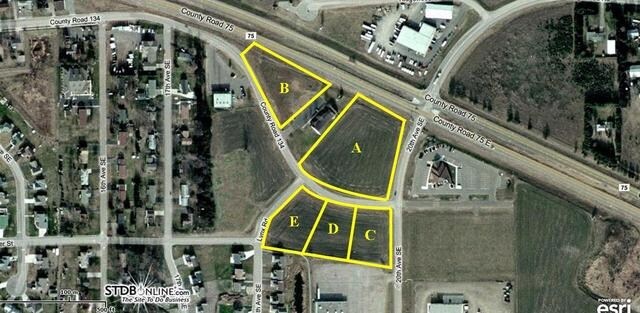
LOT 002 BLK 002 K & L PROPERTIES SECTION 11 TOWNSHIP 124 RANGE 029 SECTION 11 TOWNSHIP 124 RANGE 029
84.53547.0004
STEARNS
Agriculturalland
Minnesota
B and X Area of moderate flood hazard, usually the area between the limits of the 100-year and 500-year floods.
2
2025
1 AC
2025
Stearns County
010200
Minneapolis/St Paul
NEARBY LISTINGS FOR SALE OR LEASE
DEMOGRAPHICS near 1906 E Minnesota St
1 mile
3 mile
5 mile
2025 Total Population
3,674
16,136
49,630
2030 Population
3,848
16,712
51,767
Pop Growth 2025-2030
+ 4.74%
+ 3.57%
+ 4.31%
Average Age
33
37
38
2025 Total Households
1,173
6,223
19,734
HH Growth 2025-2030
+ 5.71%
+ 3.81%
+ 4.41%
Median Household Inc
$75,249
$69,550
$69,632
Avg Household Size
2.30
2.30
2.40
2025 Avg HH Vehicles
2.00
2.00
2.00
Median Home Value
$239,668
$271,849
$267,979
Median Year Built
1995
1994
1994
Nearby Places
Map Layers
Map Styles
 Street
 Aerial
Layers
 Traffic
 Biking
Places
Listings with unknown addresses are not visible on the map
- Restaurants
- Banks
- Shops
- Fitness
- Groceries
PUBLIC TRANSPORTATION
COMMUTER RAIL
St. Cloud Amtrak Station (Empire Builder - Amtrak)
Drive
Walk
Distance
St. Cloud Amtrak Station (Empire Builder - Amtrak)
19 min
9.8 mi
Freight Ports
Port Milwaukee
Drive
Walk
Distance
Port Milwaukee
457 min
412.5 mi
SALE & LEASE HISTORY
LISTING DATE
SALE/LEASE

Sep 24, 2016
For Sale
Nearby Properties
Address
Land Use
TOTAL SIZE
Lot Size
Zoning
Address
Land Use
TOTAL SIZE
Lot Size
Zoning
148,150 SF
71.46 AC
Address
Land Use
TOTAL SIZE
Lot Size
Zoning
269,390 SF
15.77 AC
Address
Land Use
TOTAL SIZE
Lot Size
Zoning
Address
Land Use
TOTAL SIZE
Lot Size
Zoning
33,796 SF
4.83 AC
Address
Land Use
TOTAL SIZE
Lot Size
Zoning
13,219 SF
2.19 AC
Address
Land Use
TOTAL SIZE
Lot Size
Zoning
27,694 SF
7.17 AC
Address
Land Use
TOTAL SIZE
Lot Size
Zoning
4.15 AC
Address
Land Use
TOTAL SIZE
Lot Size
Zoning
Address
Land Use
TOTAL SIZE
Lot Size
Zoning
Address
Land Use
TOTAL SIZE
Lot Size
Zoning
15,545 SF
25.34 AC
Address
Land Use
TOTAL SIZE
Lot Size
Zoning
39,604 SF
11.29 AC
Address
Land Use
TOTAL SIZE
Lot Size
Zoning
100,010 SF
10 AC
Address
Land Use
TOTAL SIZE
Lot Size
Zoning
16,562 SF
3.70 AC
Address
Land Use
TOTAL SIZE
Lot Size
Zoning
39,544 SF
6.92 AC
Address
Land Use
TOTAL SIZE
Lot Size
Zoning
Address
Land Use
TOTAL SIZE
Lot Size
Zoning
Address
Land Use
TOTAL SIZE
Lot Size
Zoning
Address
Land Use
TOTAL SIZE
Lot Size
Zoning
13,291 SF
6.05 AC
Address
Land Use
TOTAL SIZE
Lot Size
Zoning
Address
Land Use
TOTAL SIZE
Lot Size
Zoning
71,724 SF
15.99 AC
Address
Land Use
TOTAL SIZE
Lot Size
Zoning
21,116 SF
0.74 AC
Address
Land Use
TOTAL SIZE
Lot Size
Zoning
35,033 SF
49.17 AC
Address
Land Use
TOTAL SIZE
Lot Size
Zoning
14,172 SF
3.76 AC
Address
Land Use
TOTAL SIZE
Lot Size
Zoning
77,574 SF
46.14 AC
Address
Land Use
TOTAL SIZE
Lot Size
Zoning
42,000 SF
3.99 AC
Address
Land Use
TOTAL SIZE
Lot Size
Zoning
85,153 SF
6.38 AC
Address
Land Use
TOTAL SIZE
Lot Size
Zoning
9,516 SF
2.86 AC
Address
Land Use
TOTAL SIZE
Lot Size
Zoning
14,184 SF
2.54 AC
Address
Land Use
TOTAL SIZE
Lot Size
Zoning
48,906 SF
40.80 AC
Address
Land Use
TOTAL SIZE
Lot Size
Zoning
19,858 SF
1.36 AC
The World's #1 Commercial Real Estate Marketplace
Connect with us
© 2026 CoStar Group
The information above has been obtained from sources believed reliable. While we do not doubt its accuracy we have not verified it and make no guarantee, warranty or representation about it. It is your responsibility to independently confirm its accuracy and completeness. Any projections, opinions, assumptions, or estimates used are for example only and do not represent the current or future performance of the property. The value of this transaction to you depends on tax and other factors which should be evaluated by your tax, financial, and legal advisors. You and your advisors should conduct a careful, independent investigation of the property to determine to your satisfaction the suitability of the property for your needs.