Property Record
1906 N Western St, Amarillo, TX 79124
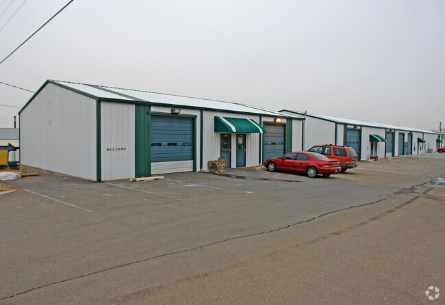

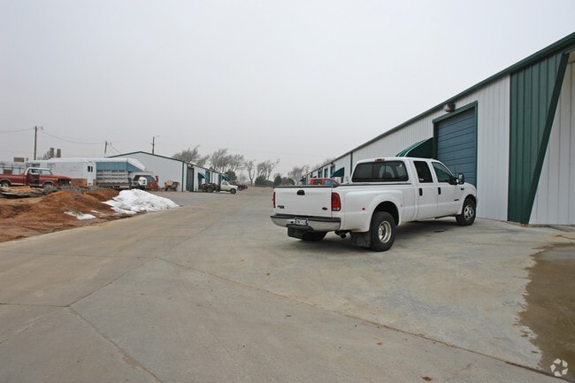
Property Detail
1906 N Western St
R-086-1460-0980-0
WEST AMA IND PK # 5 AMD, LOT 009, BLK 0006
Warehouse
Potter
I1
Texas
B and X Area of moderate flood hazard, usually the area between the limits of the 100-year and 500-year floods.
009
2024
2.47 AC
2025
Other Market Areas
015300
Amarillo, TX
34,344 SF
NEARBY LISTINGS FOR SALE OR LEASE
DEMOGRAPHICS near 1906 N Western St
1 mile
3 mile
5 mile
2024 Total Population
2,556
34,948
116,535
2029 Population
2,520
34,658
117,476
Pop Growth 2024-2029
(1.41%)
(0.83%)
+ 0.81%
Average Age
41
39
39
2024 Total Households
981
14,276
47,104
HH Growth 2024-2029
(1.73%)
(1.02%)
+ 0.87%
Median Household Inc
$65,869
$53,110
$53,434
Avg Household Size
2.50
2.30
2.40
2024 Avg HH Vehicles
2.00
2.00
2.00
Median Home Value
$231,315
$172,047
$180,181
Median Year Built
1961
1959
1965
Nearby Places
Map Layers
Map Styles
 Street
 Aerial
Transit
 Traffic
 Biking
Places
Listings with unknown addresses are not visible on the map
- Restaurants
- Banks
- Shops
- Fitness
- Groceries
PUBLIC TRANSPORTATION
AIRPORT
Rick Husband Amarillo International
Drive
Walk
Distance
Rick Husband Amarillo International
21 min
14.3 mi
Freight Ports
Tulsa Port Of Catoosa
Drive
Walk
Distance
Tulsa Port Of Catoosa
402 min
381.0 mi
Nearby Properties
Address
Land Use
TOTAL SIZE
Lot Size
Zoning
Address
Land Use
TOTAL SIZE
Lot Size
Zoning
480,593 SF
30.60 AC
O
Address
Land Use
TOTAL SIZE
Lot Size
Zoning
247,218 SF
39.36 AC
O
Address
Land Use
TOTAL SIZE
Lot Size
Zoning
207,120 SF
16.54 AC
GR
Address
Land Use
TOTAL SIZE
Lot Size
Zoning
345,555 SF
23.69 AC
PD
Address
Land Use
TOTAL SIZE
Lot Size
Zoning
116,842 SF
4.17 AC
Address
Land Use
TOTAL SIZE
Lot Size
Zoning
367,924 SF
39.99 AC
PD
Address
Land Use
TOTAL SIZE
Lot Size
Zoning
129,829 SF
14.50 AC
PD2
Address
Land Use
TOTAL SIZE
Lot Size
Zoning
145,652 SF
20.53 AC
Address
Land Use
TOTAL SIZE
Lot Size
Zoning
108,219 SF
21.87 AC
Address
Land Use
TOTAL SIZE
Lot Size
Zoning
229,869 SF
10.85 AC
Address
Land Use
TOTAL SIZE
Lot Size
Zoning
168,130 SF
16.32 AC
Address
Land Use
TOTAL SIZE
Lot Size
Zoning
99,739 SF
3.88 AC
R2
Address
Land Use
TOTAL SIZE
Lot Size
Zoning
96,942 SF
14.98 AC
PD
Address
Land Use
TOTAL SIZE
Lot Size
Zoning
327,117 SF
32.06 AC
PD
Address
Land Use
TOTAL SIZE
Lot Size
Zoning
132,914 SF
10.20 AC
PD
Address
Land Use
TOTAL SIZE
Lot Size
Zoning
67,312 SF
13.82 AC
Address
Land Use
TOTAL SIZE
Lot Size
Zoning
103,603 SF
10.43 AC
PD2
Address
Land Use
TOTAL SIZE
Lot Size
Zoning
54,962 SF
10.94 AC
R2
Address
Land Use
TOTAL SIZE
Lot Size
Zoning
95,337 SF
10.47 AC
I1
Address
Land Use
TOTAL SIZE
Lot Size
Zoning
206,486 SF
31.47 AC
GR
Address
Land Use
TOTAL SIZE
Lot Size
Zoning
127,173 SF
9.31 AC
2F
Address
Land Use
TOTAL SIZE
Lot Size
Zoning
190,951 SF
13.64 AC
GR
Address
Land Use
TOTAL SIZE
Lot Size
Zoning
95,879 SF
5.42 AC
MF1
Address
Land Use
TOTAL SIZE
Lot Size
Zoning
296,373 SF
13.20 AC
MF2
Address
Land Use
TOTAL SIZE
Lot Size
Zoning
50,351 SF
4.44 AC
Address
Land Use
TOTAL SIZE
Lot Size
Zoning
128,873 SF
7.64 AC
MF1
Address
Land Use
TOTAL SIZE
Lot Size
Zoning
51,194 SF
2.05 AC
GR
Address
Land Use
TOTAL SIZE
Lot Size
Zoning
30,580 SF
3.53 AC
PD
Address
Land Use
TOTAL SIZE
Lot Size
Zoning
69,197 SF
617.85 AC
Address
Land Use
TOTAL SIZE
Lot Size
Zoning
139,785 SF
15.45 AC
The World's #1 Commercial Real Estate Marketplace
Connect with us
© 2026 CoStar Group
The information above has been obtained from sources believed reliable. While we do not doubt its accuracy we have not verified it and make no guarantee, warranty or representation about it. It is your responsibility to independently confirm its accuracy and completeness. Any projections, opinions, assumptions, or estimates used are for example only and do not represent the current or future performance of the property. The value of this transaction to you depends on tax and other factors which should be evaluated by your tax, financial, and legal advisors. You and your advisors should conduct a careful, independent investigation of the property to determine to your satisfaction the suitability of the property for your needs.