Property Record
1909 Highway 87, Alabaster, AL 35007
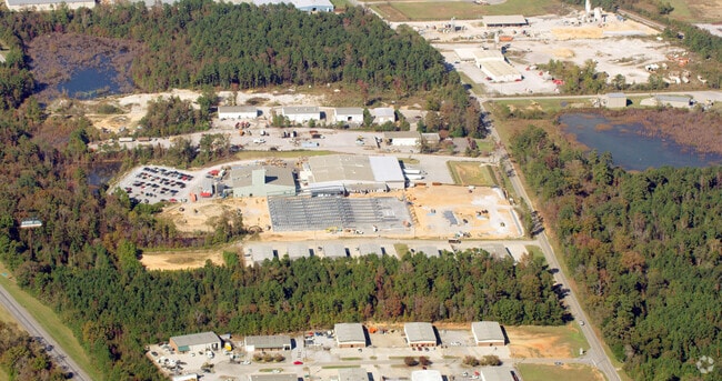

Property Detail
1909 Highway 87
Birmingham, AL
BEG SE COR NE1/4 SE1/4 W116.31N836.46 POB CONT N450.86 W1528.32 SE479.93 E1371.1 POB
224190000001005
SHELBY
Manufacturinglight
Alabama
B and X Area of moderate flood hazard, usually the area between the limits of the 100-year and 500-year floods.
1
2025
22.76 AC
2025
I-65 Corr/S Shelby County
030614
Birmingham
50,558 SF
NEARBY LISTINGS FOR SALE OR LEASE
-
-
View all Alabaster listings for sale on LoopNet.com
DEMOGRAPHICS near 1909 Highway 87
1 mile
3 mile
5 mile
2025 Total Population
240
13,060
41,580
2030 Population
255
13,700
43,376
Pop Growth 2025-2030
+ 6.25%
+ 4.90%
+ 4.32%
Average Age
39
39
39
2025 Total Households
86
4,841
15,194
HH Growth 2025-2030
+ 5.81%
+ 4.90%
+ 4.34%
Median Household Inc
$96,874
$86,551
$82,334
Avg Household Size
2.80
2.70
2.70
2025 Avg HH Vehicles
2.00
2.00
2.00
Median Home Value
$285,416
$252,702
$258,539
Median Year Built
1998
2004
1999
Nearby Places
Map Layers
Map Styles
 Street
 Aerial
Layers
 Traffic
 Biking
Places
Listings with unknown addresses are not visible on the map
- Restaurants
- Banks
- Shops
- Fitness
- Groceries
PUBLIC TRANSPORTATION
AIRPORT
Birmingham-Shuttlesworth International
Drive
Walk
Distance
Birmingham-Shuttlesworth International
42 min
31.1 mi
Nearby Properties
Address
Land Use
TOTAL SIZE
Lot Size
Zoning
Address
Land Use
TOTAL SIZE
Lot Size
Zoning
416,160 SF
58.85 AC
Address
Land Use
TOTAL SIZE
Lot Size
Zoning
573,600 SF
19.96 AC
Address
Land Use
TOTAL SIZE
Lot Size
Zoning
110,860 SF
16.90 AC
Address
Land Use
TOTAL SIZE
Lot Size
Zoning
500,500 SF
17.45 AC
Address
Land Use
TOTAL SIZE
Lot Size
Zoning
220,000 SF
21.76 AC
Address
Land Use
TOTAL SIZE
Lot Size
Zoning
249,500 SF
16.15 AC
Address
Land Use
TOTAL SIZE
Lot Size
Zoning
14,625 SF
118 AC
Address
Land Use
TOTAL SIZE
Lot Size
Zoning
38,551 SF
17.81 AC
Address
Land Use
TOTAL SIZE
Lot Size
Zoning
126,897 SF
9.43 AC
Address
Land Use
TOTAL SIZE
Lot Size
Zoning
129,305 SF
50 AC
Address
Land Use
TOTAL SIZE
Lot Size
Zoning
6,234 SF
33 AC
Address
Land Use
TOTAL SIZE
Lot Size
Zoning
8,416 SF
16.12 AC
Address
Land Use
TOTAL SIZE
Lot Size
Zoning
30,158 SF
8.35 AC
Address
Land Use
TOTAL SIZE
Lot Size
Zoning
9,728 SF
11.01 AC
Address
Land Use
TOTAL SIZE
Lot Size
Zoning
208,000 SF
11.91 AC
Address
Land Use
TOTAL SIZE
Lot Size
Zoning
154,440 SF
12.03 AC
Address
Land Use
TOTAL SIZE
Lot Size
Zoning
121,500 SF
13.80 AC
Address
Land Use
TOTAL SIZE
Lot Size
Zoning
5,000 SF
43 AC
Address
Land Use
TOTAL SIZE
Lot Size
Zoning
139,170 SF
15.30 AC
Address
Land Use
TOTAL SIZE
Lot Size
Zoning
21,000 SF
5.44 AC
Address
Land Use
TOTAL SIZE
Lot Size
Zoning
672 SF
7.33 AC
Address
Land Use
TOTAL SIZE
Lot Size
Zoning
241.36 AC
Address
Land Use
TOTAL SIZE
Lot Size
Zoning
28,090 SF
4.02 AC
Address
Land Use
TOTAL SIZE
Lot Size
Zoning
46,444 SF
2.70 AC
Address
Land Use
TOTAL SIZE
Lot Size
Zoning
14,163 SF
12.78 AC
Address
Land Use
TOTAL SIZE
Lot Size
Zoning
6,275 SF
290 AC
Address
Land Use
TOTAL SIZE
Lot Size
Zoning
92,035 SF
10.11 AC
Address
Land Use
TOTAL SIZE
Lot Size
Zoning
14,345 SF
36 AC
Address
Land Use
TOTAL SIZE
Lot Size
Zoning
85,945 SF
7.20 AC
The World's #1 Commercial Real Estate Marketplace
Connect with us
© 2026 CoStar Group
The information above has been obtained from sources believed reliable. While we do not doubt its accuracy we have not verified it and make no guarantee, warranty or representation about it. It is your responsibility to independently confirm its accuracy and completeness. Any projections, opinions, assumptions, or estimates used are for example only and do not represent the current or future performance of the property. The value of this transaction to you depends on tax and other factors which should be evaluated by your tax, financial, and legal advisors. You and your advisors should conduct a careful, independent investigation of the property to determine to your satisfaction the suitability of the property for your needs.