Property Record
1909 Kyle Ct, Gastonia, NC 28052
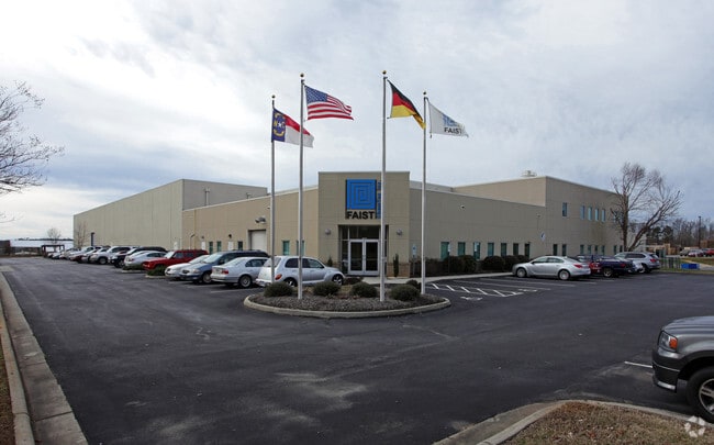

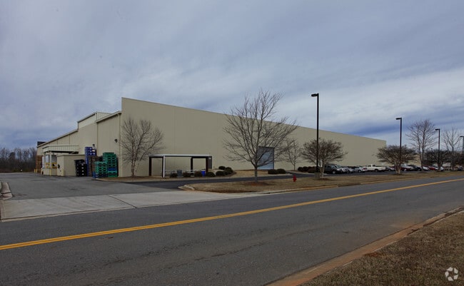
Property Detail
1909 Kyle Ct
152762
DELTA PARK L 6 11 030 023 02 000
Industrialgeneral
GASTON
INDS1
North Carolina
B and X Area of moderate flood hazard, usually the area between the limits of the 100-year and 500-year floods.
13.12 AC
2025
Gaston County
2025
Charlotte
031600
Charlotte-Concord-Gastonia, NC-SC
110,840 SF
NEARBY LISTINGS FOR SALE OR LEASE
DEMOGRAPHICS near 1909 Kyle Ct
1 mile
3 mile
5 mile
2025 Total Population
1,663
28,120
72,035
2030 Population
1,761
29,740
75,873
Pop Growth 2025-2030
+ 5.89%
+ 5.76%
+ 5.33%
Average Age
38
39
39
2025 Total Households
662
11,053
28,545
HH Growth 2025-2030
+ 6.19%
+ 5.95%
+ 5.50%
Median Household Inc
$47,620
$47,772
$52,150
Avg Household Size
2.50
2.50
2.40
2025 Avg HH Vehicles
2.00
2.00
2.00
Median Home Value
$156,763
$203,470
$224,832
Median Year Built
1970
1970
1972
Nearby Places
Map Layers
Map Styles
 Street
 Aerial
Layers
 Traffic
 Biking
Places
Listings with unknown addresses are not visible on the map
- Restaurants
- Banks
- Shops
- Fitness
- Groceries
PUBLIC TRANSPORTATION
COMMUTER RAIL
Gastonia Amtrak Station (Crescent - Amtrak)
Drive
Walk
Distance
Gastonia Amtrak Station (Crescent - Amtrak)
10 min
6.3 mi
AIRPORT
Charlotte/Douglas International
Drive
Walk
Distance
Charlotte/Douglas International
35 min
21.0 mi
Freight Ports
North Charleston Terminal
Drive
Walk
Distance
North Charleston Terminal
249 min
217.1 mi
Nearby Properties
Address
Land Use
TOTAL SIZE
Lot Size
Zoning
Address
Land Use
TOTAL SIZE
Lot Size
Zoning
68.71 AC
Address
Land Use
TOTAL SIZE
Lot Size
Zoning
4,519 SF
2.10 AC
Address
Land Use
TOTAL SIZE
Lot Size
Zoning
268,563 SF
116.96 AC
MANU1
Address
Land Use
TOTAL SIZE
Lot Size
Zoning
17.37 AC
Address
Land Use
TOTAL SIZE
Lot Size
Zoning
29.89 AC
Address
Land Use
TOTAL SIZE
Lot Size
Zoning
Address
Land Use
TOTAL SIZE
Lot Size
Zoning
312,465 SF
35.23 AC
Address
Land Use
TOTAL SIZE
Lot Size
Zoning
192,315 SF
44.12 AC
INDS1
Address
Land Use
TOTAL SIZE
Lot Size
Zoning
2,250 SF
27.79 AC
OFF01
Address
Land Use
TOTAL SIZE
Lot Size
Zoning
19,360 SF
5.17 AC
INDS1
Address
Land Use
TOTAL SIZE
Lot Size
Zoning
539,988 SF
36.32 AC
STOR6
Address
Land Use
TOTAL SIZE
Lot Size
Zoning
192,978 SF
22.67 AC
RET05
Address
Land Use
TOTAL SIZE
Lot Size
Zoning
Address
Land Use
TOTAL SIZE
Lot Size
Zoning
411,076 SF
67.01 AC
INDS2
Address
Land Use
TOTAL SIZE
Lot Size
Zoning
176,657 SF
16.19 AC
Address
Land Use
TOTAL SIZE
Lot Size
Zoning
112,513 SF
13.09 AC
PUB01
Address
Land Use
TOTAL SIZE
Lot Size
Zoning
154,681 SF
63.07 AC
INDS1
Address
Land Use
TOTAL SIZE
Lot Size
Zoning
1,760 SF
3.51 AC
Address
Land Use
TOTAL SIZE
Lot Size
Zoning
163,100 SF
41.60 AC
INDS1
Address
Land Use
TOTAL SIZE
Lot Size
Zoning
44,794 SF
46.96 AC
PUB01
Address
Land Use
TOTAL SIZE
Lot Size
Zoning
167,332 SF
19.92 AC
INDS1
Address
Land Use
TOTAL SIZE
Lot Size
Zoning
148,300 SF
12.59 AC
INDS2
Address
Land Use
TOTAL SIZE
Lot Size
Zoning
105,285 SF
25.27 AC
INDS1
Address
Land Use
TOTAL SIZE
Lot Size
Zoning
514,404 SF
27.84 AC
INDS2
Address
Land Use
TOTAL SIZE
Lot Size
Zoning
33,134 SF
6.80 AC
Address
Land Use
TOTAL SIZE
Lot Size
Zoning
780 SF
7.07 AC
APT01
Address
Land Use
TOTAL SIZE
Lot Size
Zoning
20,160 SF
18.47 AC
PUB01
Address
Land Use
TOTAL SIZE
Lot Size
Zoning
44,224 SF
3.32 AC
Address
Land Use
TOTAL SIZE
Lot Size
Zoning
952 SF
22.68 AC
SHOP1
Address
Land Use
TOTAL SIZE
Lot Size
Zoning
16,628 SF
27.04 AC
PUB01
The World's #1 Commercial Real Estate Marketplace
Connect with us
© 2026 CoStar Group
The information above has been obtained from sources believed reliable. While we do not doubt its accuracy we have not verified it and make no guarantee, warranty or representation about it. It is your responsibility to independently confirm its accuracy and completeness. Any projections, opinions, assumptions, or estimates used are for example only and do not represent the current or future performance of the property. The value of this transaction to you depends on tax and other factors which should be evaluated by your tax, financial, and legal advisors. You and your advisors should conduct a careful, independent investigation of the property to determine to your satisfaction the suitability of the property for your needs.