Property Record
1909 N Unknown Pkwy, Merritt Island, FL 32953

NEARBY LISTINGS FOR SALE OR LEASE
Property Detail
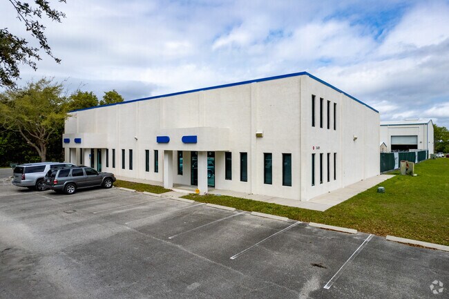
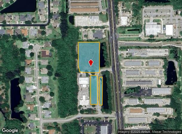
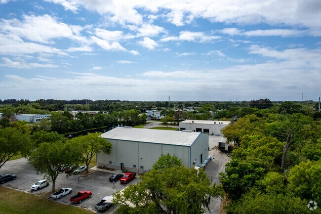
1909 N Unknown Pkwy
Palm Bay-Melbourne-Titusville, FL
Parkway Business Complex North
24-36-11-00-00261.0-0000.00
PART OF NW 1/4 OF NW 1/4 W OF ST RD 3 DESC AS THAT PART OF ORB 1599 PG 710 LYING N OF ORB 3309 PG 2660 EXC ORB 5689 PG 4861
Industrialacreage
Brevard
X
Florida
12009C0340H
2.68 AC
2024
Brevard County
2025
Orlando
069801
DEMOGRAPHICS near 1909 N Unknown Pkwy
1 Mile
3 Mile
5 Mile
2024 Total Population
2,613
18,650
60,222
2029 Population
2,816
20,204
65,731
Pop Growth 2024-2029
+ 7.77%
+ 8.33%
+ 9.15%
Average Age
46
47
45
2024 Total Households
1,058
7,796
25,938
HH Growth 2024-2029
+ 7.56%
+ 8.11%
+ 9.04%
Median Household Inc
$124,582
$93,763
$59,341
Avg Household Size
2.40
2.30
2.20
2024 Avg HH Vehicles
2.00
2.00
2.00
Median Home Value
$378,772
$382,236
$309,435
Median Year Built
1998
1986
1976
Nearby Places
Map Layers
Map Styles
 Street
 Aerial
- Restaurants
- Banks
- Shops
- Fitness
- Groceries
PUBLIC TRANSPORTATION
AIRPORT
Melbourne Orlando International
DRIVE
WALK
Distance
Melbourne Orlando International
47 min
33.9 mi
Freight Ports
Port Canaveral
DRIVE
WALK
Distance
Port Canaveral
11 min
6.9 mi
SALE & LEASE HISTORY
LISTING DATE
SALE/LEASE

Sep 17, 2020
For Sale
Nearby Properties
Address
Land Use
TOTAL SIZE
Lot Size
Zoning
Address
Land Use
TOTAL SIZE
Lot Size
Zoning
16,433 SF
89.08 AC
GML
Address
Land Use
TOTAL SIZE
Lot Size
Zoning
256,094 SF
37.37 AC
BU1
Address
Land Use
TOTAL SIZE
Lot Size
Zoning
587.88 AC
Address
Land Use
TOTAL SIZE
Lot Size
Zoning
180,092 SF
38.20 AC
PIP
Address
Land Use
TOTAL SIZE
Lot Size
Zoning
212,232 SF
20.80 AC
RU215
Address
Land Use
TOTAL SIZE
Lot Size
Zoning
105,278 SF
14.75 AC
AU
Address
Land Use
TOTAL SIZE
Lot Size
Zoning
262,753 SF
24.35 AC
PIP
Address
Land Use
TOTAL SIZE
Lot Size
Zoning
212,534 SF
14.50 AC
Address
Land Use
TOTAL SIZE
Lot Size
Zoning
6,481 SF
22.73 AC
PIP
Address
Land Use
TOTAL SIZE
Lot Size
Zoning
67,595 SF
6.62 AC
Address
Land Use
TOTAL SIZE
Lot Size
Zoning
Address
Land Use
TOTAL SIZE
Lot Size
Zoning
70,834 SF
15.33 AC
INL
Address
Land Use
TOTAL SIZE
Lot Size
Zoning
130,361 SF
12.77 AC
BU1
Address
Land Use
TOTAL SIZE
Lot Size
Zoning
68,218 SF
9.07 AC
BU1
Address
Land Use
TOTAL SIZE
Lot Size
Zoning
79,845 SF
8.47 AC
RU230
Address
Land Use
TOTAL SIZE
Lot Size
Zoning
61,207 SF
16.03 AC
GU
Address
Land Use
TOTAL SIZE
Lot Size
Zoning
109.06 AC
EU-2
Address
Land Use
TOTAL SIZE
Lot Size
Zoning
73,708 SF
8.60 AC
GMLI
Address
Land Use
TOTAL SIZE
Lot Size
Zoning
120,722 SF
15.35 AC
BU1/BSP
Address
Land Use
TOTAL SIZE
Lot Size
Zoning
63,106 SF
271.68 AC
INL
Address
Land Use
TOTAL SIZE
Lot Size
Zoning
104,594 SF
15.26 AC
BU-1
Address
Land Use
TOTAL SIZE
Lot Size
Zoning
71,307 SF
8.08 AC
IN(L)
Address
Land Use
TOTAL SIZE
Lot Size
Zoning
46,975 SF
10.90 AC
INL
Address
Land Use
TOTAL SIZE
Lot Size
Zoning
15,320 SF
113.85 AC
AU
Address
Land Use
TOTAL SIZE
Lot Size
Zoning
87,483 SF
4.20 AC
PIP(CUP)
Address
Land Use
TOTAL SIZE
Lot Size
Zoning
53,465 SF
1.96 AC
PUD
Address
Land Use
TOTAL SIZE
Lot Size
Zoning
58,962 SF
4.01 AC
BU1
Address
Land Use
TOTAL SIZE
Lot Size
Zoning
95.81 AC
GML-H
Address
Land Use
TOTAL SIZE
Lot Size
Zoning
66,594 SF
23.30 AC
IN(L)
Address
Land Use
TOTAL SIZE
Lot Size
Zoning
34,408 SF
9.03 AC
AU
The World's #1 Commercial Real Estate Marketplace
Connect with us
© 2025 CoStar Group
The information above has been obtained from sources believed reliable. While we do not doubt its accuracy we have not verified it and make no guarantee, warranty or representation about it. It is your responsibility to independently confirm its accuracy and completeness. Any projections, opinions, assumptions, or estimates used are for example only and do not represent the current or future performance of the property. The value of this transaction to you depends on tax and other factors which should be evaluated by your tax, financial, and legal advisors. You and your advisors should conduct a careful, independent investigation of the property to determine to your satisfaction the suitability of the property for your needs.