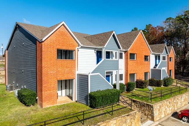
Property Record
1909 Shiloh Rd, Tyler, TX 75703

Property Detail
1909 Shiloh Rd
1-00000-0636-00-020002
ABST A0636 M UNIVERSITYBLOCK 1434 TRACT 20.2
Apartment
Smith
RMF
Texas
B and X Area of moderate flood hazard, usually the area between the limits of the 100-year and 500-year floods.
9.64 AC
2025
Tyler
2025
Other Market Areas
002010
Tyler, TX
14,752 SF
NEARBY LISTINGS FOR SALE OR LEASE
DEMOGRAPHICS near 1909 Shiloh Rd
1 mile
3 mile
5 mile
2025 Total Population
11,080
59,314
102,485
2030 Population
11,623
62,193
107,908
Pop Growth 2025-2030
+ 4.90%
+ 4.85%
+ 5.29%
Average Age
37
39
39
2025 Total Households
4,831
25,065
40,937
HH Growth 2025-2030
+ 4.33%
+ 4.37%
+ 4.80%
Median Household Inc
$67,719
$73,424
$68,909
Avg Household Size
2.20
2.20
2.30
2025 Avg HH Vehicles
2.00
2.00
2.00
Median Home Value
$285,641
$285,263
$279,645
Median Year Built
1986
1984
1983
Nearby Places
Map Layers
Map Styles
 Street
 Aerial
Transit
 Traffic
 Biking
Places
Listings with unknown addresses are not visible on the map
- Restaurants
- Banks
- Shops
- Fitness
- Groceries
PUBLIC TRANSPORTATION
AIRPORT
Tyler Pounds Regional
Drive
Walk
Distance
Tyler Pounds Regional
22 min
12.8 mi
Nearby Properties
Address
Land Use
TOTAL SIZE
Lot Size
Zoning
Address
Land Use
TOTAL SIZE
Lot Size
Zoning
22,500 SF
214.44 AC
R1A
Address
Land Use
TOTAL SIZE
Lot Size
Zoning
13,067 SF
151.32 AC
M2
Address
Land Use
TOTAL SIZE
Lot Size
Zoning
9.98 AC
Address
Land Use
TOTAL SIZE
Lot Size
Zoning
18.37 AC
R1A
Address
Land Use
TOTAL SIZE
Lot Size
Zoning
403,396 SF
45.40 AC
C4
Address
Land Use
TOTAL SIZE
Lot Size
Zoning
49,544 SF
28.62 AC
Address
Land Use
TOTAL SIZE
Lot Size
Zoning
168,390 SF
7.51 AC
Address
Land Use
TOTAL SIZE
Lot Size
Zoning
37.07 AC
Address
Land Use
TOTAL SIZE
Lot Size
Zoning
16.53 AC
Address
Land Use
TOTAL SIZE
Lot Size
Zoning
84,400 SF
13.98 AC
Address
Land Use
TOTAL SIZE
Lot Size
Zoning
5,068 SF
18.35 AC
RMF
Address
Land Use
TOTAL SIZE
Lot Size
Zoning
25 AC
INT
Address
Land Use
TOTAL SIZE
Lot Size
Zoning
2,774 SF
16.15 AC
RMF
Address
Land Use
TOTAL SIZE
Lot Size
Zoning
3,724 SF
33.26 AC
RMF
Address
Land Use
TOTAL SIZE
Lot Size
Zoning
2,592 SF
9.20 AC
PMF
Address
Land Use
TOTAL SIZE
Lot Size
Zoning
300 SF
11.17 AC
RMF
Address
Land Use
TOTAL SIZE
Lot Size
Zoning
43,165 SF
7.33 AC
Address
Land Use
TOTAL SIZE
Lot Size
Zoning
20,071 SF
7.43 AC
Address
Land Use
TOTAL SIZE
Lot Size
Zoning
66.86 AC
R1A
Address
Land Use
TOTAL SIZE
Lot Size
Zoning
10.51 AC
Address
Land Use
TOTAL SIZE
Lot Size
Zoning
37,536 SF
16.81 AC
RMF
Address
Land Use
TOTAL SIZE
Lot Size
Zoning
19,450 SF
20.11 AC
INT
Address
Land Use
TOTAL SIZE
Lot Size
Zoning
3,385 SF
10.50 AC
R1A
Address
Land Use
TOTAL SIZE
Lot Size
Zoning
75,999 SF
5.09 AC
Address
Land Use
TOTAL SIZE
Lot Size
Zoning
8,279 SF
14.06 AC
RMF
Address
Land Use
TOTAL SIZE
Lot Size
Zoning
88,964 SF
11.33 AC
Address
Land Use
TOTAL SIZE
Lot Size
Zoning
1,867 SF
13.63 AC
RMF
Address
Land Use
TOTAL SIZE
Lot Size
Zoning
1,920 SF
12.04 AC
RMF
Address
Land Use
TOTAL SIZE
Lot Size
Zoning
1,813 SF
9.51 AC
RMF
The World's #1 Commercial Real Estate Marketplace
Connect with us
© 2026 CoStar Group
The information above has been obtained from sources believed reliable. While we do not doubt its accuracy we have not verified it and make no guarantee, warranty or representation about it. It is your responsibility to independently confirm its accuracy and completeness. Any projections, opinions, assumptions, or estimates used are for example only and do not represent the current or future performance of the property. The value of this transaction to you depends on tax and other factors which should be evaluated by your tax, financial, and legal advisors. You and your advisors should conduct a careful, independent investigation of the property to determine to your satisfaction the suitability of the property for your needs.