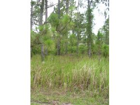
Property Record
1909 Unknown, Cocoa, FL 32926

NEARBY LISTINGS FOR SALE OR LEASE
Property Detail
1909 Unknown
Palm Bay-Melbourne-Titusville, FL
Canaveral Groves Sub
24-35-29-01-00015.0-0010.00
CANAVERAL GROVES SUBD SB 2 PG 65 LOT 10 BLK 15
Commercialacreage
Brevard
AE
Florida
12009C0425G
10
2024
0.69 AC
2025
Brevard County
0712001076
Orlando
DEMOGRAPHICS near 1909 Unknown
1 Mile
3 Mile
5 Mile
2024 Total Population
4,084
34,854
67,368
2029 Population
4,540
38,345
73,775
Pop Growth 2024-2029
+ 11.17%
+ 10.02%
+ 9.51%
Average Age
41
41
43
2024 Total Households
1,544
14,066
27,818
HH Growth 2024-2029
+ 10.82%
+ 9.78%
+ 9.28%
Median Household Inc
$34,906
$45,690
$54,900
Avg Household Size
2.50
2.40
2.30
2024 Avg HH Vehicles
2.00
2.00
2.00
Median Home Value
$145,108
$192,524
$239,729
Median Year Built
1977
1979
1981
Nearby Places
Map Layers
Map Styles
 Street
 Aerial
- Restaurants
- Banks
- Shops
- Fitness
- Groceries
PUBLIC TRANSPORTATION
AIRPORT
Melbourne Orlando International
DRIVE
WALK
Distance
Melbourne Orlando International
38 min
27.9 mi
Orlando International
DRIVE
WALK
Distance
Orlando International
39 min
33.1 mi
Freight Ports
Port Canaveral
DRIVE
WALK
Distance
Port Canaveral
22 min
15.6 mi
SALE & LEASE HISTORY
LISTING DATE
SALE/LEASE

Sep 25, 2019
For Sale
Sep 24, 2016
For Sale
Nearby Properties
Address
Land Use
TOTAL SIZE
Lot Size
Zoning
Address
Land Use
TOTAL SIZE
Lot Size
Zoning
102,141 SF
47.88 AC
BU1
Address
Land Use
TOTAL SIZE
Lot Size
Zoning
101,945 SF
11.15 AC
CG
Address
Land Use
TOTAL SIZE
Lot Size
Zoning
141,592 SF
20.22 AC
CG
Address
Land Use
TOTAL SIZE
Lot Size
Zoning
49,208 SF
18.28 AC
Address
Land Use
TOTAL SIZE
Lot Size
Zoning
65,316 SF
956.57 AC
GML(H)
Address
Land Use
TOTAL SIZE
Lot Size
Zoning
66,210 SF
12.22 AC
M2
Address
Land Use
TOTAL SIZE
Lot Size
Zoning
62,439 SF
14.19 AC
TU-2
Address
Land Use
TOTAL SIZE
Lot Size
Zoning
78,343 SF
8.50 AC
CG
Address
Land Use
TOTAL SIZE
Lot Size
Zoning
33,221 SF
6.31 AC
Address
Land Use
TOTAL SIZE
Lot Size
Zoning
3,270 SF
184.41 AC
GML
Address
Land Use
TOTAL SIZE
Lot Size
Zoning
13,616 SF
12.92 AC
Address
Land Use
TOTAL SIZE
Lot Size
Zoning
49,460 SF
5 AC
CG
Address
Land Use
TOTAL SIZE
Lot Size
Zoning
283.81 AC
OAC
Address
Land Use
TOTAL SIZE
Lot Size
Zoning
2,520 SF
69.41 AC
IU
Address
Land Use
TOTAL SIZE
Lot Size
Zoning
33,480 SF
3.03 AC
M2
Address
Land Use
TOTAL SIZE
Lot Size
Zoning
30,240 SF
14.76 AC
BU2
Address
Land Use
TOTAL SIZE
Lot Size
Zoning
20,619 SF
4.55 AC
BU-1
Address
Land Use
TOTAL SIZE
Lot Size
Zoning
12,818 SF
8 AC
IN(L)
Address
Land Use
TOTAL SIZE
Lot Size
Zoning
37.84 AC
M2
Address
Land Use
TOTAL SIZE
Lot Size
Zoning
3,560 SF
1.68 AC
BU-1
Address
Land Use
TOTAL SIZE
Lot Size
Zoning
9,324 SF
1.65 AC
BU-1
Address
Land Use
TOTAL SIZE
Lot Size
Zoning
4.83 AC
CW
Address
Land Use
TOTAL SIZE
Lot Size
Zoning
16,302 SF
13.97 AC
AGR
Address
Land Use
TOTAL SIZE
Lot Size
Zoning
5,293 SF
3.28 AC
RR-1
Address
Land Use
TOTAL SIZE
Lot Size
Zoning
14,230 SF
21.95 AC
RU210
Address
Land Use
TOTAL SIZE
Lot Size
Zoning
5.09 AC
CG
Address
Land Use
TOTAL SIZE
Lot Size
Zoning
7,576 SF
1.33 AC
M2
Address
Land Use
TOTAL SIZE
Lot Size
Zoning
6,009 SF
0.72 AC
TU-2
Address
Land Use
TOTAL SIZE
Lot Size
Zoning
15.25 AC
CG
Address
Land Use
TOTAL SIZE
Lot Size
Zoning
17.31 AC
TR-1
The World's #1 Commercial Real Estate Marketplace
Connect with us
© 2025 CoStar Group
The information above has been obtained from sources believed reliable. While we do not doubt its accuracy we have not verified it and make no guarantee, warranty or representation about it. It is your responsibility to independently confirm its accuracy and completeness. Any projections, opinions, assumptions, or estimates used are for example only and do not represent the current or future performance of the property. The value of this transaction to you depends on tax and other factors which should be evaluated by your tax, financial, and legal advisors. You and your advisors should conduct a careful, independent investigation of the property to determine to your satisfaction the suitability of the property for your needs.