Property Record
1909 Unknown, Cocoa, FL 32927

Property Detail
1909 Unknown
Palm Bay-Melbourne-Titusville, FL
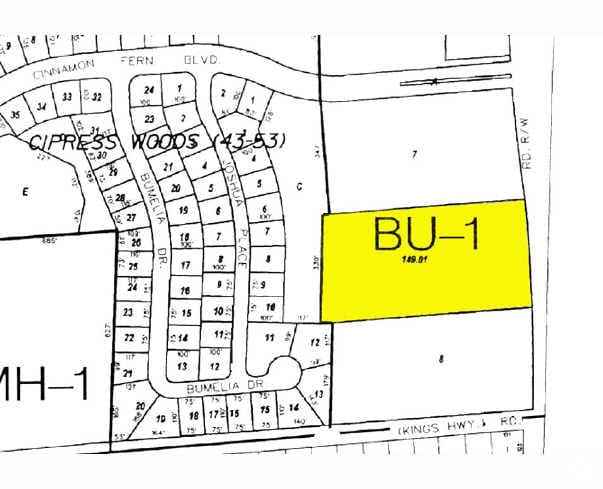
COCOA INDIAN RIVER PROPERTIES MAP NO 2 E 662.87 FT OF TRACT 149 EXC RD R/W
23-35-15-BB-00000.0-0149.01
BREVARD
Commercialacreage
Florida
BU1
149
B and X Area of moderate flood hazard, usually the area between the limits of the 100-year and 500-year floods.
4.72 AC
2024
Brevard County
2025
Orlando
061202
NEARBY LISTINGS FOR SALE OR LEASE
DEMOGRAPHICS near 1909 Unknown
1 mile
3 mile
5 mile
2025 Total Population
6,429
25,197
48,259
2030 Population
6,797
26,624
51,251
Pop Growth 2025-2030
+ 5.72%
+ 5.66%
+ 6.20%
Average Age
43
43
44
2025 Total Households
2,463
9,863
19,280
HH Growth 2025-2030
+ 5.44%
+ 5.42%
+ 6.17%
Median Household Inc
$87,096
$85,252
$82,204
Avg Household Size
2.50
2.50
2.40
2025 Avg HH Vehicles
2.00
2.00
2.00
Median Home Value
$302,597
$289,656
$303,961
Median Year Built
1989
1988
1989
Nearby Places
Map Layers
Map Styles
 Street
 Aerial
Layers
 Traffic
 Biking
Places
Listings with unknown addresses are not visible on the map
- Restaurants
- Banks
- Shops
- Fitness
- Groceries
PUBLIC TRANSPORTATION
AIRPORT
Melbourne Orlando International
Drive
Walk
Distance
Melbourne Orlando International
48 min
35.1 mi
Freight Ports
Port Canaveral
Drive
Walk
Distance
Port Canaveral
26 min
17.3 mi
Nearby Properties
Address
Land Use
TOTAL SIZE
Lot Size
Zoning
Address
Land Use
TOTAL SIZE
Lot Size
Zoning
438,322 SF
148 AC
GML
Address
Land Use
TOTAL SIZE
Lot Size
Zoning
709,592 SF
201.35 AC
IU-1
Address
Land Use
TOTAL SIZE
Lot Size
Zoning
248,110 SF
12.77 AC
Address
Land Use
TOTAL SIZE
Lot Size
Zoning
97,548 SF
9.18 AC
Address
Land Use
TOTAL SIZE
Lot Size
Zoning
203,226 SF
511.04 AC
P
Address
Land Use
TOTAL SIZE
Lot Size
Zoning
152,096 SF
62.14 AC
PID
Address
Land Use
TOTAL SIZE
Lot Size
Zoning
105,543 SF
16.08 AC
RU19
Address
Land Use
TOTAL SIZE
Lot Size
Zoning
179,499 SF
67.33 AC
CC
Address
Land Use
TOTAL SIZE
Lot Size
Zoning
73,476 SF
31.58 AC
BU1
Address
Land Use
TOTAL SIZE
Lot Size
Zoning
72,664 SF
6.44 AC
PID
Address
Land Use
TOTAL SIZE
Lot Size
Zoning
141,221 SF
85 AC
IU
Address
Land Use
TOTAL SIZE
Lot Size
Zoning
96,436 SF
19.10 AC
RU19
Address
Land Use
TOTAL SIZE
Lot Size
Zoning
60,256 SF
8.44 AC
PID
Address
Land Use
TOTAL SIZE
Lot Size
Zoning
48,555 SF
42.28 AC
IU
Address
Land Use
TOTAL SIZE
Lot Size
Zoning
63,083 SF
18.93 AC
GU
Address
Land Use
TOTAL SIZE
Lot Size
Zoning
188,466 SF
10 AC
PID
Address
Land Use
TOTAL SIZE
Lot Size
Zoning
70,062 SF
10.01 AC
PID
Address
Land Use
TOTAL SIZE
Lot Size
Zoning
89,772 SF
10.12 AC
BU1
Address
Land Use
TOTAL SIZE
Lot Size
Zoning
83,661 SF
15.08 AC
PID
Address
Land Use
TOTAL SIZE
Lot Size
Zoning
95,196 SF
9.32 AC
PID
Address
Land Use
TOTAL SIZE
Lot Size
Zoning
56,491 SF
16.45 AC
PID
Address
Land Use
TOTAL SIZE
Lot Size
Zoning
59,557 SF
7.28 AC
BU1
Address
Land Use
TOTAL SIZE
Lot Size
Zoning
52,526 SF
5.15 AC
PID
Address
Land Use
TOTAL SIZE
Lot Size
Zoning
73,134 SF
9 AC
PIP
Address
Land Use
TOTAL SIZE
Lot Size
Zoning
43,381 SF
6.37 AC
P
Address
Land Use
TOTAL SIZE
Lot Size
Zoning
66,000 SF
5.15 AC
PID
Address
Land Use
TOTAL SIZE
Lot Size
Zoning
24,151 SF
4.62 AC
GML-H
Address
Land Use
TOTAL SIZE
Lot Size
Zoning
21,820 SF
4.32 AC
BU1
Address
Land Use
TOTAL SIZE
Lot Size
Zoning
20,168 SF
17.98 AC
AU
Address
Land Use
TOTAL SIZE
Lot Size
Zoning
85,132 SF
13.62 AC
IU
The World's #1 Commercial Real Estate Marketplace
Connect with us
© 2026 CoStar Group
The information above has been obtained from sources believed reliable. While we do not doubt its accuracy we have not verified it and make no guarantee, warranty or representation about it. It is your responsibility to independently confirm its accuracy and completeness. Any projections, opinions, assumptions, or estimates used are for example only and do not represent the current or future performance of the property. The value of this transaction to you depends on tax and other factors which should be evaluated by your tax, financial, and legal advisors. You and your advisors should conduct a careful, independent investigation of the property to determine to your satisfaction the suitability of the property for your needs.