Property Record
1909 Unknown, Malabar, FL 32950

Property Detail
1909 Unknown
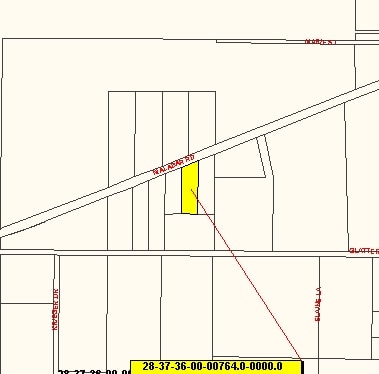
28-37-36-00-00764.0-0000.00
THE EAST 100 FT OF W 200 FT OF E 306 FT OF E 1/2 OF SW 1/4 OF SE 1/4 LYING SOUTH OF MALABAR RD EX SOUTH 224 FT
Commercialacreage
BREVARD
CG
Florida
B and X Area of moderate flood hazard, usually the area between the limits of the 100-year and 500-year floods.
0.73 AC
2024
Brevard County
2025
Orlando
065231
Palm Bay-Melbourne-Titusville, FL
NEARBY LISTINGS FOR SALE OR LEASE
DEMOGRAPHICS near 1909 Unknown
1 mile
3 mile
5 mile
2025 Total Population
1,336
21,136
82,078
2030 Population
1,450
22,638
88,633
Pop Growth 2025-2030
+ 8.53%
+ 7.11%
+ 7.99%
Average Age
46
45
45
2025 Total Households
535
8,586
35,299
HH Growth 2025-2030
+ 8.41%
+ 6.85%
+ 7.75%
Median Household Inc
$121,353
$77,734
$68,485
Avg Household Size
2.50
2.30
2.20
2025 Avg HH Vehicles
2.00
2.00
2.00
Median Home Value
$451,111
$299,950
$308,898
Median Year Built
1986
1983
1987
Nearby Places
Map Layers
Map Styles
 Street
 Aerial
Transit
 Traffic
 Biking
Places
Listings with unknown addresses are not visible on the map
- Restaurants
- Banks
- Shops
- Fitness
- Groceries
PUBLIC TRANSPORTATION
AIRPORT
Melbourne Orlando International
Drive
Walk
Distance
Melbourne Orlando International
22 min
10.5 mi
Freight Ports
Port Canaveral
Drive
Walk
Distance
Port Canaveral
56 min
45.0 mi
Nearby Properties
Address
Land Use
TOTAL SIZE
Lot Size
Zoning
Address
Land Use
TOTAL SIZE
Lot Size
Zoning
1,695,838 SF
106.06 AC
Address
Land Use
TOTAL SIZE
Lot Size
Zoning
282,680 SF
16 AC
IU
Address
Land Use
TOTAL SIZE
Lot Size
Zoning
326,454 SF
14.20 AC
RM20
Address
Land Use
TOTAL SIZE
Lot Size
Zoning
2,366 SF
32.43 AC
SR
Address
Land Use
TOTAL SIZE
Lot Size
Zoning
4,000 SF
12.20 AC
IU
Address
Land Use
TOTAL SIZE
Lot Size
Zoning
1,380 SF
21.87 AC
IU
Address
Land Use
TOTAL SIZE
Lot Size
Zoning
408,025 SF
24.10 AC
LI
Address
Land Use
TOTAL SIZE
Lot Size
Zoning
143,529 SF
7.76 AC
RM20
Address
Land Use
TOTAL SIZE
Lot Size
Zoning
161,823 SF
619.70 AC
GML
Address
Land Use
TOTAL SIZE
Lot Size
Zoning
242,454 SF
14.13 AC
LI
Address
Land Use
TOTAL SIZE
Lot Size
Zoning
352,735 SF
130.85 AC
Address
Land Use
TOTAL SIZE
Lot Size
Zoning
135,917 SF
2.92 AC
HC
Address
Land Use
TOTAL SIZE
Lot Size
Zoning
104,620 SF
12.82 AC
IU
Address
Land Use
TOTAL SIZE
Lot Size
Zoning
222,925 SF
12.75 AC
PUD
Address
Land Use
TOTAL SIZE
Lot Size
Zoning
76,534 SF
4.33 AC
HC
Address
Land Use
TOTAL SIZE
Lot Size
Zoning
202,908 SF
34.94 AC
LI
Address
Land Use
TOTAL SIZE
Lot Size
Zoning
48,492 SF
17.45 AC
OI
Address
Land Use
TOTAL SIZE
Lot Size
Zoning
109,650 SF
10.32 AC
CG
Address
Land Use
TOTAL SIZE
Lot Size
Zoning
97,728 SF
12.77 AC
IU
Address
Land Use
TOTAL SIZE
Lot Size
Zoning
78,357 SF
8.47 AC
BU1
Address
Land Use
TOTAL SIZE
Lot Size
Zoning
31.07 AC
GML
Address
Land Use
TOTAL SIZE
Lot Size
Zoning
80,425 SF
12.78 AC
HC
Address
Land Use
TOTAL SIZE
Lot Size
Zoning
93,240 SF
4.67 AC
LI
Address
Land Use
TOTAL SIZE
Lot Size
Zoning
64,984 SF
7.20 AC
RM15
Address
Land Use
TOTAL SIZE
Lot Size
Zoning
12.84 AC
GML
Address
Land Use
TOTAL SIZE
Lot Size
Zoning
91,050 SF
4.93 AC
LI
Address
Land Use
TOTAL SIZE
Lot Size
Zoning
27,837 SF
8.24 AC
IN(L)
Address
Land Use
TOTAL SIZE
Lot Size
Zoning
40,192 SF
6.92 AC
HC
Address
Land Use
TOTAL SIZE
Lot Size
Zoning
60,602 SF
5 AC
OI
Address
Land Use
TOTAL SIZE
Lot Size
Zoning
54,934 SF
6.46 AC
CC
The World's #1 Commercial Real Estate Marketplace
Connect with us
© 2026 CoStar Group
The information above has been obtained from sources believed reliable. While we do not doubt its accuracy we have not verified it and make no guarantee, warranty or representation about it. It is your responsibility to independently confirm its accuracy and completeness. Any projections, opinions, assumptions, or estimates used are for example only and do not represent the current or future performance of the property. The value of this transaction to you depends on tax and other factors which should be evaluated by your tax, financial, and legal advisors. You and your advisors should conduct a careful, independent investigation of the property to determine to your satisfaction the suitability of the property for your needs.