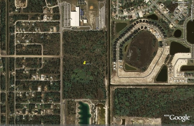
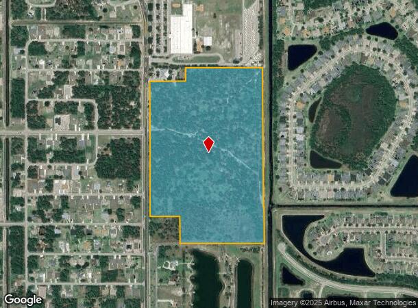
Property Record
1909 Unknown, Palm Bay, FL 32908
NEARBY LISTINGS FOR SALE OR LEASE
Property Detail
1909 Unknown
29-36-24-00-00750.0-0000.00
PART OF SE 1/4 OF SECT 24 & PART OF NE 1/4 OF SECT 25 ALL LYING E OF DEGROODT RD, S OF ORB 3608 PG 3887, N OF PB 46 PG 12 & W OF MTDD CANAL NO 37 EXC ORB 5742 PG 9736, ORB 5830 PG 8379, ORB 5830 PG 8383 & ORB 6391 PG 1128
Residentialacreage
Brevard
X
Florida
12009C0660G
43.55 AC
2024
Brevard County
2025
Orlando
071348
Palm Bay-Melbourne-Titusville, FL
DEMOGRAPHICS near 1909 Unknown
1 Mile
3 Mile
5 Mile
2024 Total Population
5,418
35,754
72,542
2029 Population
6,104
39,814
80,439
Pop Growth 2024-2029
+ 12.66%
+ 11.36%
+ 10.89%
Average Age
40
40
41
2024 Total Households
1,838
12,623
26,050
HH Growth 2024-2029
+ 12.19%
+ 11.06%
+ 10.64%
Median Household Inc
$69,757
$59,731
$60,199
Avg Household Size
2.90
2.80
2.70
2024 Avg HH Vehicles
2.00
2.00
2.00
Median Home Value
$254,764
$222,277
$227,014
Median Year Built
2007
2002
2000
Nearby Places
Map Layers
Map Styles
 Street
 Aerial
- Restaurants
- Banks
- Shops
- Fitness
- Groceries
PUBLIC TRANSPORTATION
AIRPORT
Melbourne Orlando International
DRIVE
WALK
Distance
Melbourne Orlando International
31 min
13.6 mi
Freight Ports
Port Canaveral
DRIVE
WALK
Distance
Port Canaveral
64 min
46.7 mi
Nearby Properties
Address
Land Use
TOTAL SIZE
Lot Size
Zoning
Address
Land Use
TOTAL SIZE
Lot Size
Zoning
107.80 AC
GU
Address
Land Use
TOTAL SIZE
Lot Size
Zoning
468,949 SF
123.35 AC
IU
Address
Land Use
TOTAL SIZE
Lot Size
Zoning
121,353 SF
24.37 AC
RS2
Address
Land Use
TOTAL SIZE
Lot Size
Zoning
103,507 SF
24.90 AC
IU
Address
Land Use
TOTAL SIZE
Lot Size
Zoning
69,508 SF
12.66 AC
PUD
Address
Land Use
TOTAL SIZE
Lot Size
Zoning
75,599 SF
11.06 AC
PUD
Address
Land Use
TOTAL SIZE
Lot Size
Zoning
63,962 SF
516.20 AC
LI
Address
Land Use
TOTAL SIZE
Lot Size
Zoning
88,978 SF
4.51 AC
PUD
Address
Land Use
TOTAL SIZE
Lot Size
Zoning
22,872 SF
20 AC
PUD
Address
Land Use
TOTAL SIZE
Lot Size
Zoning
34,732 SF
0.86 AC
Address
Land Use
TOTAL SIZE
Lot Size
Zoning
25,412 SF
3.34 AC
PUD
Address
Land Use
TOTAL SIZE
Lot Size
Zoning
12,714 SF
2.17 AC
PUD
Address
Land Use
TOTAL SIZE
Lot Size
Zoning
16,122 SF
1.89 AC
PUD
Address
Land Use
TOTAL SIZE
Lot Size
Zoning
58.53 AC
RS2
Address
Land Use
TOTAL SIZE
Lot Size
Zoning
23,719 SF
177.59 AC
GU
Address
Land Use
TOTAL SIZE
Lot Size
Zoning
17,662 SF
1.78 AC
PUD
Address
Land Use
TOTAL SIZE
Lot Size
Zoning
16,312 SF
3.62 AC
NC
Address
Land Use
TOTAL SIZE
Lot Size
Zoning
12,150 SF
1.72 AC
PUD
Address
Land Use
TOTAL SIZE
Lot Size
Zoning
10,752 SF
1.12 AC
PUD
Address
Land Use
TOTAL SIZE
Lot Size
Zoning
2,572 SF
1 AC
PUD
Address
Land Use
TOTAL SIZE
Lot Size
Zoning
10,161 SF
4.99 AC
IU
Address
Land Use
TOTAL SIZE
Lot Size
Zoning
5,760 SF
5.93 AC
IU
Address
Land Use
TOTAL SIZE
Lot Size
Zoning
11,592 SF
0.97 AC
PUD
Address
Land Use
TOTAL SIZE
Lot Size
Zoning
44,744 SF
478.33 AC
GU
Address
Land Use
TOTAL SIZE
Lot Size
Zoning
8,000 SF
1.24 AC
PUD
Address
Land Use
TOTAL SIZE
Lot Size
Zoning
7,396 SF
3.24 AC
PUD
Address
Land Use
TOTAL SIZE
Lot Size
Zoning
8,521 SF
1.08 AC
PUD
Address
Land Use
TOTAL SIZE
Lot Size
Zoning
9,850 SF
18.76 AC
RS2
Address
Land Use
TOTAL SIZE
Lot Size
Zoning
3,175 SF
1.26 AC
PUD
The World's #1 Commercial Real Estate Marketplace
Connect with us
© 2026 CoStar Group
The information above has been obtained from sources believed reliable. While we do not doubt its accuracy we have not verified it and make no guarantee, warranty or representation about it. It is your responsibility to independently confirm its accuracy and completeness. Any projections, opinions, assumptions, or estimates used are for example only and do not represent the current or future performance of the property. The value of this transaction to you depends on tax and other factors which should be evaluated by your tax, financial, and legal advisors. You and your advisors should conduct a careful, independent investigation of the property to determine to your satisfaction the suitability of the property for your needs.