Property Record
1909 Unknown, Palm Bay, FL 32909
NEARBY LISTINGS FOR SALE OR LEASE
Property Detail
1909 Unknown
Palm Bay-Melbourne-Titusville, FL
Cape Kennedy Groves Unit 9&11
30-37-09-00-00001.0-0000.00
PART OF N 1/2 OF NW 1/4 AS DES IN ORB 560 PG 791 EX PB 21 PG 77, RD & CANAL R/WS & ORB 1083 PG 1012
Countyproperty
Brevard
X
Florida
12009C0670G
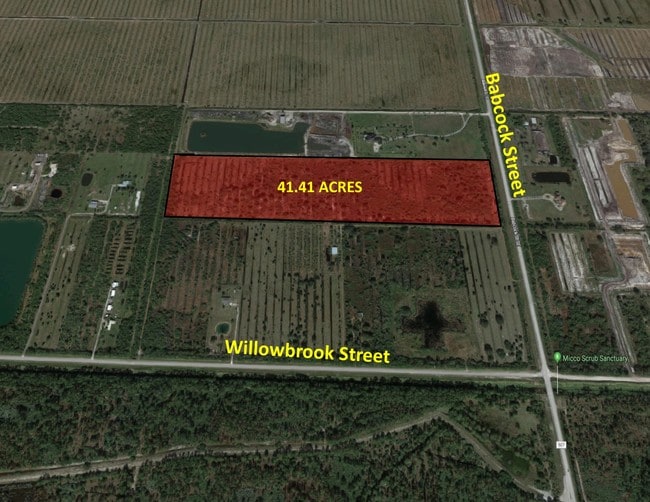
39.34 AC
2024
Brevard County
2025
Orlando
071354
DEMOGRAPHICS near 1909 Unknown
1 Mile
3 Mile
5 Mile
2024 Total Population
1,238
10,041
28,448
2029 Population
1,417
11,194
31,750
Pop Growth 2024-2029
+ 14.46%
+ 11.48%
+ 11.61%
Average Age
50
41
41
2024 Total Households
514
3,572
10,210
HH Growth 2024-2029
+ 14.40%
+ 11.39%
+ 11.36%
Median Household Inc
$117,534
$78,762
$69,632
Avg Household Size
2.40
2.70
2.70
2024 Avg HH Vehicles
2.00
2.00
2.00
Median Home Value
$407,500
$248,659
$248,045
Median Year Built
2004
2003
2004
Nearby Places
Map Layers
Map Styles
 Street
 Aerial
- Restaurants
- Banks
- Shops
- Fitness
- Groceries
PUBLIC TRANSPORTATION
AIRPORT
Melbourne Orlando International
DRIVE
WALK
Distance
Melbourne Orlando International
28 min
14.6 mi
SALE & LEASE HISTORY
LISTING DATE
SALE/LEASE

May 31, 2018
For Sale
Nearby Properties
Address
Land Use
TOTAL SIZE
Lot Size
Zoning
Address
Land Use
TOTAL SIZE
Lot Size
Zoning
111,898 SF
25.04 AC
AU
Address
Land Use
TOTAL SIZE
Lot Size
Zoning
66,453 SF
13.89 AC
Address
Land Use
TOTAL SIZE
Lot Size
Zoning
294.44 AC
GU
Address
Land Use
TOTAL SIZE
Lot Size
Zoning
230.52 AC
GU
Address
Land Use
TOTAL SIZE
Lot Size
Zoning
300 AC
GU
Address
Land Use
TOTAL SIZE
Lot Size
Zoning
636 AC
GML-P
Address
Land Use
TOTAL SIZE
Lot Size
Zoning
2.10 AC
Address
Land Use
TOTAL SIZE
Lot Size
Zoning
58.53 AC
RS2
Address
Land Use
TOTAL SIZE
Lot Size
Zoning
186.78 AC
AU
Address
Land Use
TOTAL SIZE
Lot Size
Zoning
15.25 AC
CC
Address
Land Use
TOTAL SIZE
Lot Size
Zoning
240 SF
12.27 AC
CC
Address
Land Use
TOTAL SIZE
Lot Size
Zoning
209.80 AC
GU
Address
Land Use
TOTAL SIZE
Lot Size
Zoning
9,463 SF
4.04 AC
NC
Address
Land Use
TOTAL SIZE
Lot Size
Zoning
397.60 AC
GML-P
Address
Land Use
TOTAL SIZE
Lot Size
Zoning
Address
Land Use
TOTAL SIZE
Lot Size
Zoning
1.12 AC
Address
Land Use
TOTAL SIZE
Lot Size
Zoning
5,560 SF
1.29 AC
IN(L)
Address
Land Use
TOTAL SIZE
Lot Size
Zoning
20.59 AC
Address
Land Use
TOTAL SIZE
Lot Size
Zoning
240 SF
32.41 AC
IU
Address
Land Use
TOTAL SIZE
Lot Size
Zoning
4,516 SF
4.08 AC
IN(L)
Address
Land Use
TOTAL SIZE
Lot Size
Zoning
21.97 AC
RS2
Address
Land Use
TOTAL SIZE
Lot Size
Zoning
5,102 SF
0.80 AC
RS2
Address
Land Use
TOTAL SIZE
Lot Size
Zoning
2,223 SF
14.86 AC
GU
Address
Land Use
TOTAL SIZE
Lot Size
Zoning
3,502 SF
13.50 AC
AU
Address
Land Use
TOTAL SIZE
Lot Size
Zoning
5,510 SF
2.01 AC
IU
Address
Land Use
TOTAL SIZE
Lot Size
Zoning
11,888 SF
620.61 AC
GU
Address
Land Use
TOTAL SIZE
Lot Size
Zoning
530 SF
14.12 AC
RR
Address
Land Use
TOTAL SIZE
Lot Size
Zoning
15.62 AC
Address
Land Use
TOTAL SIZE
Lot Size
Zoning
2,696 SF
34 AC
The World's #1 Commercial Real Estate Marketplace
Connect with us
© 2025 CoStar Group
The information above has been obtained from sources believed reliable. While we do not doubt its accuracy we have not verified it and make no guarantee, warranty or representation about it. It is your responsibility to independently confirm its accuracy and completeness. Any projections, opinions, assumptions, or estimates used are for example only and do not represent the current or future performance of the property. The value of this transaction to you depends on tax and other factors which should be evaluated by your tax, financial, and legal advisors. You and your advisors should conduct a careful, independent investigation of the property to determine to your satisfaction the suitability of the property for your needs.