Property Record
191 Beach Rd, Salisbury, MA 01952
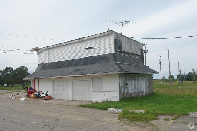

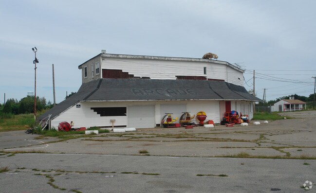
Property Detail
191 Beach Rd
Apartment
Essex
BC
Massachusetts
AE The base floodplain where base flood elevations are provided. AE Zones are now used on new format FIRMs instead of A1-A30 Zones.
13.10 AC
2025
Amesbury/Ipswich
2025
Boston
267104
Boston-Cambridge-Newton, MA-NH
267,857 SF
SALI-000028-000000-000008
NEARBY LISTINGS FOR SALE OR LEASE
DEMOGRAPHICS near 191 Beach Rd
1 mile
3 mile
5 mile
2025 Total Population
3,004
13,897
45,687
2030 Population
3,166
14,470
47,621
Pop Growth 2025-2030
+ 5.39%
+ 4.12%
+ 4.23%
Average Age
51
49
47
2025 Total Households
1,618
6,575
20,604
HH Growth 2025-2030
+ 5.50%
+ 4.29%
+ 4.30%
Median Household Inc
$90,511
$102,213
$105,262
Avg Household Size
1.90
2.10
2.10
2025 Avg HH Vehicles
2.00
2.00
2.00
Median Home Value
$583,088
$632,214
$706,547
Median Year Built
1983
1979
1968
Nearby Places
Map Layers
Map Styles
 Street
 Aerial
Layers
 Traffic
 Biking
Places
Listings with unknown addresses are not visible on the map
- Restaurants
- Banks
- Shops
- Fitness
- Groceries
PUBLIC TRANSPORTATION
COMMUTER RAIL
Newburyport (Newburyport/Rockport Line - Massachusetts Bay Transportation Authority Commuter Rail (Purple Line))
Drive
Walk
Distance
Newburyport (Newburyport/Rockport Line - Massachusetts Bay Transportation Authority Commuter Rail (Purple Line))
18 min
8.3 mi
AIRPORT
Portsmouth International at Pease
Drive
Walk
Distance
Portsmouth International at Pease
32 min
21.0 mi
General Edward Lawrence Logan International
Drive
Walk
Distance
General Edward Lawrence Logan International
60 min
41.7 mi
Manchester Boston Regional
Drive
Walk
Distance
Manchester Boston Regional
68 min
46.2 mi
Nearby Properties
Address
Land Use
TOTAL SIZE
Lot Size
Zoning
Address
Land Use
TOTAL SIZE
Lot Size
Zoning
441.30 AC
BC
Address
Land Use
TOTAL SIZE
Lot Size
Zoning
112,708 SF
40 AC
50
Address
Land Use
TOTAL SIZE
Lot Size
Zoning
3,820 SF
9.15 AC
40
Address
Land Use
TOTAL SIZE
Lot Size
Zoning
7,768 SF
3.98 AC
Address
Land Use
TOTAL SIZE
Lot Size
Zoning
106,787 SF
22.25 AC
C
Address
Land Use
TOTAL SIZE
Lot Size
Zoning
20,518 SF
6.05 AC
BC
Address
Land Use
TOTAL SIZE
Lot Size
Zoning
95,903 SF
1.64 AC
Address
Land Use
TOTAL SIZE
Lot Size
Zoning
52.50 AC
Address
Land Use
TOTAL SIZE
Lot Size
Zoning
39,728 SF
2.25 AC
Address
Land Use
TOTAL SIZE
Lot Size
Zoning
144 SF
9.18 AC
BC
Address
Land Use
TOTAL SIZE
Lot Size
Zoning
42.20 AC
C1
Address
Land Use
TOTAL SIZE
Lot Size
Zoning
52,767 SF
5.61 AC
C
Address
Land Use
TOTAL SIZE
Lot Size
Zoning
17,360 SF
1.08 AC
VC
Address
Land Use
TOTAL SIZE
Lot Size
Zoning
51,584 SF
0.79 AC
BC
Address
Land Use
TOTAL SIZE
Lot Size
Zoning
13,223 SF
1.57 AC
VC
Address
Land Use
TOTAL SIZE
Lot Size
Zoning
24,000 SF
1.69 AC
A
Address
Land Use
TOTAL SIZE
Lot Size
Zoning
60,920 SF
9.02 AC
LM-B
Address
Land Use
TOTAL SIZE
Lot Size
Zoning
59,718 SF
1.87 AC
Address
Land Use
TOTAL SIZE
Lot Size
Zoning
5,395 SF
1.32 AC
B3
Address
Land Use
TOTAL SIZE
Lot Size
Zoning
27,134 SF
1.21 AC
Address
Land Use
TOTAL SIZE
Lot Size
Zoning
33.74 AC
C1
Address
Land Use
TOTAL SIZE
Lot Size
Zoning
11,928 SF
2.20 AC
Address
Land Use
TOTAL SIZE
Lot Size
Zoning
43,422 SF
4.59 AC
VC
Address
Land Use
TOTAL SIZE
Lot Size
Zoning
18,971 SF
0.87 AC
BC
Address
Land Use
TOTAL SIZE
Lot Size
Zoning
16,492 SF
31.10 AC
LM-D
Address
Land Use
TOTAL SIZE
Lot Size
Zoning
0.23 AC
BC
Address
Land Use
TOTAL SIZE
Lot Size
Zoning
281.61 AC
OVRO
Address
Land Use
TOTAL SIZE
Lot Size
Zoning
23,432 SF
3.76 AC
C
Address
Land Use
TOTAL SIZE
Lot Size
Zoning
54,859 SF
23.80 AC
I2
The World's #1 Commercial Real Estate Marketplace
Connect with us
© 2026 CoStar Group
The information above has been obtained from sources believed reliable. While we do not doubt its accuracy we have not verified it and make no guarantee, warranty or representation about it. It is your responsibility to independently confirm its accuracy and completeness. Any projections, opinions, assumptions, or estimates used are for example only and do not represent the current or future performance of the property. The value of this transaction to you depends on tax and other factors which should be evaluated by your tax, financial, and legal advisors. You and your advisors should conduct a careful, independent investigation of the property to determine to your satisfaction the suitability of the property for your needs.