Property Record
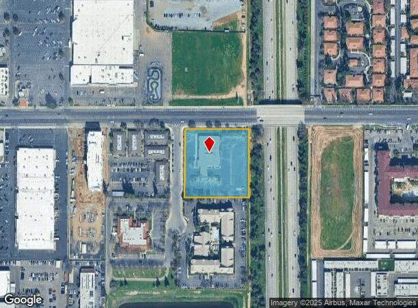
191 E Barstow Ave, Fresno, CA 93710


NEARBY LISTINGS FOR SALE OR LEASE
Property Detail
191 E Barstow Ave
Fresno, CA
Perrin Colony #2
418-060-25
2.12 AC PAR B MAP #77-19 REC IN BK 27 PG 83
Officebuilding
Fresno
X
California
06019C1560H
213
2025
2.12 AC
2025
Shaw
004505
Fresno
12,656 SF
DEMOGRAPHICS near 191 E Barstow Ave
1 Mile
3 Mile
5 Mile
2024 Total Population
15,899
148,708
387,675
2029 Population
16,199
151,681
395,481
Pop Growth 2024-2029
+ 1.89%
+ 2.00%
+ 2.01%
Average Age
37
37
37
2024 Total Households
6,143
55,273
138,878
HH Growth 2024-2029
+ 1.84%
+ 2.02%
+ 2.04%
Median Household Inc
$57,448
$61,576
$59,695
Avg Household Size
2.50
2.60
2.70
2024 Avg HH Vehicles
2.00
2.00
2.00
Median Home Value
$309,713
$317,443
$319,097
Median Year Built
1970
1971
1974
Nearby Places
Map Layers
Map Styles
 Street
 Aerial
- Restaurants
- Banks
- Shops
- Fitness
- Groceries
PUBLIC TRANSPORTATION
COMMUTER RAIL
DRIVE
WALK
Distance
10 min
6.3 mi
AIRPORT
Fresno Yosemite International
DRIVE
WALK
Distance
Fresno Yosemite International
14 min
6.9 mi
SALE & LEASE HISTORY
LISTING DATE
SALE/LEASE

Nov 09, 2018
For Sale
Nov 08, 2024
For Lease
May 08, 2023
For Sale
Apr 11, 2023
For Sale
Nearby Properties
Address
Land Use
TOTAL SIZE
Lot Size
Zoning
Address
Land Use
TOTAL SIZE
Lot Size
Zoning
574,093 SF
25.54 AC
C3
Address
Land Use
TOTAL SIZE
Lot Size
Zoning
39,888 SF
23.72 AC
C3
Address
Land Use
TOTAL SIZE
Lot Size
Zoning
451,977 SF
24.16 AC
SPLIT
Address
Land Use
TOTAL SIZE
Lot Size
Zoning
413,093 SF
33.19 AC
CP
Address
Land Use
TOTAL SIZE
Lot Size
Zoning
693,292 SF
29.86 AC
CP
Address
Land Use
TOTAL SIZE
Lot Size
Zoning
180,161 SF
10.38 AC
Address
Land Use
TOTAL SIZE
Lot Size
Zoning
239,000 SF
20.34 AC
R2
Address
Land Use
TOTAL SIZE
Lot Size
Zoning
239,437 SF
31.16 AC
RA
Address
Land Use
TOTAL SIZE
Lot Size
Zoning
81,545 SF
3.18 AC
CP
Address
Land Use
TOTAL SIZE
Lot Size
Zoning
184,694 SF
9.99 AC
SPLIT
Address
Land Use
TOTAL SIZE
Lot Size
Zoning
328,887 SF
16.34 AC
R3
Address
Land Use
TOTAL SIZE
Lot Size
Zoning
241,133 SF
13.61 AC
R3
Address
Land Use
TOTAL SIZE
Lot Size
Zoning
104,902 SF
8 AC
C6
Address
Land Use
TOTAL SIZE
Lot Size
Zoning
251,904 SF
16.70 AC
SPLIT
Address
Land Use
TOTAL SIZE
Lot Size
Zoning
121,491 SF
4.52 AC
R3
Address
Land Use
TOTAL SIZE
Lot Size
Zoning
208,444 SF
11.75 AC
R3
Address
Land Use
TOTAL SIZE
Lot Size
Zoning
157,702 SF
4.61 AC
R2A
Address
Land Use
TOTAL SIZE
Lot Size
Zoning
78,774 SF
2.10 AC
CP
Address
Land Use
TOTAL SIZE
Lot Size
Zoning
132,084 SF
9.68 AC
RM1
Address
Land Use
TOTAL SIZE
Lot Size
Zoning
8.80 AC
AE5
Address
Land Use
TOTAL SIZE
Lot Size
Zoning
105,916 SF
2.61 AC
C6
Address
Land Use
TOTAL SIZE
Lot Size
Zoning
110,456 SF
6.56 AC
RMX
Address
Land Use
TOTAL SIZE
Lot Size
Zoning
126,346 SF
5.49 AC
CP
Address
Land Use
TOTAL SIZE
Lot Size
Zoning
126,346 SF
5.31 AC
CP
Address
Land Use
TOTAL SIZE
Lot Size
Zoning
141,477 SF
5.45 AC
R4
Address
Land Use
TOTAL SIZE
Lot Size
Zoning
218,838 SF
19.06 AC
R2
Address
Land Use
TOTAL SIZE
Lot Size
Zoning
117,490 SF
0.01 AC
CP
Address
Land Use
TOTAL SIZE
Lot Size
Zoning
69,399 SF
7.31 AC
CP
Address
Land Use
TOTAL SIZE
Lot Size
Zoning
70,678 SF
4.23 AC
Address
Land Use
TOTAL SIZE
Lot Size
Zoning
66,997 SF
2.84 AC
CP
The World's #1 Commercial Real Estate Marketplace
Connect with us
© 2026 CoStar Group
The information above has been obtained from sources believed reliable. While we do not doubt its accuracy we have not verified it and make no guarantee, warranty or representation about it. It is your responsibility to independently confirm its accuracy and completeness. Any projections, opinions, assumptions, or estimates used are for example only and do not represent the current or future performance of the property. The value of this transaction to you depends on tax and other factors which should be evaluated by your tax, financial, and legal advisors. You and your advisors should conduct a careful, independent investigation of the property to determine to your satisfaction the suitability of the property for your needs.