Property Record
191 Outer Loop, Louisville, KY 40214
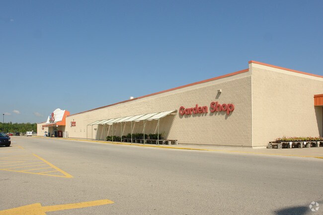

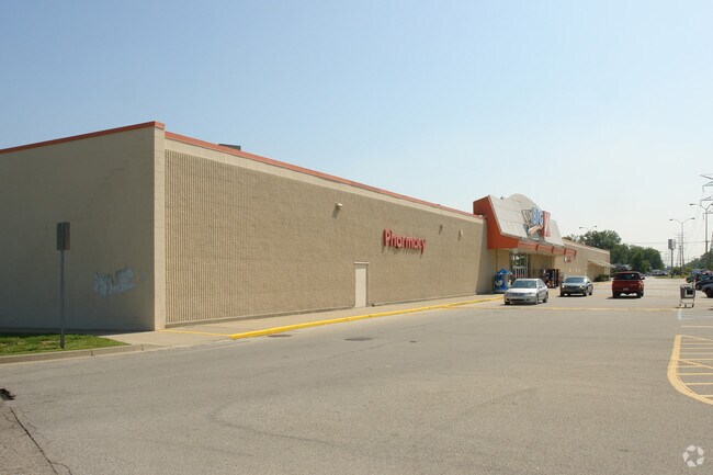
Property Detail
191 Outer Loop
104505000000
8.593 AC
Storebuilding
Jefferson
C1-COMMERC
Kentucky
AE The base floodplain where base flood elevations are provided. AE Zones are now used on new format FIRMs instead of A1-A30 Zones.
8.59 AC
2025
South Central
2025
Louisville
012205
Louisville/Jefferson County, KY-IN
94,956 SF
NEARBY LISTINGS FOR SALE OR LEASE
DEMOGRAPHICS near 191 Outer Loop
1 mile
3 mile
5 mile
2024 Total Population
7,142
47,050
142,901
2029 Population
7,284
48,008
146,049
Pop Growth 2024-2029
+ 1.99%
+ 2.04%
+ 2.20%
Average Age
38
39
39
2024 Total Households
2,685
18,432
57,302
HH Growth 2024-2029
+ 2.09%
+ 2.10%
+ 2.28%
Median Household Inc
$51,511
$55,550
$52,706
Avg Household Size
2.60
2.50
2.40
2024 Avg HH Vehicles
2.00
2.00
2.00
Median Home Value
$165,233
$181,482
$169,892
Median Year Built
1975
1970
1965
Nearby Places
Map Layers
Map Styles
 Street
 Aerial
Transit
 Traffic
 Biking
Places
Listings with unknown addresses are not visible on the map
- Restaurants
- Banks
- Shops
- Fitness
- Groceries
PUBLIC TRANSPORTATION
AIRPORT
Louisville Muhammad Ali International
Drive
Walk
Distance
Louisville Muhammad Ali International
11 min
4.6 mi
Nearby Properties
Address
Land Use
TOTAL SIZE
Lot Size
Zoning
Address
Land Use
TOTAL SIZE
Lot Size
Zoning
226,400 SF
150.18 AC
EZ1-ENTERP
Address
Land Use
TOTAL SIZE
Lot Size
Zoning
221,115 SF
97.92 AC
EZ1-ENTERP
Address
Land Use
TOTAL SIZE
Lot Size
Zoning
822,500 SF
44.75 AC
EZ1-ENTERP
Address
Land Use
TOTAL SIZE
Lot Size
Zoning
30.47 AC
R7-RESIDEN
Address
Land Use
TOTAL SIZE
Lot Size
Zoning
2,400 SF
42.61 AC
M2-INDUSTR
Address
Land Use
TOTAL SIZE
Lot Size
Zoning
517,000 SF
31.95 AC
EZ1-ENTERP
Address
Land Use
TOTAL SIZE
Lot Size
Zoning
679,250 SF
35.34 AC
Address
Land Use
TOTAL SIZE
Lot Size
Zoning
22.14 AC
EZ1-ENTERP
Address
Land Use
TOTAL SIZE
Lot Size
Zoning
1,800 SF
31.91 AC
Address
Land Use
TOTAL SIZE
Lot Size
Zoning
28.70 AC
C1-COMMERC
Address
Land Use
TOTAL SIZE
Lot Size
Zoning
22,113 SF
19.01 AC
R4-RESIDEN
Address
Land Use
TOTAL SIZE
Lot Size
Zoning
2,043 SF
60.14 AC
Address
Land Use
TOTAL SIZE
Lot Size
Zoning
31.15 AC
EZ1-ENTERP
Address
Land Use
TOTAL SIZE
Lot Size
Zoning
2,507 SF
77.40 AC
R5-RESIDEN
Address
Land Use
TOTAL SIZE
Lot Size
Zoning
20,496 SF
18.38 AC
R6-RESIDEN
Address
Land Use
TOTAL SIZE
Lot Size
Zoning
22.40 AC
Address
Land Use
TOTAL SIZE
Lot Size
Zoning
5,560 SF
Address
Land Use
TOTAL SIZE
Lot Size
Zoning
201,600 SF
11.43 AC
EZ1-ENTERP
Address
Land Use
TOTAL SIZE
Lot Size
Zoning
321,501 SF
20 AC
M3-INDUSTR
Address
Land Use
TOTAL SIZE
Lot Size
Zoning
15.72 AC
R6-RESIDEN
Address
Land Use
TOTAL SIZE
Lot Size
Zoning
350,000 SF
20.55 AC
CM-COMMERC
Address
Land Use
TOTAL SIZE
Lot Size
Zoning
5.80 AC
EZ1-ENTERP
Address
Land Use
TOTAL SIZE
Lot Size
Zoning
17,270 SF
4.74 AC
R5-RESIDEN
Address
Land Use
TOTAL SIZE
Lot Size
Zoning
200 SF
57.08 AC
R4-RESIDEN
Address
Land Use
TOTAL SIZE
Lot Size
Zoning
5,568 SF
13.52 AC
C1-COMMERC
Address
Land Use
TOTAL SIZE
Lot Size
Zoning
356,300 SF
15.76 AC
EZ1-ENTERP
Address
Land Use
TOTAL SIZE
Lot Size
Zoning
12.98 AC
EZ1-ENTERP
Address
Land Use
TOTAL SIZE
Lot Size
Zoning
11.68 AC
EZ1-ENTERP
Address
Land Use
TOTAL SIZE
Lot Size
Zoning
285,378 SF
16.79 AC
EZ1-ENTERP
Address
Land Use
TOTAL SIZE
Lot Size
Zoning
23.17 AC
R4-RESIDEN
The World's #1 Commercial Real Estate Marketplace
Connect with us
© 2026 CoStar Group
The information above has been obtained from sources believed reliable. While we do not doubt its accuracy we have not verified it and make no guarantee, warranty or representation about it. It is your responsibility to independently confirm its accuracy and completeness. Any projections, opinions, assumptions, or estimates used are for example only and do not represent the current or future performance of the property. The value of this transaction to you depends on tax and other factors which should be evaluated by your tax, financial, and legal advisors. You and your advisors should conduct a careful, independent investigation of the property to determine to your satisfaction the suitability of the property for your needs.