Property Record
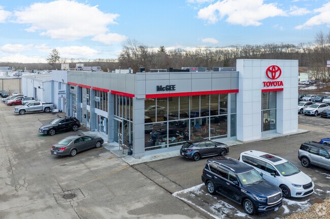
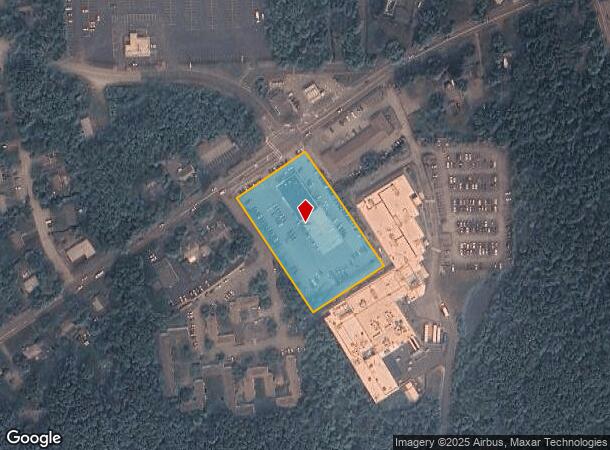
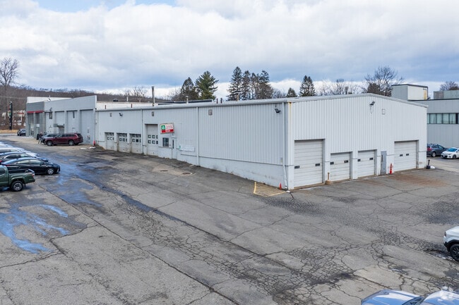
191 W Main St, Dudley, MA 01571
NEARBY LISTINGS FOR SALE OR LEASE
Property Detail
191 W Main St
DUDL-000120-000000-000018
Worcester
Vehiclerentalsvehiclesales
Massachusetts
X
18
09015C0045F
2.19 AC
2025
Outlying Worcester
2025
Boston
755201
Worcester, MA
17,250 SF
DEMOGRAPHICS near 191 W Main St
1 mile
3 mile
5 mile
2024 Total Population
3,811
24,788
41,384
2029 Population
3,774
24,532
41,176
Pop Growth 2024-2029
(0.97%)
(1.03%)
(0.50%)
Average Age
40
41
42
2024 Total Households
1,453
10,094
16,666
HH Growth 2024-2029
(1.03%)
(1.08%)
(0.53%)
Median Household Inc
$66,495
$65,976
$82,836
Avg Household Size
2.50
2.30
2.40
2024 Avg HH Vehicles
2.00
2.00
2.00
Median Home Value
$303,199
$298,365
$316,677
Median Year Built
1964
1961
1968
Nearby Places
Map Layers
Map Styles
 Street
 Aerial
Transit
 Traffic
 Biking
Places
Listings with unknown addresses are not visible on the map
- Restaurants
- Banks
- Shops
- Fitness
- Groceries
PUBLIC TRANSPORTATION
AIRPORT
Worcester Regional
Drive
Walk
Distance
Worcester Regional
36 min
20.6 mi
Freight Ports
Port of Boston
Drive
Walk
Distance
Port of Boston
81 min
59.7 mi
SALE & LEASE HISTORY
LISTING DATE
SALE/LEASE

Oct 01, 2024
For Sale
Nearby Properties
Address
Land Use
TOTAL SIZE
Lot Size
Zoning
Address
Land Use
TOTAL SIZE
Lot Size
Zoning
60.14 AC
Address
Land Use
TOTAL SIZE
Lot Size
Zoning
95,274 SF
10.18 AC
Address
Land Use
TOTAL SIZE
Lot Size
Zoning
187,396 SF
90.39 AC
Address
Land Use
TOTAL SIZE
Lot Size
Zoning
34,941 SF
47.88 AC
Address
Land Use
TOTAL SIZE
Lot Size
Zoning
3,894 SF
0.09 AC
Address
Land Use
TOTAL SIZE
Lot Size
Zoning
9.05 AC
INDUST
Address
Land Use
TOTAL SIZE
Lot Size
Zoning
10.09 AC
Address
Land Use
TOTAL SIZE
Lot Size
Zoning
2.15 AC
GB-4 W
Address
Land Use
TOTAL SIZE
Lot Size
Zoning
102,704 SF
31 AC
GB-4 W
Address
Land Use
TOTAL SIZE
Lot Size
Zoning
Address
Land Use
TOTAL SIZE
Lot Size
Zoning
52,677 SF
15.17 AC
Address
Land Use
TOTAL SIZE
Lot Size
Zoning
3.60 AC
Address
Land Use
TOTAL SIZE
Lot Size
Zoning
21,111 SF
1.71 AC
GB-4 W
Address
Land Use
TOTAL SIZE
Lot Size
Zoning
37,907 SF
28.50 AC
Address
Land Use
TOTAL SIZE
Lot Size
Zoning
5.24 AC
GB-4 W
Address
Land Use
TOTAL SIZE
Lot Size
Zoning
33,063 SF
1.96 AC
Address
Land Use
TOTAL SIZE
Lot Size
Zoning
6.08 AC
MR-12,
Address
Land Use
TOTAL SIZE
Lot Size
Zoning
7,200 SF
6.78 AC
Address
Land Use
TOTAL SIZE
Lot Size
Zoning
52,335 SF
6.39 AC
Address
Land Use
TOTAL SIZE
Lot Size
Zoning
60,233 SF
4.09 AC
GB-4 W
Address
Land Use
TOTAL SIZE
Lot Size
Zoning
70,160 SF
10.57 AC
Address
Land Use
TOTAL SIZE
Lot Size
Zoning
47,692 SF
1.89 AC
SFR-12
Address
Land Use
TOTAL SIZE
Lot Size
Zoning
14,483 SF
3.18 AC
Address
Land Use
TOTAL SIZE
Lot Size
Zoning
29,360 SF
0.38 AC
Address
Land Use
TOTAL SIZE
Lot Size
Zoning
4,993 SF
4.38 AC
MR-12,
Address
Land Use
TOTAL SIZE
Lot Size
Zoning
3.42 AC
GB-4 W
Address
Land Use
TOTAL SIZE
Lot Size
Zoning
5,353 SF
38.95 AC
Address
Land Use
TOTAL SIZE
Lot Size
Zoning
23,435 SF
1.54 AC
Address
Land Use
TOTAL SIZE
Lot Size
Zoning
45,614 SF
1.79 AC
Address
Land Use
TOTAL SIZE
Lot Size
Zoning
34,881 SF
2 AC
The World's #1 Commercial Real Estate Marketplace
Connect with us
© 2026 CoStar Group
The information above has been obtained from sources believed reliable. While we do not doubt its accuracy we have not verified it and make no guarantee, warranty or representation about it. It is your responsibility to independently confirm its accuracy and completeness. Any projections, opinions, assumptions, or estimates used are for example only and do not represent the current or future performance of the property. The value of this transaction to you depends on tax and other factors which should be evaluated by your tax, financial, and legal advisors. You and your advisors should conduct a careful, independent investigation of the property to determine to your satisfaction the suitability of the property for your needs.