Property Record
191 Walls Dr, Cleburne, TX 76033
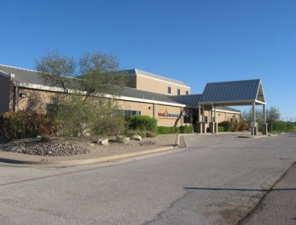

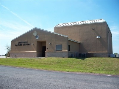

Property Detail
191 Walls Dr
Dallas-Fort Worth-Arlington, TX
LOT 1R2 BLK 1 WALLS REGIONAL SEC 1 126.5528.33174
126-3062-01015
Johnson
Commercialnec
Texas
B and X Area of moderate flood hazard, usually the area between the limits of the 100-year and 500-year floods.
1
2024
0.86 AC
2025
Johnson County
130302
Dallas/Ft Worth
8,823 SF
NEARBY LISTINGS FOR SALE OR LEASE
DEMOGRAPHICS near 191 Walls Dr
1 mile
3 mile
5 mile
2025 Total Population
3,511
24,966
39,557
2030 Population
4,092
28,487
45,268
Pop Growth 2025-2030
+ 16.55%
+ 14.10%
+ 14.44%
Average Age
38
39
38
2025 Total Households
1,317
9,186
13,864
HH Growth 2025-2030
+ 16.25%
+ 13.74%
+ 14.09%
Median Household Inc
$84,071
$78,459
$71,222
Avg Household Size
2.60
2.60
2.70
2025 Avg HH Vehicles
2.00
2.00
2.00
Median Home Value
$292,470
$255,591
$239,419
Median Year Built
1996
1984
1983
Nearby Places
Map Layers
Map Styles
 Street
 Aerial
Layers
 Traffic
 Biking
Places
Listings with unknown addresses are not visible on the map
- Restaurants
- Banks
- Shops
- Fitness
- Groceries
PUBLIC TRANSPORTATION
COMMUTER RAIL
Drive
Walk
Distance
8 min
4.0 mi
SALE & LEASE HISTORY
LISTING DATE
SALE/LEASE

Oct 23, 2018
For Sale
Aug 18, 2020
For Sale
Nearby Properties
Address
Land Use
TOTAL SIZE
Lot Size
Zoning
Address
Land Use
TOTAL SIZE
Lot Size
Zoning
Address
Land Use
TOTAL SIZE
Lot Size
Zoning
178,055 SF
408.63 AC
Address
Land Use
TOTAL SIZE
Lot Size
Zoning
89,466 SF
12.37 AC
Address
Land Use
TOTAL SIZE
Lot Size
Zoning
13.16 AC
Address
Land Use
TOTAL SIZE
Lot Size
Zoning
8,136 SF
25.37 AC
Address
Land Use
TOTAL SIZE
Lot Size
Zoning
89,005 SF
16.07 AC
Address
Land Use
TOTAL SIZE
Lot Size
Zoning
114,842 SF
50.28 AC
Address
Land Use
TOTAL SIZE
Lot Size
Zoning
81,253 SF
3.51 AC
Address
Land Use
TOTAL SIZE
Lot Size
Zoning
146,927 SF
33.55 AC
Address
Land Use
TOTAL SIZE
Lot Size
Zoning
630.98 AC
Address
Land Use
TOTAL SIZE
Lot Size
Zoning
Address
Land Use
TOTAL SIZE
Lot Size
Zoning
61,492 SF
20.24 AC
Address
Land Use
TOTAL SIZE
Lot Size
Zoning
654.72 AC
Address
Land Use
TOTAL SIZE
Lot Size
Zoning
66,480 SF
61.65 AC
Address
Land Use
TOTAL SIZE
Lot Size
Zoning
207,010 SF
25.39 AC
Address
Land Use
TOTAL SIZE
Lot Size
Zoning
6,300 SF
242.36 AC
Address
Land Use
TOTAL SIZE
Lot Size
Zoning
3,264 SF
6.63 AC
Address
Land Use
TOTAL SIZE
Lot Size
Zoning
12,000 SF
5.54 AC
Address
Land Use
TOTAL SIZE
Lot Size
Zoning
68,230 SF
8.15 AC
Address
Land Use
TOTAL SIZE
Lot Size
Zoning
240,318 SF
18.82 AC
Address
Land Use
TOTAL SIZE
Lot Size
Zoning
37,844 SF
21.48 AC
Address
Land Use
TOTAL SIZE
Lot Size
Zoning
42,455 SF
5.98 AC
Address
Land Use
TOTAL SIZE
Lot Size
Zoning
175.06 AC
Address
Land Use
TOTAL SIZE
Lot Size
Zoning
103,187 SF
17.86 AC
Address
Land Use
TOTAL SIZE
Lot Size
Zoning
2,412 SF
10.17 AC
Address
Land Use
TOTAL SIZE
Lot Size
Zoning
16,003 SF
10.55 AC
Address
Land Use
TOTAL SIZE
Lot Size
Zoning
90,170 SF
3.81 AC
Address
Land Use
TOTAL SIZE
Lot Size
Zoning
74,358 SF
10 AC
Address
Land Use
TOTAL SIZE
Lot Size
Zoning
64,414 SF
15 AC
Address
Land Use
TOTAL SIZE
Lot Size
Zoning
45,683 SF
3.57 AC
The World's #1 Commercial Real Estate Marketplace
Connect with us
© 2026 CoStar Group
The information above has been obtained from sources believed reliable. While we do not doubt its accuracy we have not verified it and make no guarantee, warranty or representation about it. It is your responsibility to independently confirm its accuracy and completeness. Any projections, opinions, assumptions, or estimates used are for example only and do not represent the current or future performance of the property. The value of this transaction to you depends on tax and other factors which should be evaluated by your tax, financial, and legal advisors. You and your advisors should conduct a careful, independent investigation of the property to determine to your satisfaction the suitability of the property for your needs.