Property Record
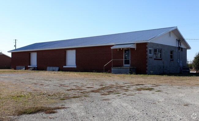
1910 Hwy 258 S, Kinston, NC 28504


NEARBY LISTINGS FOR SALE OR LEASE
Property Detail
1910 Hwy 258 S
Timberlandforesttreesagricultural
MULTIPLE ADDRESS POINTS 2024 HWY 258 SOUTH 2160 HWY 258 SOUTH
AE
Lenoir
3720450400K
North Carolina
2025
64.52 AC
2025
Other Market Areas
011001
Kinston, NC
2,580 SF
451404630380
DEMOGRAPHICS near 1910 Hwy 258 S
1 Mile
3 Mile
5 Mile
2024 Total Population
687
8,644
26,992
2029 Population
674
8,749
26,917
Pop Growth 2024-2029
(1.89%)
+ 1.21%
(0.28%)
Average Age
43
41
42
2024 Total Households
286
3,876
11,608
HH Growth 2024-2029
(2.10%)
+ 1.19%
(0.25%)
Median Household Inc
$43,385
$26,952
$35,273
Avg Household Size
2.40
2.20
2.20
2024 Avg HH Vehicles
2.00
1.00
2.00
Median Home Value
$83,912
$77,671
$102,732
Median Year Built
1985
1970
1971
Nearby Places
Map Layers
Map Styles
 Street
 Aerial
- Restaurants
- Banks
- Shops
- Fitness
- Groceries
PUBLIC TRANSPORTATION
AIRPORT
Albert J Ellis
DRIVE
WALK
Distance
Albert J Ellis
57 min
32.6 mi
Freight Ports
Port of Morehead City
DRIVE
WALK
Distance
Port of Morehead City
108 min
76.4 mi
Nearby Properties
Address
Land Use
TOTAL SIZE
Lot Size
Zoning
Address
Land Use
TOTAL SIZE
Lot Size
Zoning
107,460 SF
17.70 AC
I2
Address
Land Use
TOTAL SIZE
Lot Size
Zoning
20,042 SF
77.79 AC
O&I
Address
Land Use
TOTAL SIZE
Lot Size
Zoning
525,504 SF
76.02 AC
I1
Address
Land Use
TOTAL SIZE
Lot Size
Zoning
45,675 SF
2.89 AC
IB
Address
Land Use
TOTAL SIZE
Lot Size
Zoning
77,100 SF
1.91 AC
B2
Address
Land Use
TOTAL SIZE
Lot Size
Zoning
119,634 SF
1.86 AC
B2
Address
Land Use
TOTAL SIZE
Lot Size
Zoning
51,934 SF
0.32 AC
B2
Address
Land Use
TOTAL SIZE
Lot Size
Zoning
73,800 SF
5.38 AC
B1
Address
Land Use
TOTAL SIZE
Lot Size
Zoning
23,086 SF
7.39 AC
RA5
Address
Land Use
TOTAL SIZE
Lot Size
Zoning
424,443 SF
104.04 AC
SC
Address
Land Use
TOTAL SIZE
Lot Size
Zoning
6,178 SF
6.33 AC
RA5
Address
Land Use
TOTAL SIZE
Lot Size
Zoning
108,816 SF
1.30 AC
B2
Address
Land Use
TOTAL SIZE
Lot Size
Zoning
13,257 SF
27.42 AC
Address
Land Use
TOTAL SIZE
Lot Size
Zoning
83,088 SF
1.19 AC
B2
Address
Land Use
TOTAL SIZE
Lot Size
Zoning
14,706 SF
2.62 AC
B1
Address
Land Use
TOTAL SIZE
Lot Size
Zoning
3,724 SF
8.84 AC
RA5
Address
Land Use
TOTAL SIZE
Lot Size
Zoning
51,828 SF
7.05 AC
O&I
Address
Land Use
TOTAL SIZE
Lot Size
Zoning
43,545 SF
5.62 AC
SC
Address
Land Use
TOTAL SIZE
Lot Size
Zoning
35,906 SF
4.08 AC
Address
Land Use
TOTAL SIZE
Lot Size
Zoning
136,368 SF
11.60 AC
I1
Address
Land Use
TOTAL SIZE
Lot Size
Zoning
22,124 SF
Address
Land Use
TOTAL SIZE
Lot Size
Zoning
8,680 SF
12.35 AC
RA5
Address
Land Use
TOTAL SIZE
Lot Size
Zoning
74,734 SF
8.81 AC
RA8
Address
Land Use
TOTAL SIZE
Lot Size
Zoning
29,108 SF
88.62 AC
RA6
Address
Land Use
TOTAL SIZE
Lot Size
Zoning
10,171 SF
478.12 AC
RA8
Address
Land Use
TOTAL SIZE
Lot Size
Zoning
112,564 SF
29.12 AC
I1
Address
Land Use
TOTAL SIZE
Lot Size
Zoning
162,825 SF
19.02 AC
I1
Address
Land Use
TOTAL SIZE
Lot Size
Zoning
61,720 SF
10 AC
B1
Address
Land Use
TOTAL SIZE
Lot Size
Zoning
12,000 SF
16.02 AC
I2
Address
Land Use
TOTAL SIZE
Lot Size
Zoning
39,948 SF
1.02 AC
B2
The World's #1 Commercial Real Estate Marketplace
Connect with us
© 2026 CoStar Group
The information above has been obtained from sources believed reliable. While we do not doubt its accuracy we have not verified it and make no guarantee, warranty or representation about it. It is your responsibility to independently confirm its accuracy and completeness. Any projections, opinions, assumptions, or estimates used are for example only and do not represent the current or future performance of the property. The value of this transaction to you depends on tax and other factors which should be evaluated by your tax, financial, and legal advisors. You and your advisors should conduct a careful, independent investigation of the property to determine to your satisfaction the suitability of the property for your needs.