Property Record
1910 Lockbourne Rd, Columbus, OH 43207


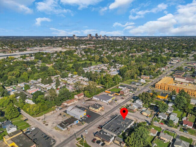
Property Detail
1910 Lockbourne Rd
Columbus, OH
LOCKBOURNE RD WOODROW AVE ACRES .576
010-112368
Franklin
Storebuilding
Ohio
2024
0.57 AC
2025
Southeast
008720
Columbus
8,400 SF
NEARBY LISTINGS FOR SALE OR LEASE
DEMOGRAPHICS near 1910 Lockbourne Rd
1 mile
3 mile
5 mile
2025 Total Population
11,007
104,153
265,477
2030 Population
11,517
109,485
277,351
Pop Growth 2025-2030
+ 4.63%
+ 5.12%
+ 4.47%
Average Age
40
39
38
2025 Total Households
4,442
47,308
116,925
HH Growth 2025-2030
+ 4.73%
+ 5.35%
+ 4.76%
Median Household Inc
$44,147
$61,767
$58,584
Avg Household Size
2.40
2.10
2.20
2025 Avg HH Vehicles
2.00
1.00
1.00
Median Home Value
$164,406
$278,370
$248,893
Median Year Built
1955
1957
1963
Nearby Places
Map Layers
Map Styles
 Street
 Aerial
Layers
 Traffic
 Biking
Places
Listings with unknown addresses are not visible on the map
- Restaurants
- Banks
- Shops
- Fitness
- Groceries
PUBLIC TRANSPORTATION
AIRPORT
John Glenn Columbus International
Drive
Walk
Distance
John Glenn Columbus International
18 min
8.4 mi
Rickenbacker International
Drive
Walk
Distance
Rickenbacker International
19 min
8.6 mi
SALE & LEASE HISTORY
LISTING DATE
SALE/LEASE

Dec 09, 2022
For Lease
Aug 07, 2020
For Lease
Nearby Properties
Address
Land Use
TOTAL SIZE
Lot Size
Zoning
Address
Land Use
TOTAL SIZE
Lot Size
Zoning
1,949,795 SF
20.56 AC
Address
Land Use
TOTAL SIZE
Lot Size
Zoning
1,467,891 SF
10.49 AC
Address
Land Use
TOTAL SIZE
Lot Size
Zoning
304,340 SF
3.86 AC
Address
Land Use
TOTAL SIZE
Lot Size
Zoning
477,854 SF
0.72 AC
Address
Land Use
TOTAL SIZE
Lot Size
Zoning
832,673 SF
2.87 AC
Address
Land Use
TOTAL SIZE
Lot Size
Zoning
481,704 SF
0.92 AC
Address
Land Use
TOTAL SIZE
Lot Size
Zoning
339,231 SF
0.73 AC
Address
Land Use
TOTAL SIZE
Lot Size
Zoning
669,626 SF
0.97 AC
Address
Land Use
TOTAL SIZE
Lot Size
Zoning
459,012 SF
3.71 AC
Address
Land Use
TOTAL SIZE
Lot Size
Zoning
697,192 SF
2.72 AC
Address
Land Use
TOTAL SIZE
Lot Size
Zoning
597,600 SF
68.91 AC
Address
Land Use
TOTAL SIZE
Lot Size
Zoning
180,636 SF
4.33 AC
Address
Land Use
TOTAL SIZE
Lot Size
Zoning
122,019 SF
0.92 AC
Address
Land Use
TOTAL SIZE
Lot Size
Zoning
573,031 SF
5.88 AC
Address
Land Use
TOTAL SIZE
Lot Size
Zoning
496,729 SF
3.47 AC
Address
Land Use
TOTAL SIZE
Lot Size
Zoning
243,888 SF
0.88 AC
Address
Land Use
TOTAL SIZE
Lot Size
Zoning
360,962 SF
33.91 AC
Address
Land Use
TOTAL SIZE
Lot Size
Zoning
440,454 SF
3.92 AC
Address
Land Use
TOTAL SIZE
Lot Size
Zoning
523,793 SF
6.94 AC
Address
Land Use
TOTAL SIZE
Lot Size
Zoning
157,856 SF
0.74 AC
Address
Land Use
TOTAL SIZE
Lot Size
Zoning
705,600 SF
43.41 AC
Address
Land Use
TOTAL SIZE
Lot Size
Zoning
229,128 SF
1.18 AC
Address
Land Use
TOTAL SIZE
Lot Size
Zoning
184,068 SF
0.19 AC
Address
Land Use
TOTAL SIZE
Lot Size
Zoning
192,038 SF
2.84 AC
Address
Land Use
TOTAL SIZE
Lot Size
Zoning
485,673 SF
0.43 AC
Address
Land Use
TOTAL SIZE
Lot Size
Zoning
503,279 SF
1.99 AC
Address
Land Use
TOTAL SIZE
Lot Size
Zoning
238,624 SF
6.38 AC
Address
Land Use
TOTAL SIZE
Lot Size
Zoning
143,397 SF
25.50 AC
Address
Land Use
TOTAL SIZE
Lot Size
Zoning
245,142 SF
11.56 AC
Address
Land Use
TOTAL SIZE
Lot Size
Zoning
292,416 SF
1.03 AC
The World's #1 Commercial Real Estate Marketplace
Connect with us
© 2026 CoStar Group
The information above has been obtained from sources believed reliable. While we do not doubt its accuracy we have not verified it and make no guarantee, warranty or representation about it. It is your responsibility to independently confirm its accuracy and completeness. Any projections, opinions, assumptions, or estimates used are for example only and do not represent the current or future performance of the property. The value of this transaction to you depends on tax and other factors which should be evaluated by your tax, financial, and legal advisors. You and your advisors should conduct a careful, independent investigation of the property to determine to your satisfaction the suitability of the property for your needs.