Property Record
1910 Oceanside Blvd, Oceanside, CA 92054


Save to a Folder
{{folder.Name}}
{{folder.ListingIds.length}} Properties
{{folder.ListingIds.length}} Property
Create a New Folder
Property Detail
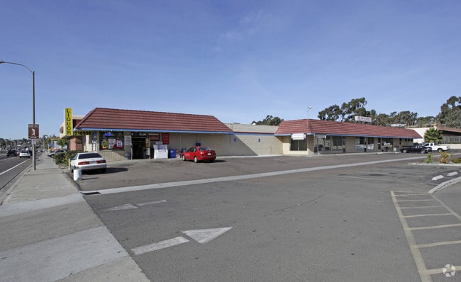
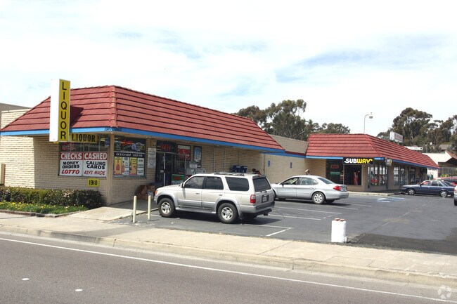
1910 Oceanside Blvd
151-010-31
BLK 6 DOC62642REC71 IN SEC 25-11-5W&IN ST CLSD&IN BLK 5&IN TR 001171
Storesoffices
San Diego
CG
California
AE The base floodplain where base flood elevations are provided. AE Zones are now used on new format FIRMs instead of A1-A30 Zones.
0.66 AC
2025
Oceanside
2026
San Diego
018509
San Diego-Chula Vista-Carlsbad, CA
7,000 SF
NEARBY LISTINGS FOR SALE OR LEASE
DEMOGRAPHICS near 1910 Oceanside Blvd
1 mile
3 mile
5 mile
2025 Total Population
18,021
104,182
208,379
2030 Population
18,069
105,759
210,374
Pop Growth 2025-2030
+ 0.27%
+ 1.51%
+ 0.96%
Average Age
39
39
39
2025 Total Households
6,558
39,468
74,550
HH Growth 2025-2030
+ 0.14%
+ 1.77%
+ 1.10%
Median Household Inc
$80,236
$85,863
$94,214
Avg Household Size
2.60
2.40
2.60
2025 Avg HH Vehicles
2.00
2.00
2.00
Median Home Value
$911,834
$848,734
$815,889
Median Year Built
1973
1979
1983
Nearby Places
Map Layers
Map Styles
 Street
 Aerial
Layers
 Traffic
 Biking
Places
Listings with unknown addresses are not visible on the map
- Restaurants
- Banks
- Shops
- Fitness
- Groceries
PUBLIC TRANSPORTATION
TRANSIT/SUBWAY
Crouch Street (Sprinter - San Diego North County Transit District (Coaster/Sprinter/Breeze))
Drive
Walk
Distance
Crouch Street (Sprinter - San Diego North County Transit District (Coaster/Sprinter/Breeze))
2 min
4 min
0.2 mi
COMMUTER RAIL
Oceanside Transit Center (Orange County Line - Southern California Regional Rail Authority (Metrolink))
Drive
Walk
Distance
Oceanside Transit Center (Orange County Line - Southern California Regional Rail Authority (Metrolink))
6 min
2.3 mi
Carlsbad Village (Coaster - San Diego North County Transit District (Coaster/Sprinter/Breeze))
Drive
Walk
Distance
Carlsbad Village (Coaster - San Diego North County Transit District (Coaster/Sprinter/Breeze))
8 min
3.5 mi
AIRPORT
San Diego International
Drive
Walk
Distance
San Diego International
44 min
35.4 mi
Freight Ports
Port of San Diego
Drive
Walk
Distance
Port of San Diego
51 min
39.9 mi
Nearby Properties
Address
Land Use
TOTAL SIZE
Lot Size
Zoning
Address
Land Use
TOTAL SIZE
Lot Size
Zoning
9,999 SF
5.28 AC
C2
Address
Land Use
TOTAL SIZE
Lot Size
Zoning
9,999 SF
1.38 AC
C
Address
Land Use
TOTAL SIZE
Lot Size
Zoning
9,999 SF
12 AC
SP-1-09
Address
Land Use
TOTAL SIZE
Lot Size
Zoning
9,999 SF
16 AC
P-C
Address
Land Use
TOTAL SIZE
Lot Size
Zoning
9,999 SF
5.24 AC
SP-1-09
Address
Land Use
TOTAL SIZE
Lot Size
Zoning
9,999 SF
1.38 AC
C
Address
Land Use
TOTAL SIZE
Lot Size
Zoning
9,999 SF
9.22 AC
RH
Address
Land Use
TOTAL SIZE
Lot Size
Zoning
9,999 SF
1.14 AC
C
Address
Land Use
TOTAL SIZE
Lot Size
Zoning
6,240 SF
22.25 AC
PD-2
Address
Land Use
TOTAL SIZE
Lot Size
Zoning
5,000 SF
4.40 AC
CC
Address
Land Use
TOTAL SIZE
Lot Size
Zoning
9,999 SF
10.63 AC
RD-M
Address
Land Use
TOTAL SIZE
Lot Size
Zoning
9,999 SF
19.51 AC
C-2-Q
Address
Land Use
TOTAL SIZE
Lot Size
Zoning
2.30 AC
V-R
Address
Land Use
TOTAL SIZE
Lot Size
Zoning
9,999 SF
15.02 AC
SP-1-84 (I
Address
Land Use
TOTAL SIZE
Lot Size
Zoning
9,999 SF
1.02 AC
D-1
Address
Land Use
TOTAL SIZE
Lot Size
Zoning
9,999 SF
6.63 AC
RD-M
Address
Land Use
TOTAL SIZE
Lot Size
Zoning
8,489 SF
2.67 AC
PD-1 (IL)
Address
Land Use
TOTAL SIZE
Lot Size
Zoning
7,905 SF
2.16 AC
R-3
Address
Land Use
TOTAL SIZE
Lot Size
Zoning
3,995 SF
5.88 AC
PD-1 (IL)
Address
Land Use
TOTAL SIZE
Lot Size
Zoning
9,999 SF
1.34 AC
V-B
Address
Land Use
TOTAL SIZE
Lot Size
Zoning
9,999 SF
15.81 AC
SP-1-84 (I
Address
Land Use
TOTAL SIZE
Lot Size
Zoning
4.68 AC
D-6B
Address
Land Use
TOTAL SIZE
Lot Size
Zoning
12.72 AC
CC
Address
Land Use
TOTAL SIZE
Lot Size
Zoning
4,722 SF
2.17 AC
D-1
Address
Land Use
TOTAL SIZE
Lot Size
Zoning
9,999 SF
2.98 AC
SP-1-84 (I
Address
Land Use
TOTAL SIZE
Lot Size
Zoning
6,024 SF
6.92 AC
VC
Address
Land Use
TOTAL SIZE
Lot Size
Zoning
9,771 SF
4.22 AC
SP-1-84
Address
Land Use
TOTAL SIZE
Lot Size
Zoning
9,999 SF
4.30 AC
RH
Address
Land Use
TOTAL SIZE
Lot Size
Zoning
2,481 SF
9.53 AC
CG-PBD
Address
Land Use
TOTAL SIZE
Lot Size
Zoning
6,942 SF
4.49 AC
R-3
The World's #1 Commercial Real Estate Marketplace
Connect with us
© 2026 CoStar Group
The information above has been obtained from sources believed reliable. While we do not doubt its accuracy we have not verified it and make no guarantee, warranty or representation about it. It is your responsibility to independently confirm its accuracy and completeness. Any projections, opinions, assumptions, or estimates used are for example only and do not represent the current or future performance of the property. The value of this transaction to you depends on tax and other factors which should be evaluated by your tax, financial, and legal advisors. You and your advisors should conduct a careful, independent investigation of the property to determine to your satisfaction the suitability of the property for your needs.