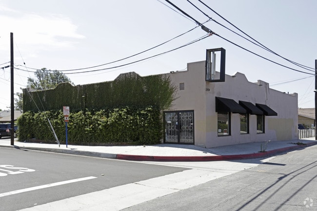
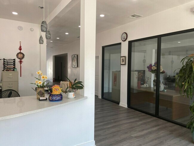
Property Record
19104 Norwalk Blvd, Artesia, CA 90701


Current Lease Availabilities
NEARBY LISTINGS FOR SALE OR LEASE
Property Detail
19104 Norwalk Blvd
Los Angeles-Long Beach-Glendale, CA
3894
7054-007-001
TRACT NO 3894 (EX OF ST) LOTS 97 AND LOT 98
Storemultistory
Los Angeles
X
California
06037C1980F
97,98
2024
0.15 AC
2025
Mid-Cities
554900
Los Angeles
4,358 SF
DEMOGRAPHICS near 19104 Norwalk Blvd
1 Mile
3 Mile
5 Mile
2024 Total Population
23,578
214,232
592,830
2029 Population
22,722
207,476
575,817
Pop Growth 2024-2029
(3.63%)
(3.15%)
(2.87%)
Average Age
44
41
40
2024 Total Households
7,211
65,602
182,039
HH Growth 2024-2029
(3.92%)
(3.36%)
(3.08%)
Median Household Inc
$102,978
$99,695
$93,253
Avg Household Size
3.20
3.20
3.10
2024 Avg HH Vehicles
2.00
2.00
2.00
Median Home Value
$786,135
$742,273
$730,248
Median Year Built
1971
1966
1962
Nearby Places
Map Layers
Map Styles
 Street
 Aerial
- Restaurants
- Banks
- Shops
- Fitness
- Groceries
PUBLIC TRANSPORTATION
COMMUTER RAIL
Norwalk/Santa Fe Springs (91 Line - Southern California Regional Rail Authority (Metrolink), Orange County Line - Southern California Regional Rail Authority (Metrolink))
DRIVE
WALK
Distance
Norwalk/Santa Fe Springs (91 Line - Southern California Regional Rail Authority (Metrolink), Orange County Line - Southern California Regional Rail Authority (Metrolink))
11 min
5.1 mi
Buena Park (91 Line - Southern California Regional Rail Authority (Metrolink), Orange County Line - Southern California Regional Rail Authority (Metrolink))
DRIVE
WALK
Distance
Buena Park (91 Line - Southern California Regional Rail Authority (Metrolink), Orange County Line - Southern California Regional Rail Authority (Metrolink))
13 min
6.5 mi
AIRPORT
Long Beach (Daugherty Field)
DRIVE
WALK
Distance
Long Beach (Daugherty Field)
16 min
8.8 mi
John Wayne/Orange County
DRIVE
WALK
Distance
John Wayne/Orange County
30 min
22.0 mi
Los Angeles International
DRIVE
WALK
Distance
Los Angeles International
32 min
24.8 mi
Nearby Properties
Address
Land Use
TOTAL SIZE
Lot Size
Zoning
Address
Land Use
TOTAL SIZE
Lot Size
Zoning
324,400 SF
55.03 AC
CECR
Address
Land Use
TOTAL SIZE
Lot Size
Zoning
634,060 SF
76.06 AC
SSM2
Address
Land Use
TOTAL SIZE
Lot Size
Zoning
Address
Land Use
TOTAL SIZE
Lot Size
Zoning
235,971 SF
10.58 AC
HGC4*
Address
Land Use
TOTAL SIZE
Lot Size
Zoning
369,940 SF
8.70 AC
CEM
Address
Land Use
TOTAL SIZE
Lot Size
Zoning
353,001 SF
4.81 AC
CEM
Address
Land Use
TOTAL SIZE
Lot Size
Zoning
224,131 SF
9.03 AC
CEM
Address
Land Use
TOTAL SIZE
Lot Size
Zoning
266,337 SF
2.40 AC
CE-ADP-16
Address
Land Use
TOTAL SIZE
Lot Size
Zoning
272,080 SF
13.34 AC
C
Address
Land Use
TOTAL SIZE
Lot Size
Zoning
203,371 SF
0.14 AC
HGC4*
Address
Land Use
TOTAL SIZE
Lot Size
Zoning
163,350 SF
7.58 AC
CEM
Address
Land Use
TOTAL SIZE
Lot Size
Zoning
154,616 SF
7.53 AC
CEM
Address
Land Use
TOTAL SIZE
Lot Size
Zoning
247,536 SF
5.79 AC
CECR
Address
Land Use
TOTAL SIZE
Lot Size
Zoning
11.86 AC
Address
Land Use
TOTAL SIZE
Lot Size
Zoning
168,912 SF
8.09 AC
CEM
Address
Land Use
TOTAL SIZE
Lot Size
Zoning
124,820 SF
4.11 AC
NOM2*
Address
Land Use
TOTAL SIZE
Lot Size
Zoning
161,650 SF
6 AC
CEM(D1)*
Address
Land Use
TOTAL SIZE
Lot Size
Zoning
118,906 SF
8.32 AC
CEM
Address
Land Use
TOTAL SIZE
Lot Size
Zoning
Address
Land Use
TOTAL SIZE
Lot Size
Zoning
300,102 SF
11.94 AC
SSM2*
Address
Land Use
TOTAL SIZE
Lot Size
Zoning
307,248 SF
14.83 AC
CEM
Address
Land Use
TOTAL SIZE
Lot Size
Zoning
145,520 SF
6.64 AC
CEADP1
Address
Land Use
TOTAL SIZE
Lot Size
Zoning
120,094 SF
5.93 AC
Address
Land Use
TOTAL SIZE
Lot Size
Zoning
64,160 SF
6.62 AC
CEADP1
Address
Land Use
TOTAL SIZE
Lot Size
Zoning
140,624 SF
4.35 AC
ATMRV1200*
Address
Land Use
TOTAL SIZE
Lot Size
Zoning
259,760 SF
11.45 AC
CEM
Address
Land Use
TOTAL SIZE
Lot Size
Zoning
1,004,620 SF
19.73 AC
CECR
Address
Land Use
TOTAL SIZE
Lot Size
Zoning
121,987 SF
5.49 AC
CEM
Address
Land Use
TOTAL SIZE
Lot Size
Zoning
102,680 SF
4.43 AC
CEADP1
Address
Land Use
TOTAL SIZE
Lot Size
Zoning
132,019 SF
5.22 AC
LKMFR*
The World's #1 Commercial Real Estate Marketplace
Connect with us
© 2025 CoStar Group
The information above has been obtained from sources believed reliable. While we do not doubt its accuracy we have not verified it and make no guarantee, warranty or representation about it. It is your responsibility to independently confirm its accuracy and completeness. Any projections, opinions, assumptions, or estimates used are for example only and do not represent the current or future performance of the property. The value of this transaction to you depends on tax and other factors which should be evaluated by your tax, financial, and legal advisors. You and your advisors should conduct a careful, independent investigation of the property to determine to your satisfaction the suitability of the property for your needs.