Property Record
19106 E Sprague Ave, Spokane Valley, WA 99016


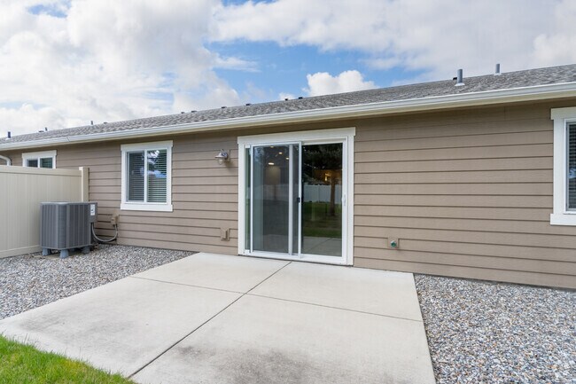
Property Detail
19106 E Sprague Ave
55202.3402
SHP 2015-0008 LT 2 (AFN# 6445783)
Apartment
Spokane
R-4
Washington
B and X Area of moderate flood hazard, usually the area between the limits of the 100-year and 500-year floods.
2
2025
4.27 AC
2025
Greenacres
013102
Spokane
52,958 SF
Spokane-Spokane Valley, WA
NEARBY LISTINGS FOR SALE OR LEASE
DEMOGRAPHICS near 19106 E Sprague Ave
1 mile
3 mile
5 mile
2025 Total Population
7,405
45,491
101,541
2030 Population
7,746
47,074
104,503
Pop Growth 2025-2030
+ 4.60%
+ 3.48%
+ 2.92%
Average Age
41
40
40
2025 Total Households
2,797
17,867
40,105
HH Growth 2025-2030
+ 4.58%
+ 3.47%
+ 2.89%
Median Household Inc
$91,358
$86,050
$81,897
Avg Household Size
2.60
2.50
2.50
2025 Avg HH Vehicles
2.00
2.00
2.00
Median Home Value
$473,445
$474,128
$457,375
Median Year Built
2000
2000
1993
Nearby Places
Map Layers
Map Styles
 Street
 Aerial
Layers
 Traffic
 Biking
Places
Listings with unknown addresses are not visible on the map
- Restaurants
- Banks
- Shops
- Fitness
- Groceries
PUBLIC TRANSPORTATION
AIRPORT
Spokane International
Drive
Walk
Distance
Spokane International
29 min
20.2 mi
Freight Ports
Port of Everett
Drive
Walk
Distance
Port of Everett
357 min
315.8 mi
SALE & LEASE HISTORY
LISTING DATE
SALE/LEASE

Aug 29, 2022
For Sale
Nearby Properties
Address
Land Use
TOTAL SIZE
Lot Size
Zoning
Address
Land Use
TOTAL SIZE
Lot Size
Zoning
1,077,082 SF
85.91 AC
I-2
Address
Land Use
TOTAL SIZE
Lot Size
Zoning
275,534 SF
67.98 AC
P
Address
Land Use
TOTAL SIZE
Lot Size
Zoning
373,111 SF
12.44 AC
MUC
Address
Land Use
TOTAL SIZE
Lot Size
Zoning
130,380 SF
11.10 AC
MUC
Address
Land Use
TOTAL SIZE
Lot Size
Zoning
237,094 SF
58.56 AC
R-3
Address
Land Use
TOTAL SIZE
Lot Size
Zoning
296,760 SF
37.61 AC
I-1
Address
Land Use
TOTAL SIZE
Lot Size
Zoning
358,700 SF
16.41 AC
R3
Address
Land Use
TOTAL SIZE
Lot Size
Zoning
216,965 SF
10.70 AC
MUC
Address
Land Use
TOTAL SIZE
Lot Size
Zoning
227,044 SF
7.20 AC
MUC
Address
Land Use
TOTAL SIZE
Lot Size
Zoning
98,088 SF
13.94 AC
SAP
Address
Land Use
TOTAL SIZE
Lot Size
Zoning
323,993 SF
10.97 AC
MUC
Address
Land Use
TOTAL SIZE
Lot Size
Zoning
197,868 SF
7.15 AC
MUC
Address
Land Use
TOTAL SIZE
Lot Size
Zoning
192,698 SF
9.55 AC
MUC
Address
Land Use
TOTAL SIZE
Lot Size
Zoning
346,589 SF
16.28 AC
MF-2
Address
Land Use
TOTAL SIZE
Lot Size
Zoning
153,691 SF
24.92 AC
P
Address
Land Use
TOTAL SIZE
Lot Size
Zoning
123,400 SF
4.50 AC
MUC
Address
Land Use
TOTAL SIZE
Lot Size
Zoning
133,310 SF
10.93 AC
M2
Address
Land Use
TOTAL SIZE
Lot Size
Zoning
211,011 SF
8.81 AC
CMU
Address
Land Use
TOTAL SIZE
Lot Size
Zoning
139,122 SF
6.17 AC
MUC
Address
Land Use
TOTAL SIZE
Lot Size
Zoning
150,936 SF
9.30 AC
M2
Address
Land Use
TOTAL SIZE
Lot Size
Zoning
68,928 SF
10.96 AC
R-3
Address
Land Use
TOTAL SIZE
Lot Size
Zoning
231,172 SF
19.20 AC
RC
Address
Land Use
TOTAL SIZE
Lot Size
Zoning
145,884 SF
6.87 AC
M2
Address
Land Use
TOTAL SIZE
Lot Size
Zoning
107,279 SF
7.31 AC
MF-2
Address
Land Use
TOTAL SIZE
Lot Size
Zoning
144,544 SF
9.65 AC
I-1
Address
Land Use
TOTAL SIZE
Lot Size
Zoning
152,033 SF
6.14 AC
MF-2
Address
Land Use
TOTAL SIZE
Lot Size
Zoning
144,349 SF
8.06 AC
I-2
Address
Land Use
TOTAL SIZE
Lot Size
Zoning
149,106 SF
4.99 AC
MF-2
Address
Land Use
TOTAL SIZE
Lot Size
Zoning
126,989 SF
7.55 AC
I-2
Address
Land Use
TOTAL SIZE
Lot Size
Zoning
143,394 SF
4.38 AC
MUC
The World's #1 Commercial Real Estate Marketplace
Connect with us
© 2026 CoStar Group
The information above has been obtained from sources believed reliable. While we do not doubt its accuracy we have not verified it and make no guarantee, warranty or representation about it. It is your responsibility to independently confirm its accuracy and completeness. Any projections, opinions, assumptions, or estimates used are for example only and do not represent the current or future performance of the property. The value of this transaction to you depends on tax and other factors which should be evaluated by your tax, financial, and legal advisors. You and your advisors should conduct a careful, independent investigation of the property to determine to your satisfaction the suitability of the property for your needs.