Property Record
1911 Chain Bridge Rd, Mc Lean, VA 22102
NEARBY LISTINGS FOR SALE OR LEASE
Property Detail
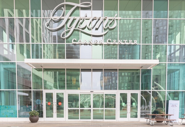
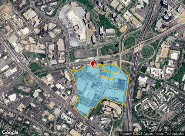
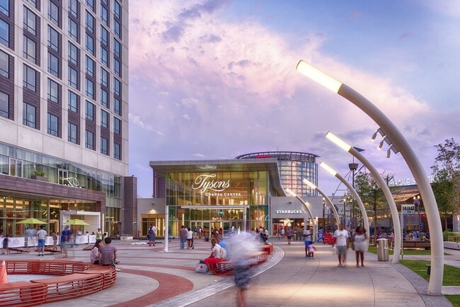
1911 Chain Bridge Rd
Washington-Arlington-Alexandria, DC-VA-MD-WV
Div Of Lehndorff Tysons
0294-01-0035A
DIV OF LEHNDORFF TYSONS JOINT VENTURE PCL 35A COMMERCIAL COMPONENT OF 0294T01 0035A
Regionalshoppingcenterormallwithanchorstore
Fairfax
X
Virginia
5100540015D
35a
2024
62.90 AC
2025
Tysons Corner
480205
Washington, DC
2,385,458 SF
DEMOGRAPHICS near 1911 Chain Bridge Rd
1 Mile
3 Mile
5 Mile
2024 Total Population
22,040
118,657
273,345
2029 Population
22,238
117,809
270,175
Pop Growth 2024-2029
+ 0.90%
(0.71%)
(1.16%)
Average Age
38
40
40
2024 Total Households
10,795
46,371
100,979
HH Growth 2024-2029
+ 1.19%
(0.68%)
(1.18%)
Median Household Inc
$129,693
$159,000
$162,776
Avg Household Size
2.00
2.50
2.60
2024 Avg HH Vehicles
1.00
2.00
2.00
Median Home Value
$652,212
$886,358
$857,053
Median Year Built
1995
1983
1977
Nearby Places
Map Layers
Map Styles
 Street
 Aerial
- Restaurants
- Banks
- Shops
- Fitness
- Groceries
PUBLIC TRANSPORTATION
TRANSIT/SUBWAY
Tysons Corner (Silver Line - Washington Metropolitan Area Transit Authority Metrorail (Metrorail))
DRIVE
WALK
Distance
Tysons Corner (Silver Line - Washington Metropolitan Area Transit Authority Metrorail (Metrorail))
1 min
3 min
0.2 mi
Mclean (Silver Line - Washington Metropolitan Area Transit Authority Metrorail (Metrorail))
DRIVE
WALK
Distance
Mclean (Silver Line - Washington Metropolitan Area Transit Authority Metrorail (Metrorail))
2 min
17 min
0.9 mi
Greensboro (Silver Line - Washington Metropolitan Area Transit Authority Metrorail (Metrorail))
DRIVE
WALK
Distance
Greensboro (Silver Line - Washington Metropolitan Area Transit Authority Metrorail (Metrorail))
3 min
20 min
1.0 mi
AIRPORT
Washington Dulles International
DRIVE
WALK
Distance
Washington Dulles International
26 min
14.9 mi
Ronald Reagan Washington Ntl
DRIVE
WALK
Distance
Ronald Reagan Washington Ntl
26 min
15.6 mi
Freight Ports
Port of Baltimore
DRIVE
WALK
Distance
Port of Baltimore
65 min
48.1 mi
SALE & LEASE HISTORY
LISTING DATE
SALE/LEASE

Sep 29, 2020
For Lease
Sep 24, 2016
For Lease
Nearby Properties
Address
Land Use
TOTAL SIZE
Lot Size
Zoning
Address
Land Use
TOTAL SIZE
Lot Size
Zoning
562,860 SF
23.56 AC
400
Address
Land Use
TOTAL SIZE
Lot Size
Zoning
964,537 SF
5.06 AC
360
Address
Land Use
TOTAL SIZE
Lot Size
Zoning
915,666 SF
2.77 AC
360
Address
Land Use
TOTAL SIZE
Lot Size
Zoning
729,473 SF
3.89 AC
360
Address
Land Use
TOTAL SIZE
Lot Size
Zoning
553,360 SF
1.99 AC
403
Address
Land Use
TOTAL SIZE
Lot Size
Zoning
842,366 SF
16.74 AC
400
Address
Land Use
TOTAL SIZE
Lot Size
Zoning
613,642 SF
19.08 AC
330
Address
Land Use
TOTAL SIZE
Lot Size
Zoning
929,735 SF
21.95 AC
430
Address
Land Use
TOTAL SIZE
Lot Size
Zoning
431,636 SF
3.25 AC
360
Address
Land Use
TOTAL SIZE
Lot Size
Zoning
510,357 SF
3.03 AC
360
Address
Land Use
TOTAL SIZE
Lot Size
Zoning
567,363 SF
2.39 AC
360
Address
Land Use
TOTAL SIZE
Lot Size
Zoning
475,471 SF
2.51 AC
360
Address
Land Use
TOTAL SIZE
Lot Size
Zoning
402,531 SF
0.97 AC
360
Address
Land Use
TOTAL SIZE
Lot Size
Zoning
455,583 SF
3.51 AC
400
Address
Land Use
TOTAL SIZE
Lot Size
Zoning
601,758 SF
3.70 AC
360
Address
Land Use
TOTAL SIZE
Lot Size
Zoning
601,409 SF
3.89 AC
360
Address
Land Use
TOTAL SIZE
Lot Size
Zoning
505,415 SF
1.95 AC
403
Address
Land Use
TOTAL SIZE
Lot Size
Zoning
363,805 SF
2.64 AC
350
Address
Land Use
TOTAL SIZE
Lot Size
Zoning
483,000 SF
1.98 AC
360
Address
Land Use
TOTAL SIZE
Lot Size
Zoning
B-1 LTD.BU
Address
Land Use
TOTAL SIZE
Lot Size
Zoning
584,872 SF
10.58 AC
470
Address
Land Use
TOTAL SIZE
Lot Size
Zoning
290,749 SF
1.49 AC
403
Address
Land Use
TOTAL SIZE
Lot Size
Zoning
425,118 SF
16.99 AC
320
Address
Land Use
TOTAL SIZE
Lot Size
Zoning
440,641 SF
3.11 AC
360
Address
Land Use
TOTAL SIZE
Lot Size
Zoning
346,335 SF
1.42 AC
350
Address
Land Use
TOTAL SIZE
Lot Size
Zoning
356,812 SF
0.92 AC
400
Address
Land Use
TOTAL SIZE
Lot Size
Zoning
520,200 SF
4.53 AC
360
Address
Land Use
TOTAL SIZE
Lot Size
Zoning
394,539 SF
15.87 AC
230
The World's #1 Commercial Real Estate Marketplace
Connect with us
© 2026 CoStar Group
The information above has been obtained from sources believed reliable. While we do not doubt its accuracy we have not verified it and make no guarantee, warranty or representation about it. It is your responsibility to independently confirm its accuracy and completeness. Any projections, opinions, assumptions, or estimates used are for example only and do not represent the current or future performance of the property. The value of this transaction to you depends on tax and other factors which should be evaluated by your tax, financial, and legal advisors. You and your advisors should conduct a careful, independent investigation of the property to determine to your satisfaction the suitability of the property for your needs.