Property Record
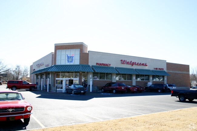
1911 N Broadway St, Pittsburg, KS 66762

NEARBY LISTINGS FOR SALE OR LEASE
Property Detail
1911 N Broadway St
Other Market Areas
K&T Coal Co 4Th Addition
Pittsburg, KS
K&T COAL CO 4TH ADDITION, ACRES 2.5, LTS 1 - 22, BLK 1 & ALL VAC ALLEYS LYG ADJ TO & BETW SD LTS, LESS BEG NE COR SD LT 1, TH
204-19-0-10-01-001.00-0
Crawford
Storebuilding
Kansas
2025
1-22
2025
2.51 AC
957200
Kansas Area
14,820 SF
DEMOGRAPHICS near 1911 N Broadway St
1 Mile
3 Mile
5 Mile
2024 Total Population
5,621
23,575
27,534
2029 Population
5,665
23,630
27,579
Pop Growth 2024-2029
+ 0.78%
+ 0.23%
+ 0.16%
Average Age
35
35
36
2024 Total Households
2,360
9,427
10,979
HH Growth 2024-2029
+ 0.89%
+ 0.28%
+ 0.18%
Median Household Inc
$30,320
$39,242
$42,435
Avg Household Size
2.30
2.30
2.30
2024 Avg HH Vehicles
1.00
2.00
2.00
Median Home Value
$63,762
$112,600
$128,752
Median Year Built
1959
1970
1972
Nearby Places
Map Layers
Map Styles
 Street
 Aerial
- Restaurants
- Banks
- Shops
- Fitness
- Groceries
Nearby Properties
Address
Land Use
TOTAL SIZE
Lot Size
Zoning
Address
Land Use
TOTAL SIZE
Lot Size
Zoning
232,664 SF
16.10 AC
CP2
Address
Land Use
TOTAL SIZE
Lot Size
Zoning
431,989 SF
19.40 AC
Address
Land Use
TOTAL SIZE
Lot Size
Zoning
197,181 SF
49 AC
R1A
Address
Land Use
TOTAL SIZE
Lot Size
Zoning
88,644 SF
15.10 AC
Address
Land Use
TOTAL SIZE
Lot Size
Zoning
89,822 SF
5.60 AC
R2
Address
Land Use
TOTAL SIZE
Lot Size
Zoning
5,512 SF
530.50 AC
A0
Address
Land Use
TOTAL SIZE
Lot Size
Zoning
64,068 SF
3.50 AC
R1B
Address
Land Use
TOTAL SIZE
Lot Size
Zoning
53,664 SF
7 AC
R1B
Address
Land Use
TOTAL SIZE
Lot Size
Zoning
8,000 SF
23 AC
Address
Land Use
TOTAL SIZE
Lot Size
Zoning
43,756 SF
2 AC
R1C
Address
Land Use
TOTAL SIZE
Lot Size
Zoning
49,748 SF
10.30 AC
R1B
Address
Land Use
TOTAL SIZE
Lot Size
Zoning
46,949 SF
2.93 AC
CP2
Address
Land Use
TOTAL SIZE
Lot Size
Zoning
112,419 SF
2.70 AC
Address
Land Use
TOTAL SIZE
Lot Size
Zoning
31,930 SF
4.80 AC
Address
Land Use
TOTAL SIZE
Lot Size
Zoning
55,320 SF
1.19 AC
CP4
Address
Land Use
TOTAL SIZE
Lot Size
Zoning
139,580 SF
5 AC
Address
Land Use
TOTAL SIZE
Lot Size
Zoning
42,938 SF
2.19 AC
R2
Address
Land Use
TOTAL SIZE
Lot Size
Zoning
86,906 SF
3.10 AC
R1C
Address
Land Use
TOTAL SIZE
Lot Size
Zoning
1,565 SF
20.20 AC
Address
Land Use
TOTAL SIZE
Lot Size
Zoning
184,784 SF
33.98 AC
IP3
Address
Land Use
TOTAL SIZE
Lot Size
Zoning
25,256 SF
1.30 AC
CP4
Address
Land Use
TOTAL SIZE
Lot Size
Zoning
29,840 SF
2.68 AC
CP4
Address
Land Use
TOTAL SIZE
Lot Size
Zoning
46,821 SF
2.76 AC
R1C
Address
Land Use
TOTAL SIZE
Lot Size
Zoning
27,044 SF
5.36 AC
Address
Land Use
TOTAL SIZE
Lot Size
Zoning
5,200 SF
13.02 AC
Address
Land Use
TOTAL SIZE
Lot Size
Zoning
12,960 SF
5.10 AC
Address
Land Use
TOTAL SIZE
Lot Size
Zoning
22,668 SF
1.80 AC
CP2
Address
Land Use
TOTAL SIZE
Lot Size
Zoning
15,000 SF
2.40 AC
CP4
Address
Land Use
TOTAL SIZE
Lot Size
Zoning
1,829 SF
139.70 AC
Address
Land Use
TOTAL SIZE
Lot Size
Zoning
41,806 SF
3.31 AC
CP2
The World's #1 Commercial Real Estate Marketplace
Connect with us
© 2025 CoStar Group
The information above has been obtained from sources believed reliable. While we do not doubt its accuracy we have not verified it and make no guarantee, warranty or representation about it. It is your responsibility to independently confirm its accuracy and completeness. Any projections, opinions, assumptions, or estimates used are for example only and do not represent the current or future performance of the property. The value of this transaction to you depends on tax and other factors which should be evaluated by your tax, financial, and legal advisors. You and your advisors should conduct a careful, independent investigation of the property to determine to your satisfaction the suitability of the property for your needs.