Property Record
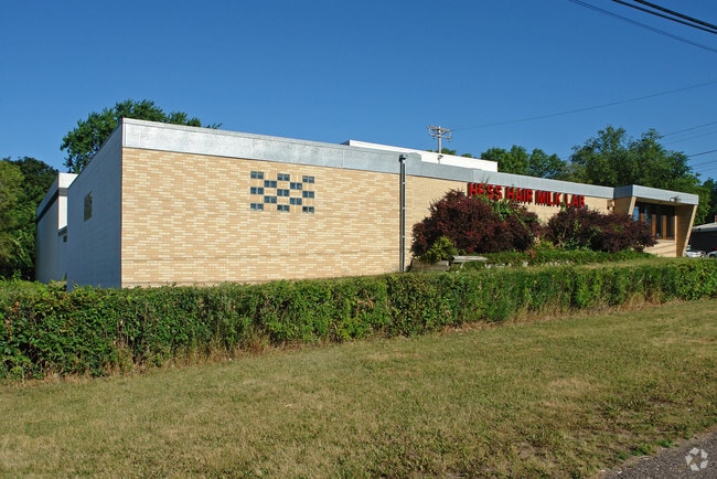
1911 Rice St, Saint Paul, MN 55113


Current Lease Availabilities
NEARBY LISTINGS FOR SALE OR LEASE
Property Detail
1911 Rice St
Minneapolis-St. Paul-Bloomington, MN-WI
Shady Beach
13-29-23-41-0034
SHADY BEACH VAC ALLEY ACCRUING AND N 30 FT OF LOT 3 & ALL OF LOTS 1 & LOT 2
Heavyindustrial
Ramsey
X
Minnesota
27037C0050E
3,1,2
2024
0.74 AC
2025
North Central
041602
Minneapolis/St Paul
18,136 SF
DEMOGRAPHICS near 1911 Rice St
1 Mile
3 Mile
5 Mile
2024 Total Population
10,914
116,047
310,584
2029 Population
10,618
112,261
302,058
Pop Growth 2024-2029
(2.71%)
(3.26%)
(2.75%)
Average Age
36
37
37
2024 Total Households
4,080
42,900
121,921
HH Growth 2024-2029
(2.92%)
(3.43%)
(2.80%)
Median Household Inc
$58,312
$67,095
$67,047
Avg Household Size
2.60
2.60
2.40
2024 Avg HH Vehicles
2.00
2.00
2.00
Median Home Value
$270,799
$265,945
$272,213
Median Year Built
1970
1962
1961
Nearby Places
Map Layers
Map Styles
 Street
 Aerial
- Restaurants
- Banks
- Shops
- Fitness
- Groceries
PUBLIC TRANSPORTATION
COMMUTER RAIL
DRIVE
WALK
Distance
8 min
4.7 mi
AIRPORT
Minneapolis-St Paul International/Wold-Chamberlain
DRIVE
WALK
Distance
Minneapolis-St Paul International/Wold-Chamberlain
22 min
12.7 mi
Nearby Properties
Address
Land Use
TOTAL SIZE
Lot Size
Zoning
Address
Land Use
TOTAL SIZE
Lot Size
Zoning
384,515 SF
1.33 AC
Address
Land Use
TOTAL SIZE
Lot Size
Zoning
404,491 SF
27.01 AC
Address
Land Use
TOTAL SIZE
Lot Size
Zoning
18.24 AC
Address
Land Use
TOTAL SIZE
Lot Size
Zoning
48.52 AC
Address
Land Use
TOTAL SIZE
Lot Size
Zoning
7.41 AC
Address
Land Use
TOTAL SIZE
Lot Size
Zoning
3,050 SF
58.60 AC
Address
Land Use
TOTAL SIZE
Lot Size
Zoning
276,144 SF
347.68 AC
Address
Land Use
TOTAL SIZE
Lot Size
Zoning
220 SF
19.66 AC
Address
Land Use
TOTAL SIZE
Lot Size
Zoning
160,800 SF
5.05 AC
Address
Land Use
TOTAL SIZE
Lot Size
Zoning
4,800 SF
20.36 AC
Address
Land Use
TOTAL SIZE
Lot Size
Zoning
47,670 SF
179 AC
Address
Land Use
TOTAL SIZE
Lot Size
Zoning
13.10 AC
Address
Land Use
TOTAL SIZE
Lot Size
Zoning
658,453 SF
40.22 AC
Address
Land Use
TOTAL SIZE
Lot Size
Zoning
Address
Land Use
TOTAL SIZE
Lot Size
Zoning
273,937 SF
16.75 AC
Address
Land Use
TOTAL SIZE
Lot Size
Zoning
180,756 SF
40.63 AC
Address
Land Use
TOTAL SIZE
Lot Size
Zoning
202,958 SF
4.87 AC
Address
Land Use
TOTAL SIZE
Lot Size
Zoning
73,933 SF
2.50 AC
Address
Land Use
TOTAL SIZE
Lot Size
Zoning
270,140 SF
2.01 AC
Address
Land Use
TOTAL SIZE
Lot Size
Zoning
313,546 SF
7.33 AC
Address
Land Use
TOTAL SIZE
Lot Size
Zoning
272,002 SF
8.16 AC
Address
Land Use
TOTAL SIZE
Lot Size
Zoning
129,854 SF
5.08 AC
Address
Land Use
TOTAL SIZE
Lot Size
Zoning
24.60 AC
Address
Land Use
TOTAL SIZE
Lot Size
Zoning
129,290 SF
5.13 AC
Address
Land Use
TOTAL SIZE
Lot Size
Zoning
278,392 SF
8.04 AC
Address
Land Use
TOTAL SIZE
Lot Size
Zoning
2,442 SF
98.05 AC
Address
Land Use
TOTAL SIZE
Lot Size
Zoning
35.93 AC
W7PUBLC
Address
Land Use
TOTAL SIZE
Lot Size
Zoning
2,779 SF
95.22 AC
Address
Land Use
TOTAL SIZE
Lot Size
Zoning
157,404 SF
40.84 AC
Address
Land Use
TOTAL SIZE
Lot Size
Zoning
17.16 AC
The World's #1 Commercial Real Estate Marketplace
Connect with us
© 2025 CoStar Group
The information above has been obtained from sources believed reliable. While we do not doubt its accuracy we have not verified it and make no guarantee, warranty or representation about it. It is your responsibility to independently confirm its accuracy and completeness. Any projections, opinions, assumptions, or estimates used are for example only and do not represent the current or future performance of the property. The value of this transaction to you depends on tax and other factors which should be evaluated by your tax, financial, and legal advisors. You and your advisors should conduct a careful, independent investigation of the property to determine to your satisfaction the suitability of the property for your needs.