Property Record
1911 S Wiggins Rd, Plant City, FL 33566


NEARBY LISTINGS FOR SALE OR LEASE
Property Detail
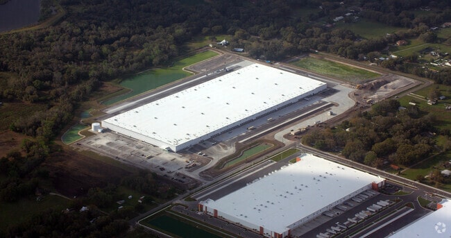
1911 S Wiggins Rd
Tampa-St. Petersburg-Clearwater, FL
Unplatted
P-36-28-22-ZZZ-000004-81660.0
BEG AT NE COR OF SE 1/4 OF SW 1/4 AND RUN W 958.15 FT S 412 FT W TO PT ON W BDRY OF SE 1/4 OF SW 1/4 CONT W 185 FT S TO S BDRY OF SW 1/4 E ALONG BDRY TO SE COR OF SE 1/4 OF SW 1/4 AND N TO BEG ... AND NE 1/4 OF NW 1/4 OF SEC 01 TWP 29 RGE 22 LESS S 4
Warehouse
Hillsborough
A
Florida
12057C0430H
81660
2024
67.03 AC
2024
E Hillsborough/Plant
013001
Tampa/St Petersburg
781,200 SF
DEMOGRAPHICS near 1911 S Wiggins Rd
1 Mile
3 Mile
5 Mile
2024 Total Population
952
13,012
67,870
2029 Population
1,055
14,478
76,774
Pop Growth 2024-2029
+ 10.82%
+ 11.27%
+ 13.12%
Average Age
39
39
39
2024 Total Households
308
4,396
23,929
HH Growth 2024-2029
+ 11.36%
+ 11.81%
+ 13.46%
Median Household Inc
$66,275
$67,391
$62,990
Avg Household Size
2.90
2.80
2.70
2024 Avg HH Vehicles
2.00
2.00
2.00
Median Home Value
$272,448
$248,266
$247,463
Median Year Built
1995
1997
1988
Nearby Places
Map Layers
Map Styles
 Street
 Aerial
- Restaurants
- Banks
- Shops
- Fitness
- Groceries
PUBLIC TRANSPORTATION
COMMUTER RAIL
Lakeland (Silver Star - Amtrak)
DRIVE
WALK
Distance
Lakeland (Silver Star - Amtrak)
19 min
9.7 mi
AIRPORT
Tampa International
DRIVE
WALK
Distance
Tampa International
52 min
37.9 mi
Freight Ports
Port of Tampa Bay
DRIVE
WALK
Distance
Port of Tampa Bay
45 min
31.3 mi
Nearby Properties
Address
Land Use
TOTAL SIZE
Lot Size
Zoning
Address
Land Use
TOTAL SIZE
Lot Size
Zoning
1,055,503 SF
112.72 AC
R-4
Address
Land Use
TOTAL SIZE
Lot Size
Zoning
1,210,880 SF
405.82 AC
PUD
Address
Land Use
TOTAL SIZE
Lot Size
Zoning
1,494,080 SF
116.77 AC
Address
Land Use
TOTAL SIZE
Lot Size
Zoning
705,615 SF
33.05 AC
Address
Land Use
TOTAL SIZE
Lot Size
Zoning
711,568 SF
42.87 AC
PD
Address
Land Use
TOTAL SIZE
Lot Size
Zoning
805,336 SF
52.50 AC
I
Address
Land Use
TOTAL SIZE
Lot Size
Zoning
519,942 SF
130.03 AC
I
Address
Land Use
TOTAL SIZE
Lot Size
Zoning
595,473 SF
47.29 AC
Address
Land Use
TOTAL SIZE
Lot Size
Zoning
711,568 SF
43.33 AC
PD
Address
Land Use
TOTAL SIZE
Lot Size
Zoning
723,962 SF
47.49 AC
I
Address
Land Use
TOTAL SIZE
Lot Size
Zoning
655,123 SF
45.28 AC
Address
Land Use
TOTAL SIZE
Lot Size
Zoning
508,310 SF
37.85 AC
M-1A
Address
Land Use
TOTAL SIZE
Lot Size
Zoning
520,806 SF
25.62 AC
Address
Land Use
TOTAL SIZE
Lot Size
Zoning
605,109 SF
141.96 AC
PD
Address
Land Use
TOTAL SIZE
Lot Size
Zoning
505,506 SF
50.60 AC
MU-R/C/I
Address
Land Use
TOTAL SIZE
Lot Size
Zoning
492,960 SF
22.09 AC
Address
Land Use
TOTAL SIZE
Lot Size
Zoning
599,280 SF
35.27 AC
GI
Address
Land Use
TOTAL SIZE
Lot Size
Zoning
566,274 SF
33.79 AC
GI
Address
Land Use
TOTAL SIZE
Lot Size
Zoning
417,890 SF
14.59 AC
Address
Land Use
TOTAL SIZE
Lot Size
Zoning
387,165 SF
37 AC
I2
Address
Land Use
TOTAL SIZE
Lot Size
Zoning
415,389 SF
62.31 AC
MU-R/C/I
Address
Land Use
TOTAL SIZE
Lot Size
Zoning
220,510 SF
37.56 AC
I
Address
Land Use
TOTAL SIZE
Lot Size
Zoning
243,294 SF
19.80 AC
CC
Address
Land Use
TOTAL SIZE
Lot Size
Zoning
333,718 SF
28.99 AC
I
Address
Land Use
TOTAL SIZE
Lot Size
Zoning
349,920 SF
22.21 AC
Address
Land Use
TOTAL SIZE
Lot Size
Zoning
328,863 SF
38.87 AC
M-1A
Address
Land Use
TOTAL SIZE
Lot Size
Zoning
300,411 SF
18.77 AC
I
Address
Land Use
TOTAL SIZE
Lot Size
Zoning
297,907 SF
21.43 AC
M-1A
Address
Land Use
TOTAL SIZE
Lot Size
Zoning
492,180 SF
32.61 AC
PD
The World's #1 Commercial Real Estate Marketplace
Connect with us
© 2026 CoStar Group
The information above has been obtained from sources believed reliable. While we do not doubt its accuracy we have not verified it and make no guarantee, warranty or representation about it. It is your responsibility to independently confirm its accuracy and completeness. Any projections, opinions, assumptions, or estimates used are for example only and do not represent the current or future performance of the property. The value of this transaction to you depends on tax and other factors which should be evaluated by your tax, financial, and legal advisors. You and your advisors should conduct a careful, independent investigation of the property to determine to your satisfaction the suitability of the property for your needs.