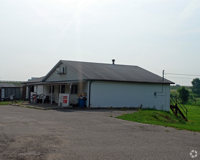
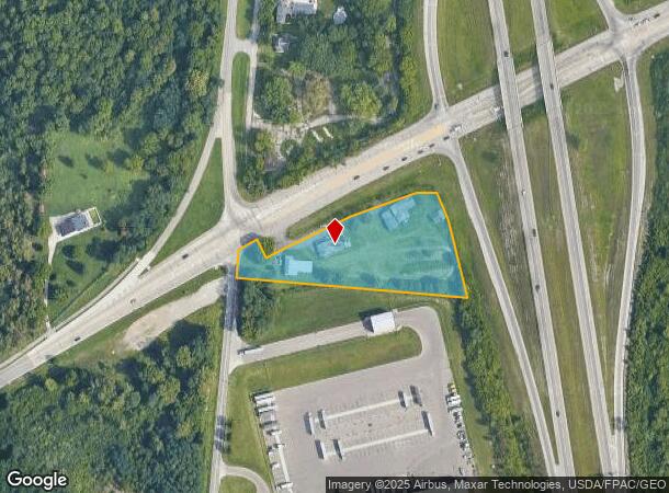
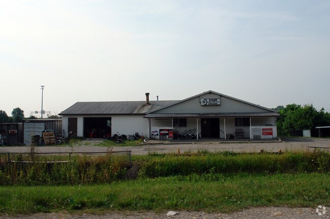
Property Record
1876 N Broad St, Fairborn, OH 45324
NEARBY LISTINGS FOR SALE OR LEASE
Property Detail
1876 N Broad St
Dayton, OH
Mrs
A01-0002-0019-0-0019-00
Greene
Sfr
Ohio
X
2.38 AC
39057C0030D
East Dayton
2,229 SF
Cincinnati/Dayton
DEMOGRAPHICS near 1876 N Broad St
1 Mile
3 Mile
5 Mile
2024 Total Population
896
18,393
51,952
2029 Population
909
18,722
52,732
Pop Growth 2024-2029
+ 1.45%
+ 1.79%
+ 1.50%
Average Age
44
42
41
2024 Total Households
366
7,958
22,396
HH Growth 2024-2029
+ 1.37%
+ 1.78%
+ 1.59%
Median Household Inc
$68,203
$66,253
$65,335
Avg Household Size
2.30
2.20
2.30
2024 Avg HH Vehicles
2.00
2.00
2.00
Median Home Value
$137,179
$154,028
$152,910
Median Year Built
1958
1959
1966
Nearby Places
- Restaurants
- Banks
- Shops
- Fitness
- Groceries
PUBLIC TRANSPORTATION
AIRPORT
James M Cox Dayton International
DRIVE
WALK
Distance
James M Cox Dayton International
23 min
17.3 mi
Freight Ports
Port of Toledo
DRIVE
WALK
Distance
Port of Toledo
182 min
157.5 mi
SALE & LEASE HISTORY
LISTING DATE
SALE/LEASE

Feb 15, 2024
For Sale
Nearby Properties
Address
Land Use
TOTAL SIZE
Lot Size
Zoning
Address
Land Use
TOTAL SIZE
Lot Size
Zoning
61,121 SF
7.73 AC
R-2A
Address
Land Use
TOTAL SIZE
Lot Size
Zoning
46,802 SF
25.30 AC
R3
Address
Land Use
TOTAL SIZE
Lot Size
Zoning
4,494 SF
23.15 AC
R1
Address
Land Use
TOTAL SIZE
Lot Size
Zoning
55,805 SF
9.30 AC
B-3
Address
Land Use
TOTAL SIZE
Lot Size
Zoning
261,152 SF
15.63 AC
B3
Address
Land Use
TOTAL SIZE
Lot Size
Zoning
24,522 SF
8.46 AC
R3
Address
Land Use
TOTAL SIZE
Lot Size
Zoning
42,733 SF
66.92 AC
Address
Land Use
TOTAL SIZE
Lot Size
Zoning
38,324 SF
2.77 AC
R4
Address
Land Use
TOTAL SIZE
Lot Size
Zoning
2,456 SF
559 AC
A-1
Address
Land Use
TOTAL SIZE
Lot Size
Zoning
31,338 SF
0.25 AC
B2
Address
Land Use
TOTAL SIZE
Lot Size
Zoning
11,176 SF
9.03 AC
Address
Land Use
TOTAL SIZE
Lot Size
Zoning
11,631 SF
2.44 AC
B3
Address
Land Use
TOTAL SIZE
Lot Size
Zoning
7.95 AC
R-2A
Address
Land Use
TOTAL SIZE
Lot Size
Zoning
121,316 SF
20.43 AC
AG
Address
Land Use
TOTAL SIZE
Lot Size
Zoning
48,228 SF
1.60 AC
R4
Address
Land Use
TOTAL SIZE
Lot Size
Zoning
31,907 SF
10.96 AC
Address
Land Use
TOTAL SIZE
Lot Size
Zoning
79,032 SF
15.40 AC
IR
Address
Land Use
TOTAL SIZE
Lot Size
Zoning
27,500 SF
18.01 AC
I2
Address
Land Use
TOTAL SIZE
Lot Size
Zoning
402.31 AC
A-1
Address
Land Use
TOTAL SIZE
Lot Size
Zoning
17,822 SF
1.88 AC
R1
Address
Land Use
TOTAL SIZE
Lot Size
Zoning
94,317 SF
4.12 AC
PD1
Address
Land Use
TOTAL SIZE
Lot Size
Zoning
14,038 SF
4.88 AC
Address
Land Use
TOTAL SIZE
Lot Size
Zoning
2,556 SF
338.34 AC
Address
Land Use
TOTAL SIZE
Lot Size
Zoning
91,172 SF
18.11 AC
B3
Address
Land Use
TOTAL SIZE
Lot Size
Zoning
26,283 SF
15.37 AC
PARK
Address
Land Use
TOTAL SIZE
Lot Size
Zoning
31,528 SF
3.95 AC
B3
Address
Land Use
TOTAL SIZE
Lot Size
Zoning
42,738 SF
4.58 AC
B-2
Address
Land Use
TOTAL SIZE
Lot Size
Zoning
31,910 SF
7.40 AC
IR
Address
Land Use
TOTAL SIZE
Lot Size
Zoning
15,982 SF
3.93 AC
Address
Land Use
TOTAL SIZE
Lot Size
Zoning
249.99 AC
A-1
The World's #1 Commercial Real Estate Marketplace
Connect with us
© 2025 CoStar Group
The information above has been obtained from sources believed reliable. While we do not doubt its accuracy we have not verified it and make no guarantee, warranty or representation about it. It is your responsibility to independently confirm its accuracy and completeness. Any projections, opinions, assumptions, or estimates used are for example only and do not represent the current or future performance of the property. The value of this transaction to you depends on tax and other factors which should be evaluated by your tax, financial, and legal advisors. You and your advisors should conduct a careful, independent investigation of the property to determine to your satisfaction the suitability of the property for your needs.