Property Record
1913 W 33Rd St, Edmond, OK 73013


NEARBY LISTINGS FOR SALE OR LEASE
Property Detail
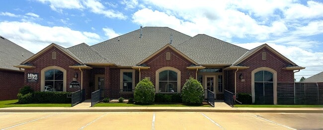
1913 W 33Rd St
Oklahoma City, OK
Bristol Office Park Ii
211121000
BRISTOL OFFICE PARK II 001 001
Commercialnec
Oklahoma
X
Oklahoma
40109C0160H
1
2024
0.15 AC
2025
Edmond
108317
Oklahoma City
4,181 SF
DEMOGRAPHICS near 1913 W 33Rd St
1 mile
3 mile
5 mile
2024 Total Population
6,237
75,458
182,823
2029 Population
6,308
77,009
187,043
Pop Growth 2024-2029
+ 1.14%
+ 2.06%
+ 2.31%
Average Age
39
37
37
2024 Total Households
2,388
31,089
74,976
HH Growth 2024-2029
+ 1.21%
+ 2.33%
+ 2.46%
Median Household Inc
$89,357
$67,288
$70,506
Avg Household Size
2.60
2.30
2.40
2024 Avg HH Vehicles
2.00
2.00
2.00
Median Home Value
$220,864
$210,674
$239,008
Median Year Built
1993
1991
1990
Nearby Places
Map Layers
Map Styles
 Street
 Aerial
Transit
 Traffic
 Biking
Places
Listings with unknown addresses are not visible on the map
- Restaurants
- Banks
- Shops
- Fitness
- Groceries
PUBLIC TRANSPORTATION
AIRPORT
Will Rogers World
Drive
Walk
Distance
Will Rogers World
31 min
21.4 mi
SALE & LEASE HISTORY
LISTING DATE
SALE/LEASE

Oct 29, 2025
For Lease
Mar 01, 2017
For Lease
Nearby Properties
Address
Land Use
TOTAL SIZE
Lot Size
Zoning
Address
Land Use
TOTAL SIZE
Lot Size
Zoning
242,907 SF
I-2
Address
Land Use
TOTAL SIZE
Lot Size
Zoning
594,334 SF
71.64 AC
C-3
Address
Land Use
TOTAL SIZE
Lot Size
Zoning
460,954 SF
24.83 AC
PUD
Address
Land Use
TOTAL SIZE
Lot Size
Zoning
469,063 SF
71.44 AC
I-2
Address
Land Use
TOTAL SIZE
Lot Size
Zoning
8,354 SF
16.65 AC
PUD
Address
Land Use
TOTAL SIZE
Lot Size
Zoning
253,426 SF
23.80 AC
Address
Land Use
TOTAL SIZE
Lot Size
Zoning
268,796 SF
45.68 AC
I-2
Address
Land Use
TOTAL SIZE
Lot Size
Zoning
304,423 SF
31.20 AC
PUD
Address
Land Use
TOTAL SIZE
Lot Size
Zoning
7.42 AC
PUD
Address
Land Use
TOTAL SIZE
Lot Size
Zoning
391,776 SF
10.12 AC
PUD
Address
Land Use
TOTAL SIZE
Lot Size
Zoning
399,688 SF
80.57 AC
PUD
Address
Land Use
TOTAL SIZE
Lot Size
Zoning
297,836 SF
15 AC
PUD
Address
Land Use
TOTAL SIZE
Lot Size
Zoning
285,136 SF
13.04 AC
PUD
Address
Land Use
TOTAL SIZE
Lot Size
Zoning
470,139 SF
80.39 AC
I-2
Address
Land Use
TOTAL SIZE
Lot Size
Zoning
191,504 SF
20.03 AC
PUD
Address
Land Use
TOTAL SIZE
Lot Size
Zoning
158,078 SF
15.58 AC
PUD
Address
Land Use
TOTAL SIZE
Lot Size
Zoning
12,633 SF
2 AC
C-3
Address
Land Use
TOTAL SIZE
Lot Size
Zoning
225,492 SF
11.86 AC
R-4
Address
Land Use
TOTAL SIZE
Lot Size
Zoning
13,101 SF
1.22 AC
PUD
Address
Land Use
TOTAL SIZE
Lot Size
Zoning
43,489 SF
14.86 AC
PUD
Address
Land Use
TOTAL SIZE
Lot Size
Zoning
140,153 SF
13.07 AC
PUD
Address
Land Use
TOTAL SIZE
Lot Size
Zoning
333,902 SF
19.32 AC
PUD
Address
Land Use
TOTAL SIZE
Lot Size
Zoning
574,062 SF
53.69 AC
I-2
Address
Land Use
TOTAL SIZE
Lot Size
Zoning
242,196 SF
14.07 AC
Address
Land Use
TOTAL SIZE
Lot Size
Zoning
265,194 SF
13.67 AC
Address
Land Use
TOTAL SIZE
Lot Size
Zoning
234,208 SF
8.61 AC
PUD
Address
Land Use
TOTAL SIZE
Lot Size
Zoning
102,304 SF
9.89 AC
PUD
Address
Land Use
TOTAL SIZE
Lot Size
Zoning
221,364 SF
12.09 AC
Address
Land Use
TOTAL SIZE
Lot Size
Zoning
200,836 SF
10.79 AC
R-4
Address
Land Use
TOTAL SIZE
Lot Size
Zoning
138,774 SF
14.63 AC
The World's #1 Commercial Real Estate Marketplace
Connect with us
© 2026 CoStar Group
The information above has been obtained from sources believed reliable. While we do not doubt its accuracy we have not verified it and make no guarantee, warranty or representation about it. It is your responsibility to independently confirm its accuracy and completeness. Any projections, opinions, assumptions, or estimates used are for example only and do not represent the current or future performance of the property. The value of this transaction to you depends on tax and other factors which should be evaluated by your tax, financial, and legal advisors. You and your advisors should conduct a careful, independent investigation of the property to determine to your satisfaction the suitability of the property for your needs.