Property Record
19135 W Jensen Ave, Kerman, CA 93630
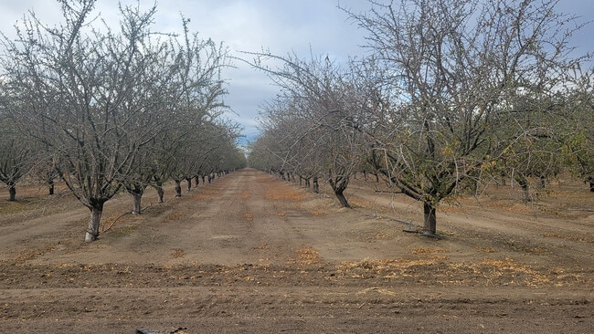

Property Detail
19135 W Jensen Ave
020-030-43S
SUR RT 29.50 AC IN NE1/4 SEC 20 T14R17
Orchard
FRESNO
AE20
California
B and X Area of moderate flood hazard, usually the area between the limits of the 100-year and 500-year floods.
29.29 AC
2025
W Outlying Fresno County
2025
Fresno
003900
Fresno, CA
1,110 SF
NEARBY LISTINGS FOR SALE OR LEASE
-
-
View all Kerman listings for sale on LoopNet.com
DEMOGRAPHICS near 19135 W Jensen Ave
1 mile
3 mile
5 mile
2025 Total Population
64
1,272
17,491
2030 Population
63
1,251
17,808
Pop Growth 2025-2030
(1.56%)
(1.65%)
+ 1.81%
Average Age
36
36
35
2025 Total Households
15
316
4,822
HH Growth 2025-2030
0.00%
(1.90%)
+ 1.85%
Median Household Inc
$112,500
$108,984
$59,502
Avg Household Size
3.80
3.60
3.60
2025 Avg HH Vehicles
3.00
3.00
2.00
Median Home Value
$450,000
$443,292
$380,036
Median Year Built
1979
1979
1993
Nearby Places
Map Layers
Map Styles
 Street
 Aerial
Transit
 Traffic
 Biking
Places
Listings with unknown addresses are not visible on the map
- Restaurants
- Banks
- Shops
- Fitness
- Groceries
PUBLIC TRANSPORTATION
AIRPORT
Fresno Yosemite International
Drive
Walk
Distance
Fresno Yosemite International
42 min
26.7 mi
Freight Ports
Port of Stockton
Drive
Walk
Distance
Port of Stockton
162 min
127.3 mi
SALE & LEASE HISTORY
LISTING DATE
SALE/LEASE

Dec 02, 2024
For Sale
Nearby Properties
Address
Land Use
TOTAL SIZE
Lot Size
Zoning
Address
Land Use
TOTAL SIZE
Lot Size
Zoning
29,746 SF
39.10 AC
AE20
Address
Land Use
TOTAL SIZE
Lot Size
Zoning
1,346 SF
620 AC
AE20
Address
Land Use
TOTAL SIZE
Lot Size
Zoning
1,154 SF
91.23 AC
AE20
Address
Land Use
TOTAL SIZE
Lot Size
Zoning
864 SF
628.28 AC
AE20
Address
Land Use
TOTAL SIZE
Lot Size
Zoning
1,189 SF
29.71 AC
AE20
Address
Land Use
TOTAL SIZE
Lot Size
Zoning
4,416 SF
80 AC
AE20
Address
Land Use
TOTAL SIZE
Lot Size
Zoning
2,842 SF
75.25 AC
AE20
Address
Land Use
TOTAL SIZE
Lot Size
Zoning
2,416 SF
242.36 AC
AE20
Address
Land Use
TOTAL SIZE
Lot Size
Zoning
2,409 SF
80 AC
A1
Address
Land Use
TOTAL SIZE
Lot Size
Zoning
49.37 AC
AE20
Address
Land Use
TOTAL SIZE
Lot Size
Zoning
20 AC
AE20
Address
Land Use
TOTAL SIZE
Lot Size
Zoning
327.49 AC
AE20
Address
Land Use
TOTAL SIZE
Lot Size
Zoning
1,712 SF
186.64 AC
AE20
Address
Land Use
TOTAL SIZE
Lot Size
Zoning
1,614 SF
156.97 AC
AE20
Address
Land Use
TOTAL SIZE
Lot Size
Zoning
78 AC
AE20
Address
Land Use
TOTAL SIZE
Lot Size
Zoning
2,690 SF
218.21 AC
AE20
Address
Land Use
TOTAL SIZE
Lot Size
Zoning
4,618 SF
18.77 AC
AE20
Address
Land Use
TOTAL SIZE
Lot Size
Zoning
158.80 AC
AE20
Address
Land Use
TOTAL SIZE
Lot Size
Zoning
2,691 SF
80 AC
AE20
Address
Land Use
TOTAL SIZE
Lot Size
Zoning
1,749 SF
37.50 AC
AE20
Address
Land Use
TOTAL SIZE
Lot Size
Zoning
2,377 SF
165.09 AC
AE20
Address
Land Use
TOTAL SIZE
Lot Size
Zoning
29.40 AC
AE20
Address
Land Use
TOTAL SIZE
Lot Size
Zoning
962 SF
43.44 AC
AE20
Address
Land Use
TOTAL SIZE
Lot Size
Zoning
1,946 SF
67.53 AC
AE20
Address
Land Use
TOTAL SIZE
Lot Size
Zoning
19.62 AC
AE20
Address
Land Use
TOTAL SIZE
Lot Size
Zoning
40 AC
AE20
Address
Land Use
TOTAL SIZE
Lot Size
Zoning
1,008 SF
20 AC
AE20
Address
Land Use
TOTAL SIZE
Lot Size
Zoning
1,404 SF
78.25 AC
AE20
The World's #1 Commercial Real Estate Marketplace
Connect with us
© 2026 CoStar Group
The information above has been obtained from sources believed reliable. While we do not doubt its accuracy we have not verified it and make no guarantee, warranty or representation about it. It is your responsibility to independently confirm its accuracy and completeness. Any projections, opinions, assumptions, or estimates used are for example only and do not represent the current or future performance of the property. The value of this transaction to you depends on tax and other factors which should be evaluated by your tax, financial, and legal advisors. You and your advisors should conduct a careful, independent investigation of the property to determine to your satisfaction the suitability of the property for your needs.