Property Record
1914 Commerce St, Dallas, TX 75201
Current Lease Availabilities
NEARBY LISTINGS FOR SALE OR LEASE
-
-
View all Dallas listings for lease on LoopNet.com
Property Detail
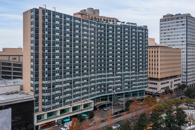
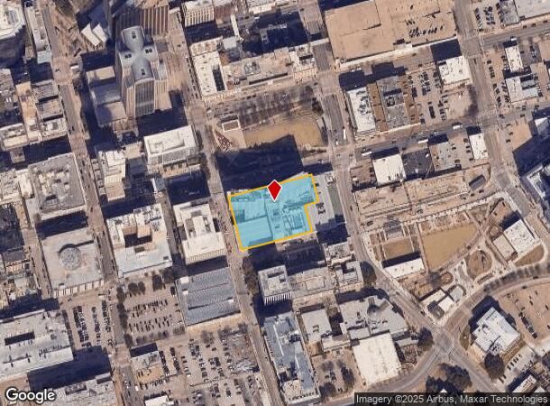
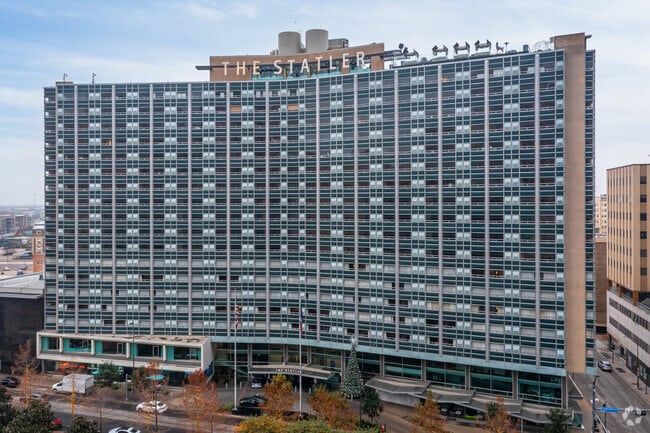
1914 Commerce St
00000101695000000
Statler Hotels Delawara Corpor
Parkingstructure
BLK 97 ACS 1.303 COMMERCE ST PAUL & JACKSON INT201400131257 DD05272014 CO-DC 0097 000 00000 1000097 000
X
Dallas
48113C0345J
Texas
2024
1.30 AC
2025
Dallas CBD/Market Center
003103
Dallas/Ft Worth
741,673 SF
Dallas-Fort Worth-Arlington, TX
DEMOGRAPHICS near 1914 Commerce St
1 Mile
3 Mile
5 Mile
2024 Total Population
28,669
189,340
397,604
2029 Population
29,808
193,108
401,240
Pop Growth 2024-2029
+ 3.97%
+ 1.99%
+ 0.91%
Average Age
36
36
36
2024 Total Households
18,265
100,742
181,649
HH Growth 2024-2029
+ 4.02%
+ 1.93%
+ 1.08%
Median Household Inc
$89,886
$71,916
$68,225
Avg Household Size
1.50
1.80
2.10
2024 Avg HH Vehicles
1.00
1.00
2.00
Median Home Value
$387,163
$383,107
$389,638
Median Year Built
2005
2000
1990
Nearby Places
Map Layers
Map Styles
 Street
 Aerial
- Restaurants
- Banks
- Shops
- Fitness
- Groceries
PUBLIC TRANSPORTATION
TRANSIT/SUBWAY
St Paul (Blue Line - Dallas Area Rapid Transit (DART), DART LIGHT RAIL - BLUE LINE - Dallas Area Rapid Transit (DART), DART LIGHT RAIL - GREEN LINE - Dallas Area Rapid Transit (DART), DART LIGHT RAIL - ORANGE LINE - Dallas Area Rapid Transit (DART), DART LIGHT RAIL - RED LINE - Dallas Area Rapid Transit (DART), Green Line - Dallas Area Rapid Transit (DART), Orange Line - Dallas Area Rapid Transit (DART), Red Line - Dallas Area Rapid Transit (DART))
DRIVE
WALK
Distance
St Paul (Blue Line - Dallas Area Rapid Transit (DART), DART LIGHT RAIL - BLUE LINE - Dallas Area Rapid Transit (DART), DART LIGHT RAIL - GREEN LINE - Dallas Area Rapid Transit (DART), DART LIGHT RAIL - ORANGE LINE - Dallas Area Rapid Transit (DART), DART LIGHT RAIL - RED LINE - Dallas Area Rapid Transit (DART), Green Line - Dallas Area Rapid Transit (DART), Orange Line - Dallas Area Rapid Transit (DART), Red Line - Dallas Area Rapid Transit (DART))
1 min
7 min
0.4 mi
Pearl (Blue Line - Dallas Area Rapid Transit (DART), Green Line - Dallas Area Rapid Transit (DART), Orange Line - Dallas Area Rapid Transit (DART), Red Line - Dallas Area Rapid Transit (DART))
DRIVE
WALK
Distance
Pearl (Blue Line - Dallas Area Rapid Transit (DART), Green Line - Dallas Area Rapid Transit (DART), Orange Line - Dallas Area Rapid Transit (DART), Red Line - Dallas Area Rapid Transit (DART))
1 min
9 min
0.5 mi
Akard (Blue Line - Dallas Area Rapid Transit (DART), Green Line - Dallas Area Rapid Transit (DART), Orange Line - Dallas Area Rapid Transit (DART), Red Line - Dallas Area Rapid Transit (DART))
DRIVE
WALK
Distance
Akard (Blue Line - Dallas Area Rapid Transit (DART), Green Line - Dallas Area Rapid Transit (DART), Orange Line - Dallas Area Rapid Transit (DART), Red Line - Dallas Area Rapid Transit (DART))
1 min
10 min
0.5 mi
St Paul And Ross (McKinney Avenue Streetcar - Dallas Area Rapid Transit (DART))
DRIVE
WALK
Distance
St Paul And Ross (McKinney Avenue Streetcar - Dallas Area Rapid Transit (DART))
2 min
12 min
0.7 mi
Deep Ellum (DART LIGHT RAIL - BLUE LINE - Dallas Area Rapid Transit (DART), DART LIGHT RAIL - GREEN LINE - Dallas Area Rapid Transit (DART), DART LIGHT RAIL - ORANGE LINE - Dallas Area Rapid Transit (DART), DART LIGHT RAIL - RED LINE - Dallas Area Rapid Transit (DART), Green Line - Dallas Area Rapid Transit (DART))
DRIVE
WALK
Distance
Deep Ellum (DART LIGHT RAIL - BLUE LINE - Dallas Area Rapid Transit (DART), DART LIGHT RAIL - GREEN LINE - Dallas Area Rapid Transit (DART), DART LIGHT RAIL - ORANGE LINE - Dallas Area Rapid Transit (DART), DART LIGHT RAIL - RED LINE - Dallas Area Rapid Transit (DART), Green Line - Dallas Area Rapid Transit (DART))
1 min
12 min
0.7 mi
COMMUTER RAIL
Victory Station (DART LIGHT RAIL - GREEN LINE - Dallas Area Rapid Transit (DART), DART LIGHT RAIL - ORANGE LINE - Dallas Area Rapid Transit (DART), TRINITY RAILWAY - Dallas Area Rapid Transit (DART))
DRIVE
WALK
Distance
Victory Station (DART LIGHT RAIL - GREEN LINE - Dallas Area Rapid Transit (DART), DART LIGHT RAIL - ORANGE LINE - Dallas Area Rapid Transit (DART), TRINITY RAILWAY - Dallas Area Rapid Transit (DART))
4 min
1.8 mi
Medical/Market Ctr Station (TRINITY RAILWAY - Dallas Area Rapid Transit (DART))
DRIVE
WALK
Distance
Medical/Market Ctr Station (TRINITY RAILWAY - Dallas Area Rapid Transit (DART))
8 min
3.7 mi
AIRPORT
Dallas Love Field
DRIVE
WALK
Distance
Dallas Love Field
13 min
6.0 mi
Dallas-Fort Worth International
DRIVE
WALK
Distance
Dallas-Fort Worth International
28 min
21.1 mi
Freight Ports
Port of Shreveport
DRIVE
WALK
Distance
Port of Shreveport
211 min
196.1 mi
Nearby Properties
Address
Land Use
TOTAL SIZE
Lot Size
Zoning
Address
Land Use
TOTAL SIZE
Lot Size
Zoning
3,713,071 SF
9.94 AC
Address
Land Use
TOTAL SIZE
Lot Size
Zoning
1,298,826 SF
33.16 AC
Z163
Address
Land Use
TOTAL SIZE
Lot Size
Zoning
815,000 SF
7.20 AC
Z239
Address
Land Use
TOTAL SIZE
Lot Size
Zoning
1,676,176 SF
2.18 AC
Z239
Address
Land Use
TOTAL SIZE
Lot Size
Zoning
906,730 SF
3.09 AC
Z239
Address
Land Use
TOTAL SIZE
Lot Size
Zoning
1,308,710 SF
8.42 AC
Z21
Address
Land Use
TOTAL SIZE
Lot Size
Zoning
731,849 SF
3.13 AC
Z239
Address
Land Use
TOTAL SIZE
Lot Size
Zoning
1,896,570 SF
18.08 AC
Z151
Address
Land Use
TOTAL SIZE
Lot Size
Zoning
1,480,246 SF
1.86 AC
Z21
Address
Land Use
TOTAL SIZE
Lot Size
Zoning
1,291,660 SF
2.56 AC
Z248
Address
Land Use
TOTAL SIZE
Lot Size
Zoning
1,026,046 SF
2.89 AC
Z248
Address
Land Use
TOTAL SIZE
Lot Size
Zoning
864,909 SF
3.02 AC
Z248
Address
Land Use
TOTAL SIZE
Lot Size
Zoning
1,001,504 SF
3.37 AC
Z151
Address
Land Use
TOTAL SIZE
Lot Size
Zoning
1,424,070 SF
1.36 AC
Z21
Address
Land Use
TOTAL SIZE
Lot Size
Zoning
724,979 SF
1.05 AC
Z239
Address
Land Use
TOTAL SIZE
Lot Size
Zoning
893,159 SF
1.17 AC
Z21
Address
Land Use
TOTAL SIZE
Lot Size
Zoning
1,980,000 SF
2.57 AC
Z21
Address
Land Use
TOTAL SIZE
Lot Size
Zoning
857,292 SF
1.47 AC
Z239
Address
Land Use
TOTAL SIZE
Lot Size
Zoning
602,716 SF
11.21 AC
Z239
Address
Land Use
TOTAL SIZE
Lot Size
Zoning
763,198 SF
3.01 AC
Z248
Address
Land Use
TOTAL SIZE
Lot Size
Zoning
638,046 SF
2.11 AC
Z239
Address
Land Use
TOTAL SIZE
Lot Size
Zoning
486,300 SF
1.55 AC
Z239
Address
Land Use
TOTAL SIZE
Lot Size
Zoning
906,627 SF
3.83 AC
Z239
Address
Land Use
TOTAL SIZE
Lot Size
Zoning
653,557 SF
0.68 AC
Z248
Address
Land Use
TOTAL SIZE
Lot Size
Zoning
676,930 SF
1.38 AC
Z248
Address
Land Use
TOTAL SIZE
Lot Size
Zoning
536,874 SF
1.03 AC
Z239
Address
Land Use
TOTAL SIZE
Lot Size
Zoning
784,725 SF
2.33 AC
Z239
Address
Land Use
TOTAL SIZE
Lot Size
Zoning
2,695,010 SF
8.69 AC
Z239
Address
Land Use
TOTAL SIZE
Lot Size
Zoning
180,000 SF
4.66 AC
Z116
Address
Land Use
TOTAL SIZE
Lot Size
Zoning
818,188 SF
2.89 AC
Z239
The World's #1 Commercial Real Estate Marketplace
Connect with us
© 2025 CoStar Group
The information above has been obtained from sources believed reliable. While we do not doubt its accuracy we have not verified it and make no guarantee, warranty or representation about it. It is your responsibility to independently confirm its accuracy and completeness. Any projections, opinions, assumptions, or estimates used are for example only and do not represent the current or future performance of the property. The value of this transaction to you depends on tax and other factors which should be evaluated by your tax, financial, and legal advisors. You and your advisors should conduct a careful, independent investigation of the property to determine to your satisfaction the suitability of the property for your needs.