Property Record
1914 Walnut Plz, Carrollton, TX 75006


NEARBY LISTINGS FOR SALE OR LEASE
Property Detail
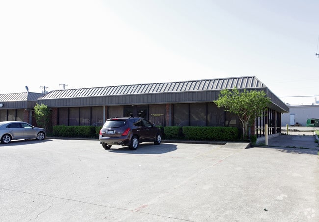
1914 Walnut Plz
Dallas-Fort Worth-Arlington, TX
Metro Rep
140595000A01D0000
METRO REP BLK A LOT 1D ACS 0.285 VOL99144/1136 DD071499 CO-DALLAS 0595000A01D00 1140595000A
Officebuilding
Dallas
X
Texas
48113C0160K
1d
2024
0.28 AC
2025
Quorum/Bent Tree
013718
Dallas/Ft Worth
3,640 SF
DEMOGRAPHICS near 1914 Walnut Plz
1 Mile
3 Mile
5 Mile
2024 Total Population
15,537
98,531
338,578
2029 Population
15,435
100,676
359,526
Pop Growth 2024-2029
(0.66%)
+ 2.18%
+ 6.19%
Average Age
35
39
38
2024 Total Households
4,680
38,388
144,829
HH Growth 2024-2029
(0.64%)
+ 2.13%
+ 6.37%
Median Household Inc
$63,561
$77,107
$77,910
Avg Household Size
3.20
2.50
2.30
2024 Avg HH Vehicles
2.00
2.00
2.00
Median Home Value
$226,264
$285,512
$342,396
Median Year Built
1969
1981
1987
Nearby Places
Map Layers
Map Styles
 Street
 Aerial
- Restaurants
- Banks
- Shops
- Fitness
- Groceries
PUBLIC TRANSPORTATION
COMMUTER RAIL
Trinity Mills Station (Green Line - Dallas Area Rapid Transit (DART))
DRIVE
WALK
Distance
Trinity Mills Station (Green Line - Dallas Area Rapid Transit (DART))
8 min
3.9 mi
DRIVE
WALK
Distance
14 min
7.8 mi
AIRPORT
Dallas Love Field
DRIVE
WALK
Distance
Dallas Love Field
25 min
14.2 mi
Dallas-Fort Worth International
DRIVE
WALK
Distance
Dallas-Fort Worth International
24 min
16.8 mi
Nearby Properties
Address
Land Use
TOTAL SIZE
Lot Size
Zoning
Address
Land Use
TOTAL SIZE
Lot Size
Zoning
174,718 SF
186.51 AC
Address
Land Use
TOTAL SIZE
Lot Size
Zoning
597,347 SF
4.40 AC
Z09
Address
Land Use
TOTAL SIZE
Lot Size
Zoning
113,688 SF
72.86 AC
Z274
Address
Land Use
TOTAL SIZE
Lot Size
Zoning
284,890 SF
40.44 AC
Z274
Address
Land Use
TOTAL SIZE
Lot Size
Zoning
561,139 SF
3.64 AC
Z09
Address
Land Use
TOTAL SIZE
Lot Size
Zoning
605,278 SF
10.70 AC
Z236
Address
Land Use
TOTAL SIZE
Lot Size
Zoning
660,842 SF
4.82 AC
Z09
Address
Land Use
TOTAL SIZE
Lot Size
Zoning
584,128 SF
3.51 AC
Z241
Address
Land Use
TOTAL SIZE
Lot Size
Zoning
513,871 SF
3.63 AC
Z235
Address
Land Use
TOTAL SIZE
Lot Size
Zoning
534,929 SF
4.19 AC
Z236
Address
Land Use
TOTAL SIZE
Lot Size
Zoning
321,732 SF
4.05 AC
Z235
Address
Land Use
TOTAL SIZE
Lot Size
Zoning
255,627 SF
14.79 AC
Z123
Address
Land Use
TOTAL SIZE
Lot Size
Zoning
315,426 SF
3.52 AC
Z241
Address
Land Use
TOTAL SIZE
Lot Size
Zoning
266,871 SF
87 SF
Address
Land Use
TOTAL SIZE
Lot Size
Zoning
725,972 SF
4 AC
Address
Land Use
TOTAL SIZE
Lot Size
Zoning
497,851 SF
3.34 AC
Z241
Address
Land Use
TOTAL SIZE
Lot Size
Zoning
308,779 SF
19.42 AC
Z235
Address
Land Use
TOTAL SIZE
Lot Size
Zoning
268,132 SF
16.19 AC
Z235
Address
Land Use
TOTAL SIZE
Lot Size
Zoning
285,576 SF
22.13 AC
Z236
Address
Land Use
TOTAL SIZE
Lot Size
Zoning
270,915 SF
3.91 AC
Z84
Address
Land Use
TOTAL SIZE
Lot Size
Zoning
396,899 SF
3.68 AC
Z236
Address
Land Use
TOTAL SIZE
Lot Size
Zoning
330,000 SF
3.05 AC
Z236
Address
Land Use
TOTAL SIZE
Lot Size
Zoning
374,093 SF
21.54 AC
Z268
Address
Land Use
TOTAL SIZE
Lot Size
Zoning
210,289 SF
10.16 AC
Z147
Address
Land Use
TOTAL SIZE
Lot Size
Zoning
264,847 SF
14.26 AC
Z236
Address
Land Use
TOTAL SIZE
Lot Size
Zoning
300,956 SF
8.79 AC
Z236
Address
Land Use
TOTAL SIZE
Lot Size
Zoning
228,674 SF
11.81 AC
Z235
Address
Land Use
TOTAL SIZE
Lot Size
Zoning
332,512 SF
17.65 AC
Z236
Address
Land Use
TOTAL SIZE
Lot Size
Zoning
399,880 SF
25.21 AC
Z236
Address
Land Use
TOTAL SIZE
Lot Size
Zoning
222,452 SF
3.12 AC
Z137
The World's #1 Commercial Real Estate Marketplace
Connect with us
© 2025 CoStar Group
The information above has been obtained from sources believed reliable. While we do not doubt its accuracy we have not verified it and make no guarantee, warranty or representation about it. It is your responsibility to independently confirm its accuracy and completeness. Any projections, opinions, assumptions, or estimates used are for example only and do not represent the current or future performance of the property. The value of this transaction to you depends on tax and other factors which should be evaluated by your tax, financial, and legal advisors. You and your advisors should conduct a careful, independent investigation of the property to determine to your satisfaction the suitability of the property for your needs.