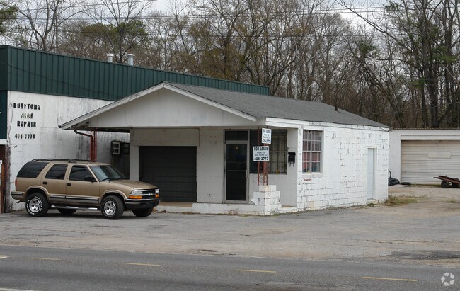
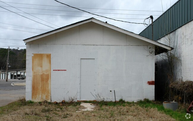
Property Record
1915 26Th Ave N, Bessemer, AL 35023
NEARBY LISTINGS FOR SALE OR LEASE
Property Detail
1915 26Th Ave N
Birmingham-Hoover, AL
Bess No Hglds
38-00-05-2-001-005.000
LOTS 1 & 2 BL 1 BESS C I & LD COS MAP OF NORTH HIGHLANDS ALSO THE NW 1/2 OF RD R/W LYING SE & ADJ TO LOTS 1 & 2
Vehiclerentalsvehiclesales
Jefferson
AE
Alabama
01073C0536G
1,2
2024
0.49 AC
2024
Bessemer
010002
Birmingham
5,412 SF
DEMOGRAPHICS near 1915 26Th Ave N
1 Mile
3 Mile
5 Mile
2024 Total Population
4,677
31,332
67,395
2029 Population
4,574
31,002
66,445
Pop Growth 2024-2029
(2.20%)
(1.05%)
(1.41%)
Average Age
39
40
41
2024 Total Households
1,772
12,442
26,797
HH Growth 2024-2029
(2.31%)
(1.19%)
(1.52%)
Median Household Inc
$55,663
$41,323
$46,889
Avg Household Size
2.60
2.40
2.40
2024 Avg HH Vehicles
2.00
2.00
2.00
Median Home Value
$127,233
$109,845
$138,807
Median Year Built
1961
1963
1968
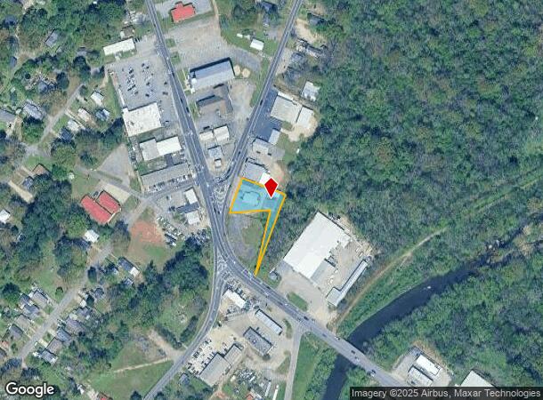
Nearby Places
Map Layers
Map Styles
 Street
 Aerial
- Restaurants
- Banks
- Shops
- Fitness
- Groceries
PUBLIC TRANSPORTATION
AIRPORT
Birmingham-Shuttlesworth International
DRIVE
WALK
Distance
Birmingham-Shuttlesworth International
26 min
20.4 mi
Freight Ports
Port of Mobile
DRIVE
WALK
Distance
Port of Mobile
281 min
239.1 mi
Nearby Properties
Address
Land Use
TOTAL SIZE
Lot Size
Zoning
Address
Land Use
TOTAL SIZE
Lot Size
Zoning
311,900 SF
30.20 AC
Address
Land Use
TOTAL SIZE
Lot Size
Zoning
460,483 SF
20 AC
I3
Address
Land Use
TOTAL SIZE
Lot Size
Zoning
195,495 SF
28.97 AC
B3
Address
Land Use
TOTAL SIZE
Lot Size
Zoning
553,137 SF
87 AC
I2
Address
Land Use
TOTAL SIZE
Lot Size
Zoning
195,461 SF
15.03 AC
C3-R
Address
Land Use
TOTAL SIZE
Lot Size
Zoning
136,115 SF
14.90 AC
C3
Address
Land Use
TOTAL SIZE
Lot Size
Zoning
145,300 SF
25 AC
R3
Address
Land Use
TOTAL SIZE
Lot Size
Zoning
137,641 SF
26.80 AC
R4
Address
Land Use
TOTAL SIZE
Lot Size
Zoning
219,210 SF
19.40 AC
M2
Address
Land Use
TOTAL SIZE
Lot Size
Zoning
230,088 SF
I3
Address
Land Use
TOTAL SIZE
Lot Size
Zoning
66,928 SF
5.70 AC
B2-R
Address
Land Use
TOTAL SIZE
Lot Size
Zoning
77,902 SF
44 AC
I3
Address
Land Use
TOTAL SIZE
Lot Size
Zoning
1,090,237 SF
28.10 AC
I4
Address
Land Use
TOTAL SIZE
Lot Size
Zoning
66,900 SF
3.78 AC
I4
Address
Land Use
TOTAL SIZE
Lot Size
Zoning
58,822 SF
7.80 AC
B3
Address
Land Use
TOTAL SIZE
Lot Size
Zoning
1,200 SF
13.40 AC
R3
Address
Land Use
TOTAL SIZE
Lot Size
Zoning
69,344 SF
2.30 AC
B-1
Address
Land Use
TOTAL SIZE
Lot Size
Zoning
26,234 SF
3.30 AC
B2
Address
Land Use
TOTAL SIZE
Lot Size
Zoning
366,421 SF
21 AC
I3
Address
Land Use
TOTAL SIZE
Lot Size
Zoning
80,043 SF
10.89 AC
B3-C
Address
Land Use
TOTAL SIZE
Lot Size
Zoning
163,056 SF
I-3
Address
Land Use
TOTAL SIZE
Lot Size
Zoning
49,022 SF
5.50 AC
R2
Address
Land Use
TOTAL SIZE
Lot Size
Zoning
43,674 SF
0.44 AC
C3
Address
Land Use
TOTAL SIZE
Lot Size
Zoning
80,220 SF
6.68 AC
M2
Address
Land Use
TOTAL SIZE
Lot Size
Zoning
172,253 SF
20 AC
C1
Address
Land Use
TOTAL SIZE
Lot Size
Zoning
40,098 SF
0.48 AC
C1
Address
Land Use
TOTAL SIZE
Lot Size
Zoning
52,810 SF
3.44 AC
B-3
Address
Land Use
TOTAL SIZE
Lot Size
Zoning
65,232 SF
3.60 AC
R-5
Address
Land Use
TOTAL SIZE
Lot Size
Zoning
32,606 SF
2.18 AC
B2-R
Address
Land Use
TOTAL SIZE
Lot Size
Zoning
51,920 SF
1.70 AC
01
The World's #1 Commercial Real Estate Marketplace
Connect with us
© 2025 CoStar Group
The information above has been obtained from sources believed reliable. While we do not doubt its accuracy we have not verified it and make no guarantee, warranty or representation about it. It is your responsibility to independently confirm its accuracy and completeness. Any projections, opinions, assumptions, or estimates used are for example only and do not represent the current or future performance of the property. The value of this transaction to you depends on tax and other factors which should be evaluated by your tax, financial, and legal advisors. You and your advisors should conduct a careful, independent investigation of the property to determine to your satisfaction the suitability of the property for your needs.