Property Record
1915 B Normal Park, Huntsville, TX 77340

NEARBY LISTINGS FOR SALE OR LEASE
Property Detail
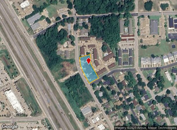
1915 B Normal Park
Huntsville, TX
Highland - Sec 3
29297
HIGHLAND - SEC 3, BLOCK 15, LOT 12-14, ACRES .87, 8 UNITS
Apartment
Walker
X
Texas
48471C0355D
12-14
2024
0.87 AC
2025
Downtown Huntsville
790700
Other Market Areas
11,408 SF
DEMOGRAPHICS near 1915 B Normal Park
1 mile
3 mile
5 mile
2024 Total Population
10,278
33,943
42,557
2029 Population
10,956
36,494
46,074
Pop Growth 2024-2029
+ 6.60%
+ 7.52%
+ 8.26%
Average Age
32
33
36
2024 Total Households
3,947
12,550
15,954
HH Growth 2024-2029
+ 7.04%
+ 8.43%
+ 9.31%
Median Household Inc
$27,053
$27,877
$34,196
Avg Household Size
2.00
2.20
2.20
2024 Avg HH Vehicles
2.00
2.00
2.00
Median Home Value
$150,289
$149,572
$188,403
Median Year Built
1986
1987
1989
Nearby Places
Map Layers
Map Styles
 Street
 Aerial
Transit
 Traffic
 Biking
Places
Listings with unknown addresses are not visible on the map
- Restaurants
- Banks
- Shops
- Fitness
- Groceries
SALE & LEASE HISTORY
LISTING DATE
SALE/LEASE

Mar 06, 2024
For Sale
Feb 29, 2024
For Sale
Nearby Properties
Address
Land Use
TOTAL SIZE
Lot Size
Zoning
Address
Land Use
TOTAL SIZE
Lot Size
Zoning
48,924 SF
125.60 AC
Address
Land Use
TOTAL SIZE
Lot Size
Zoning
584,188 SF
3.94 AC
Address
Land Use
TOTAL SIZE
Lot Size
Zoning
316,247 SF
320.50 AC
Address
Land Use
TOTAL SIZE
Lot Size
Zoning
1,826 SF
25.84 AC
Address
Land Use
TOTAL SIZE
Lot Size
Zoning
519,255 SF
12.68 AC
Address
Land Use
TOTAL SIZE
Lot Size
Zoning
334,939 SF
2.50 AC
Address
Land Use
TOTAL SIZE
Lot Size
Zoning
139,218 SF
8.66 AC
Address
Land Use
TOTAL SIZE
Lot Size
Zoning
461,858 SF
21.23 AC
Address
Land Use
TOTAL SIZE
Lot Size
Zoning
266,498 SF
279.39 AC
Address
Land Use
TOTAL SIZE
Lot Size
Zoning
72,835 SF
9.81 AC
Address
Land Use
TOTAL SIZE
Lot Size
Zoning
486,687 SF
11.95 AC
Address
Land Use
TOTAL SIZE
Lot Size
Zoning
526,884 SF
12.91 AC
Address
Land Use
TOTAL SIZE
Lot Size
Zoning
517,265 SF
13.12 AC
Address
Land Use
TOTAL SIZE
Lot Size
Zoning
473,407 SF
26.58 AC
Address
Land Use
TOTAL SIZE
Lot Size
Zoning
220,991 SF
7.11 AC
Address
Land Use
TOTAL SIZE
Lot Size
Zoning
10,923 SF
19.10 AC
Address
Land Use
TOTAL SIZE
Lot Size
Zoning
20,996 SF
8.70 AC
Address
Land Use
TOTAL SIZE
Lot Size
Zoning
365,448 SF
11.74 AC
Address
Land Use
TOTAL SIZE
Lot Size
Zoning
8,092 SF
7.86 AC
Address
Land Use
TOTAL SIZE
Lot Size
Zoning
531,914 SF
9.60 AC
Address
Land Use
TOTAL SIZE
Lot Size
Zoning
471,882 SF
15.44 AC
Address
Land Use
TOTAL SIZE
Lot Size
Zoning
529,686 SF
20.09 AC
Address
Land Use
TOTAL SIZE
Lot Size
Zoning
130,891 SF
23.14 AC
Address
Land Use
TOTAL SIZE
Lot Size
Zoning
739,742 SF
26.49 AC
Address
Land Use
TOTAL SIZE
Lot Size
Zoning
142,792 SF
13.76 AC
Address
Land Use
TOTAL SIZE
Lot Size
Zoning
416,433 SF
12.19 AC
Address
Land Use
TOTAL SIZE
Lot Size
Zoning
356,395 SF
7.94 AC
Address
Land Use
TOTAL SIZE
Lot Size
Zoning
290,351 SF
10.32 AC
Address
Land Use
TOTAL SIZE
Lot Size
Zoning
331,400 SF
6.10 AC
Address
Land Use
TOTAL SIZE
Lot Size
Zoning
231,367 SF
6.29 AC
The World's #1 Commercial Real Estate Marketplace
Connect with us
© 2026 CoStar Group
The information above has been obtained from sources believed reliable. While we do not doubt its accuracy we have not verified it and make no guarantee, warranty or representation about it. It is your responsibility to independently confirm its accuracy and completeness. Any projections, opinions, assumptions, or estimates used are for example only and do not represent the current or future performance of the property. The value of this transaction to you depends on tax and other factors which should be evaluated by your tax, financial, and legal advisors. You and your advisors should conduct a careful, independent investigation of the property to determine to your satisfaction the suitability of the property for your needs.