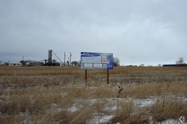
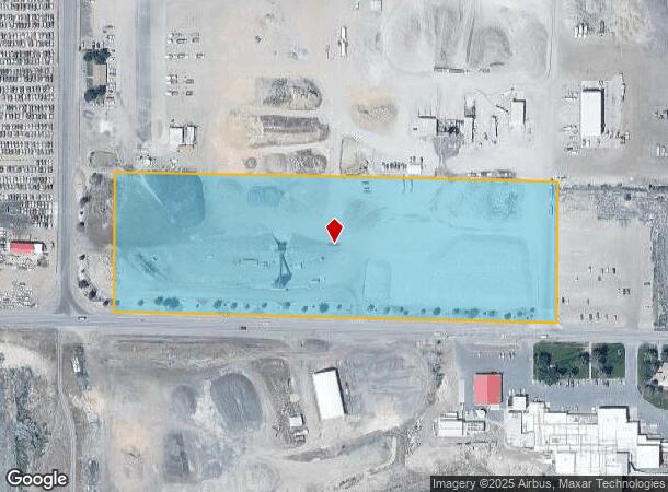
Property Record
1915 Orchard Dr E, Twin Falls, ID 83301
NEARBY LISTINGS FOR SALE OR LEASE
Property Detail
1915 Orchard Dr E
Twin Falls, ID
Twin Falls
RPT00107228845A
TWIN FALLS ACRES INSIDE TAX #3302 IN SW SE (22-10-17)
Realpropertynec
Twin Falls
X
Idaho
16083C1387C
9.95 AC
2025
Idaho South Area
2025
Other Market Areas
001002
DEMOGRAPHICS near 1915 Orchard Dr E
1 Mile
3 Mile
5 Mile
2024 Total Population
1,101
36,331
67,974
2029 Population
1,205
39,925
75,136
Pop Growth 2024-2029
+ 9.45%
+ 9.89%
+ 10.54%
Average Age
35
37
37
2024 Total Households
395
13,814
24,909
HH Growth 2024-2029
+ 9.87%
+ 10.26%
+ 10.89%
Median Household Inc
$46,742
$49,816
$54,715
Avg Household Size
2.80
2.50
2.60
2024 Avg HH Vehicles
2.00
2.00
2.00
Median Home Value
$302,055
$242,931
$275,026
Median Year Built
1990
1977
1985
Nearby Places
Map Layers
Map Styles
 Street
 Aerial
- Restaurants
- Banks
- Shops
- Fitness
- Groceries
Nearby Properties
Address
Land Use
TOTAL SIZE
Lot Size
Zoning
Address
Land Use
TOTAL SIZE
Lot Size
Zoning
917,616 SF
143.88 AC
M-2
Address
Land Use
TOTAL SIZE
Lot Size
Zoning
259,424 SF
89.44 AC
M-2
Address
Land Use
TOTAL SIZE
Lot Size
Zoning
6,384 SF
5.89 AC
M-2
Address
Land Use
TOTAL SIZE
Lot Size
Zoning
382,261 SF
11.44 AC
M-2
Address
Land Use
TOTAL SIZE
Lot Size
Zoning
57,683 SF
36.64 AC
Address
Land Use
TOTAL SIZE
Lot Size
Zoning
167,708 SF
14.90 AC
C-1
Address
Land Use
TOTAL SIZE
Lot Size
Zoning
240,740 SF
6.74 AC
M-2
Address
Land Use
TOTAL SIZE
Lot Size
Zoning
9,440 SF
7.05 AC
R-6
Address
Land Use
TOTAL SIZE
Lot Size
Zoning
127,520 SF
16.82 AC
M-2
Address
Land Use
TOTAL SIZE
Lot Size
Zoning
40,730 SF
0.36 AC
O-T
Address
Land Use
TOTAL SIZE
Lot Size
Zoning
78,849 SF
18.66 AC
M-2
Address
Land Use
TOTAL SIZE
Lot Size
Zoning
29,988 SF
3.80 AC
Address
Land Use
TOTAL SIZE
Lot Size
Zoning
233,304 SF
6.01 AC
M-2
Address
Land Use
TOTAL SIZE
Lot Size
Zoning
94,366 SF
9.85 AC
M-2
Address
Land Use
TOTAL SIZE
Lot Size
Zoning
52,095 SF
0.22 AC
C-B
Address
Land Use
TOTAL SIZE
Lot Size
Zoning
88,314 SF
8.15 AC
C-1
Address
Land Use
TOTAL SIZE
Lot Size
Zoning
46,122 SF
6.37 AC
R-6
Address
Land Use
TOTAL SIZE
Lot Size
Zoning
10,536 SF
3.07 AC
C-1
Address
Land Use
TOTAL SIZE
Lot Size
Zoning
74,375 SF
3.02 AC
M-2
Address
Land Use
TOTAL SIZE
Lot Size
Zoning
36,192 SF
0.34 AC
C-B
Address
Land Use
TOTAL SIZE
Lot Size
Zoning
157,403 SF
14.69 AC
M-1
Address
Land Use
TOTAL SIZE
Lot Size
Zoning
52,068 SF
0.86 AC
R-4
Address
Land Use
TOTAL SIZE
Lot Size
Zoning
14,913 SF
104.49 AC
M-2
Address
Land Use
TOTAL SIZE
Lot Size
Zoning
7,062 SF
3.62 AC
R-4
Address
Land Use
TOTAL SIZE
Lot Size
Zoning
19,286 SF
10.10 AC
C-1
Address
Land Use
TOTAL SIZE
Lot Size
Zoning
90,334 SF
8.14 AC
Address
Land Use
TOTAL SIZE
Lot Size
Zoning
5,906 SF
3.28 AC
R-4
Address
Land Use
TOTAL SIZE
Lot Size
Zoning
33,600 SF
0.94 AC
C-1
Address
Land Use
TOTAL SIZE
Lot Size
Zoning
236.96 AC
M-2
The World's #1 Commercial Real Estate Marketplace
Connect with us
© 2025 CoStar Group
The information above has been obtained from sources believed reliable. While we do not doubt its accuracy we have not verified it and make no guarantee, warranty or representation about it. It is your responsibility to independently confirm its accuracy and completeness. Any projections, opinions, assumptions, or estimates used are for example only and do not represent the current or future performance of the property. The value of this transaction to you depends on tax and other factors which should be evaluated by your tax, financial, and legal advisors. You and your advisors should conduct a careful, independent investigation of the property to determine to your satisfaction the suitability of the property for your needs.