Property Record
19157 Rapidan Ave, Mankato, MN 56001
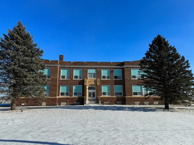

This Property Is For Sale
NEARBY LISTINGS FOR SALE OR LEASE
-
-
View all Mankato listings for sale on LoopNet.com
Property Detail
19157 Rapidan Ave
Mankato, MN
Rapidan School Subdivision
R48-13-03-351-019
RAPIDAN SCHOOL SUBDIVISION PT LB6 NWCOR S497.06' E 451' N406.37' W 205.01' N24.56' NW100.13' W 170' 002 001 00 004.660A N406.
Privateschool
Blue Earth
X
Minnesota
27013C0205F
2
2025
4.66 AC
2025
Minnesota South Area
171300
Other Market Areas
34,260 SF
DEMOGRAPHICS near 19157 Rapidan Ave
1 Mile
3 Mile
5 Mile
2024 Total Population
204
1,120
15,014
2029 Population
199
1,097
15,112
Pop Growth 2024-2029
(2.45%)
(2.05%)
+ 0.65%
Average Age
46
45
36
2024 Total Households
81
436
4,879
HH Growth 2024-2029
(2.47%)
(2.06%)
+ 0.49%
Median Household Inc
$73,499
$80,435
$80,474
Avg Household Size
2.40
2.50
2.50
2024 Avg HH Vehicles
2.00
2.00
2.00
Median Home Value
$269,999
$274,271
$251,813
Median Year Built
1968
1969
1973
Nearby Places
Map Layers
Map Styles
 Street
 Aerial
- Restaurants
- Banks
- Shops
- Fitness
- Groceries
Nearby Properties
Address
Land Use
TOTAL SIZE
Lot Size
Zoning
Address
Land Use
TOTAL SIZE
Lot Size
Zoning
9.07 AC
Address
Land Use
TOTAL SIZE
Lot Size
Zoning
139.92 AC
Address
Land Use
TOTAL SIZE
Lot Size
Zoning
18,873 SF
25.16 AC
Address
Land Use
TOTAL SIZE
Lot Size
Zoning
97.22 AC
Address
Land Use
TOTAL SIZE
Lot Size
Zoning
98.07 AC
Address
Land Use
TOTAL SIZE
Lot Size
Zoning
148.07 AC
Address
Land Use
TOTAL SIZE
Lot Size
Zoning
65.89 AC
Address
Land Use
TOTAL SIZE
Lot Size
Zoning
55.84 AC
Address
Land Use
TOTAL SIZE
Lot Size
Zoning
35.05 AC
Address
Land Use
TOTAL SIZE
Lot Size
Zoning
60 AC
Address
Land Use
TOTAL SIZE
Lot Size
Zoning
648 SF
50 AC
Address
Land Use
TOTAL SIZE
Lot Size
Zoning
Address
Land Use
TOTAL SIZE
Lot Size
Zoning
7,712 SF
2.19 AC
Address
Land Use
TOTAL SIZE
Lot Size
Zoning
Address
Land Use
TOTAL SIZE
Lot Size
Zoning
2,400 SF
93.32 AC
Address
Land Use
TOTAL SIZE
Lot Size
Zoning
87.13 AC
Address
Land Use
TOTAL SIZE
Lot Size
Zoning
73.36 AC
Address
Land Use
TOTAL SIZE
Lot Size
Zoning
72.39 AC
Address
Land Use
TOTAL SIZE
Lot Size
Zoning
127.17 AC
Address
Land Use
TOTAL SIZE
Lot Size
Zoning
42.54 AC
Address
Land Use
TOTAL SIZE
Lot Size
Zoning
66.44 AC
Address
Land Use
TOTAL SIZE
Lot Size
Zoning
7,389 SF
0.71 AC
Address
Land Use
TOTAL SIZE
Lot Size
Zoning
66.61 AC
Address
Land Use
TOTAL SIZE
Lot Size
Zoning
6,400 SF
5 AC
Address
Land Use
TOTAL SIZE
Lot Size
Zoning
Address
Land Use
TOTAL SIZE
Lot Size
Zoning
76.20 AC
Address
Land Use
TOTAL SIZE
Lot Size
Zoning
3,060 SF
4 AC
Address
Land Use
TOTAL SIZE
Lot Size
Zoning
39.04 AC
Address
Land Use
TOTAL SIZE
Lot Size
Zoning
Address
Land Use
TOTAL SIZE
Lot Size
Zoning
The World's #1 Commercial Real Estate Marketplace
Connect with us
© 2026 CoStar Group
The information above has been obtained from sources believed reliable. While we do not doubt its accuracy we have not verified it and make no guarantee, warranty or representation about it. It is your responsibility to independently confirm its accuracy and completeness. Any projections, opinions, assumptions, or estimates used are for example only and do not represent the current or future performance of the property. The value of this transaction to you depends on tax and other factors which should be evaluated by your tax, financial, and legal advisors. You and your advisors should conduct a careful, independent investigation of the property to determine to your satisfaction the suitability of the property for your needs.