Property Record
1916 Mayview Rd, Bridgeville, PA 15017


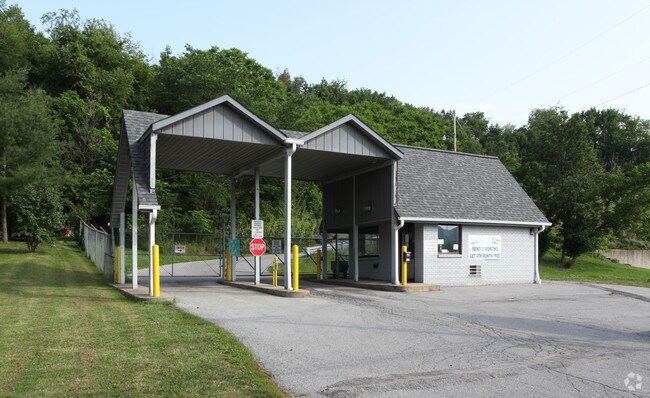
Property Detail
1916 Mayview Rd
Pittsburgh, PA
M.R.A. PLAN PT PARCEL A IRREG LOT = 111.80 X156.38X115.08 (.416 ALD) MAYVIEW RD M.R.A. PLAN PT PARCEL A IRREG LOT =
0671-C-00011-0000-00
Allegheny
Publicstorage
Pennsylvania
A Areas with a 1% annual chance of flooding and a 26% chance of flooding over the life of a 30-year mortgage.
11
2024
11.19 AC
2025
South Pittsburgh/I-79
456004
Pittsburgh
NEARBY LISTINGS FOR SALE OR LEASE
-
-
View all Bridgeville listings for sale on LoopNet.com
DEMOGRAPHICS near 1916 Mayview Rd
1 mile
3 mile
5 mile
2025 Total Population
5,697
38,241
118,367
2030 Population
5,698
37,978
117,094
Pop Growth 2025-2030
+ 0.02%
(0.69%)
(1.08%)
Average Age
45
44
43
2025 Total Households
2,478
15,186
46,874
HH Growth 2025-2030
(0.16%)
(0.70%)
(1.12%)
Median Household Inc
$94,144
$112,707
$112,980
Avg Household Size
2.20
2.40
2.40
2025 Avg HH Vehicles
2.00
2.00
2.00
Median Home Value
$328,544
$360,750
$342,615
Median Year Built
1986
1976
1972
Nearby Places
Map Layers
Map Styles
 Street
 Aerial
Layers
 Traffic
 Biking
Places
Listings with unknown addresses are not visible on the map
- Restaurants
- Banks
- Shops
- Fitness
- Groceries
PUBLIC TRANSPORTATION
AIRPORT
Pittsburgh International
Drive
Walk
Distance
Pittsburgh International
35 min
19.6 mi
Freight Ports
Port of Toledo
Drive
Walk
Distance
Port of Toledo
277 min
242.5 mi
Nearby Properties
Address
Land Use
TOTAL SIZE
Lot Size
Zoning
Address
Land Use
TOTAL SIZE
Lot Size
Zoning
90.27 AC
Address
Land Use
TOTAL SIZE
Lot Size
Zoning
69.28 AC
Address
Land Use
TOTAL SIZE
Lot Size
Zoning
239.25 AC
Address
Land Use
TOTAL SIZE
Lot Size
Zoning
19.26 AC
Address
Land Use
TOTAL SIZE
Lot Size
Zoning
Address
Land Use
TOTAL SIZE
Lot Size
Zoning
24.33 AC
Address
Land Use
TOTAL SIZE
Lot Size
Zoning
33.49 AC
Address
Land Use
TOTAL SIZE
Lot Size
Zoning
Address
Land Use
TOTAL SIZE
Lot Size
Zoning
13.77 AC
Address
Land Use
TOTAL SIZE
Lot Size
Zoning
Address
Land Use
TOTAL SIZE
Lot Size
Zoning
Address
Land Use
TOTAL SIZE
Lot Size
Zoning
15.50 AC
Address
Land Use
TOTAL SIZE
Lot Size
Zoning
32.50 AC
Address
Land Use
TOTAL SIZE
Lot Size
Zoning
Address
Land Use
TOTAL SIZE
Lot Size
Zoning
20.79 AC
Address
Land Use
TOTAL SIZE
Lot Size
Zoning
201.61 AC
Address
Land Use
TOTAL SIZE
Lot Size
Zoning
15.53 AC
Address
Land Use
TOTAL SIZE
Lot Size
Zoning
9.45 AC
Address
Land Use
TOTAL SIZE
Lot Size
Zoning
18.68 AC
Address
Land Use
TOTAL SIZE
Lot Size
Zoning
13.88 AC
Address
Land Use
TOTAL SIZE
Lot Size
Zoning
14.05 AC
Address
Land Use
TOTAL SIZE
Lot Size
Zoning
Address
Land Use
TOTAL SIZE
Lot Size
Zoning
Address
Land Use
TOTAL SIZE
Lot Size
Zoning
15.57 AC
Address
Land Use
TOTAL SIZE
Lot Size
Zoning
Address
Land Use
TOTAL SIZE
Lot Size
Zoning
Address
Land Use
TOTAL SIZE
Lot Size
Zoning
63.88 AC
Address
Land Use
TOTAL SIZE
Lot Size
Zoning
Address
Land Use
TOTAL SIZE
Lot Size
Zoning
6.76 AC
Address
Land Use
TOTAL SIZE
Lot Size
Zoning
16.30 AC
The World's #1 Commercial Real Estate Marketplace
Connect with us
© 2026 CoStar Group
The information above has been obtained from sources believed reliable. While we do not doubt its accuracy we have not verified it and make no guarantee, warranty or representation about it. It is your responsibility to independently confirm its accuracy and completeness. Any projections, opinions, assumptions, or estimates used are for example only and do not represent the current or future performance of the property. The value of this transaction to you depends on tax and other factors which should be evaluated by your tax, financial, and legal advisors. You and your advisors should conduct a careful, independent investigation of the property to determine to your satisfaction the suitability of the property for your needs.