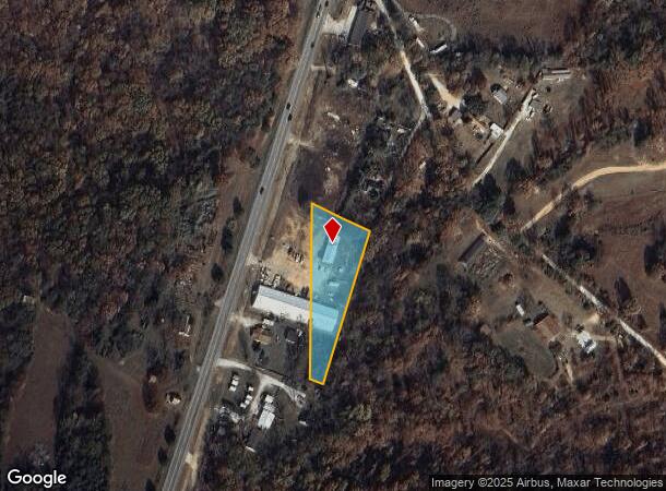
Property Record
19185 Highway 62, Garfield, AR 72732


NEARBY LISTINGS FOR SALE OR LEASE
-
-
View all Garfield listings for sale on LoopNet.com
Property Detail
19185 Highway 62
Fayetteville-Springdale-Rogers, AR-MO
Rural
18-01985-000
BEING PART OF THE SW/4 OF THE NW/4 OF SECTION 27, AND PART OF THE SE/4 OF THE NE/4 OF SECTION 28, TOWNSHIP 21 NORTH, RANGE 28 WEST, BENTON COUNTY, ARKANSAS, MORE PARTICULARLY DESCRIBED AS FOLLOWS: COMMENCING AT THE EAST 1/4 CORNER OF SAID SECTION 28;
Commercialacreage
Benton
X
Arkansas
05015C0025B
1.20 AC
2025
Outlying Benton County
2025
Fayetteville/Springdale/Rogers
021405
DEMOGRAPHICS near 19185 Highway 62
1 Mile
3 Mile
5 Mile
2024 Total Population
322
1,891
5,196
2029 Population
385
2,232
5,976
Pop Growth 2024-2029
+ 19.57%
+ 18.03%
+ 15.01%
Average Age
45
43
44
2024 Total Households
123
707
2,017
HH Growth 2024-2029
+ 19.51%
+ 17.96%
+ 15.02%
Median Household Inc
$63,214
$76,667
$59,205
Avg Household Size
2.60
2.70
2.60
2024 Avg HH Vehicles
3.00
3.00
2.00
Median Home Value
$331,250
$219,531
$199,894
Median Year Built
1990
1991
1988
Nearby Places
Map Layers
Map Styles
 Street
 Aerial
- Restaurants
- Banks
- Shops
- Fitness
- Groceries
PUBLIC TRANSPORTATION
AIRPORT
Northwest Arkansas Ntl
DRIVE
WALK
Distance
Northwest Arkansas Ntl
50 min
29.1 mi
Freight Ports
Tulsa Port of Inola
DRIVE
WALK
Distance
Tulsa Port of Inola
137 min
114.4 mi
Nearby Properties
Address
Land Use
TOTAL SIZE
Lot Size
Zoning
Address
Land Use
TOTAL SIZE
Lot Size
Zoning
60,640 SF
7.44 AC
Address
Land Use
TOTAL SIZE
Lot Size
Zoning
10,926 SF
1.52 AC
Address
Land Use
TOTAL SIZE
Lot Size
Zoning
37,688 SF
22.74 AC
Address
Land Use
TOTAL SIZE
Lot Size
Zoning
29,880 SF
2.32 AC
Address
Land Use
TOTAL SIZE
Lot Size
Zoning
9,230 SF
1.17 AC
Address
Land Use
TOTAL SIZE
Lot Size
Zoning
4,982 SF
1.26 AC
Address
Land Use
TOTAL SIZE
Lot Size
Zoning
5,440 SF
1.74 AC
Address
Land Use
TOTAL SIZE
Lot Size
Zoning
15,236 SF
1.54 AC
Address
Land Use
TOTAL SIZE
Lot Size
Zoning
4,320 SF
5.38 AC
Address
Land Use
TOTAL SIZE
Lot Size
Zoning
7,236 SF
1.12 AC
Address
Land Use
TOTAL SIZE
Lot Size
Zoning
6,000 SF
4.50 AC
Address
Land Use
TOTAL SIZE
Lot Size
Zoning
6,000 SF
7.60 AC
Address
Land Use
TOTAL SIZE
Lot Size
Zoning
1,163 SF
2.14 AC
Address
Land Use
TOTAL SIZE
Lot Size
Zoning
4,978 SF
2.62 AC
Address
Land Use
TOTAL SIZE
Lot Size
Zoning
7,040 SF
5.88 AC
Address
Land Use
TOTAL SIZE
Lot Size
Zoning
6,072 SF
1.76 AC
Address
Land Use
TOTAL SIZE
Lot Size
Zoning
7,232 SF
2 AC
Address
Land Use
TOTAL SIZE
Lot Size
Zoning
8,000 SF
3.90 AC
Address
Land Use
TOTAL SIZE
Lot Size
Zoning
3,920 SF
5.52 AC
Address
Land Use
TOTAL SIZE
Lot Size
Zoning
3,000 SF
0.48 AC
Address
Land Use
TOTAL SIZE
Lot Size
Zoning
9,504 SF
2.08 AC
Address
Land Use
TOTAL SIZE
Lot Size
Zoning
2,352 SF
1.37 AC
Address
Land Use
TOTAL SIZE
Lot Size
Zoning
4,740 SF
3.71 AC
Address
Land Use
TOTAL SIZE
Lot Size
Zoning
1,544 SF
0.33 AC
Address
Land Use
TOTAL SIZE
Lot Size
Zoning
4,200 SF
4 AC
Address
Land Use
TOTAL SIZE
Lot Size
Zoning
3,332 SF
1.25 AC
Address
Land Use
TOTAL SIZE
Lot Size
Zoning
4,100 SF
1.33 AC
Address
Land Use
TOTAL SIZE
Lot Size
Zoning
3,200 SF
1.18 AC
Address
Land Use
TOTAL SIZE
Lot Size
Zoning
6,950 SF
4.01 AC
Address
Land Use
TOTAL SIZE
Lot Size
Zoning
278 SF
0.56 AC
The World's #1 Commercial Real Estate Marketplace
Connect with us
© 2025 CoStar Group
The information above has been obtained from sources believed reliable. While we do not doubt its accuracy we have not verified it and make no guarantee, warranty or representation about it. It is your responsibility to independently confirm its accuracy and completeness. Any projections, opinions, assumptions, or estimates used are for example only and do not represent the current or future performance of the property. The value of this transaction to you depends on tax and other factors which should be evaluated by your tax, financial, and legal advisors. You and your advisors should conduct a careful, independent investigation of the property to determine to your satisfaction the suitability of the property for your needs.