Property Record
1919 N Range Line Rd, Joplin, MO 64801
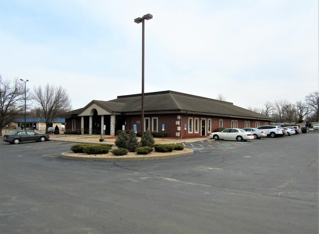

Property Detail
1919 N Range Line Rd
15-9.0-31-20-006-003.000
OAKLAND PARK VILLAGE MISC BEG 85 E & 655 N SW COR NW N 225 E 230 S 200 E 98.4 S 20 W TO POB
Apartment
Jasper
AE The base floodplain where base flood elevations are provided. AE Zones are now used on new format FIRMs instead of A1-A30 Zones.
Missouri
2024
1.22 AC
2025
Missouri South Area
010200
Other Market Areas
10,359 SF
Joplin, MO-KS
NEARBY LISTINGS FOR SALE OR LEASE
DEMOGRAPHICS near 1919 N Range Line Rd
1 mile
3 mile
5 mile
2025 Total Population
5,743
38,242
79,798
2030 Population
5,883
39,380
82,367
Pop Growth 2025-2030
+ 2.44%
+ 2.98%
+ 3.22%
Average Age
39
38
39
2025 Total Households
2,291
15,941
32,870
HH Growth 2025-2030
+ 2.62%
+ 3.16%
+ 3.39%
Median Household Inc
$61,198
$47,693
$52,061
Avg Household Size
2.20
2.20
2.30
2025 Avg HH Vehicles
2.00
2.00
2.00
Median Home Value
$212,665
$175,288
$173,355
Median Year Built
1991
1985
1985
Nearby Places
Map Layers
Map Styles
 Street
 Aerial
Layers
 Traffic
 Biking
Places
Listings with unknown addresses are not visible on the map
- Restaurants
- Banks
- Shops
- Fitness
- Groceries
SALE & LEASE HISTORY
LISTING DATE
SALE/LEASE

Feb 14, 2018
For Sale
Nearby Properties
Address
Land Use
TOTAL SIZE
Lot Size
Zoning
Address
Land Use
TOTAL SIZE
Lot Size
Zoning
238,352 SF
1.72 AC
Address
Land Use
TOTAL SIZE
Lot Size
Zoning
605,856 SF
40.96 AC
Address
Land Use
TOTAL SIZE
Lot Size
Zoning
220,377 SF
10.45 AC
Address
Land Use
TOTAL SIZE
Lot Size
Zoning
62,916 SF
0.28 AC
Address
Land Use
TOTAL SIZE
Lot Size
Zoning
194,326 SF
24.61 AC
Address
Land Use
TOTAL SIZE
Lot Size
Zoning
66,470 SF
7.71 AC
Address
Land Use
TOTAL SIZE
Lot Size
Zoning
38,032 SF
7.67 AC
Address
Land Use
TOTAL SIZE
Lot Size
Zoning
85,574 SF
16.39 AC
Address
Land Use
TOTAL SIZE
Lot Size
Zoning
Address
Land Use
TOTAL SIZE
Lot Size
Zoning
11,550 SF
1.38 AC
Address
Land Use
TOTAL SIZE
Lot Size
Zoning
151,868 SF
16.74 AC
Address
Land Use
TOTAL SIZE
Lot Size
Zoning
142,801 SF
11.85 AC
Address
Land Use
TOTAL SIZE
Lot Size
Zoning
88,710 SF
8.75 AC
Address
Land Use
TOTAL SIZE
Lot Size
Zoning
36,405 SF
4.04 AC
Address
Land Use
TOTAL SIZE
Lot Size
Zoning
73,052 SF
0.62 AC
Address
Land Use
TOTAL SIZE
Lot Size
Zoning
18,610 SF
1.66 AC
Address
Land Use
TOTAL SIZE
Lot Size
Zoning
113,028 SF
7.99 AC
Address
Land Use
TOTAL SIZE
Lot Size
Zoning
5.80 AC
Address
Land Use
TOTAL SIZE
Lot Size
Zoning
49,507 SF
0.21 AC
Address
Land Use
TOTAL SIZE
Lot Size
Zoning
104,501 SF
8.54 AC
Address
Land Use
TOTAL SIZE
Lot Size
Zoning
15,940 SF
7.76 AC
Address
Land Use
TOTAL SIZE
Lot Size
Zoning
62,428 SF
6.85 AC
Address
Land Use
TOTAL SIZE
Lot Size
Zoning
50,508 SF
0.53 AC
Address
Land Use
TOTAL SIZE
Lot Size
Zoning
14,670 SF
1.49 AC
Address
Land Use
TOTAL SIZE
Lot Size
Zoning
107,224 SF
11.24 AC
Address
Land Use
TOTAL SIZE
Lot Size
Zoning
34,563 SF
3.69 AC
Address
Land Use
TOTAL SIZE
Lot Size
Zoning
87,112 SF
4.45 AC
Address
Land Use
TOTAL SIZE
Lot Size
Zoning
373,562 SF
42.56 AC
Address
Land Use
TOTAL SIZE
Lot Size
Zoning
65,468 SF
10.30 AC
The World's #1 Commercial Real Estate Marketplace
Connect with us
© 2026 CoStar Group
The information above has been obtained from sources believed reliable. While we do not doubt its accuracy we have not verified it and make no guarantee, warranty or representation about it. It is your responsibility to independently confirm its accuracy and completeness. Any projections, opinions, assumptions, or estimates used are for example only and do not represent the current or future performance of the property. The value of this transaction to you depends on tax and other factors which should be evaluated by your tax, financial, and legal advisors. You and your advisors should conduct a careful, independent investigation of the property to determine to your satisfaction the suitability of the property for your needs.