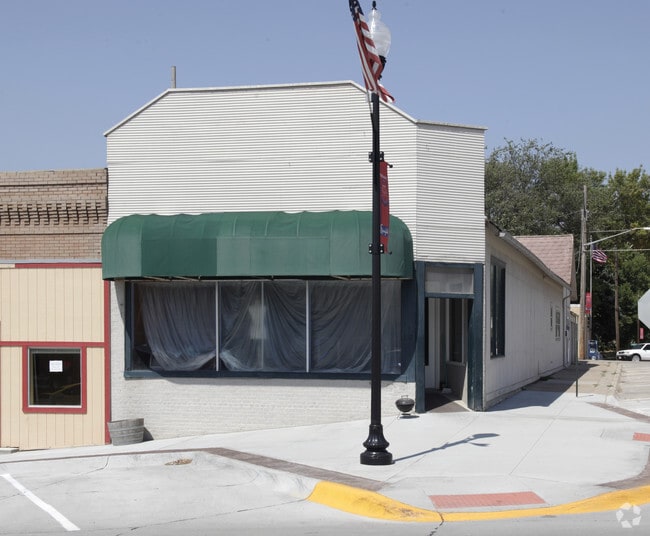
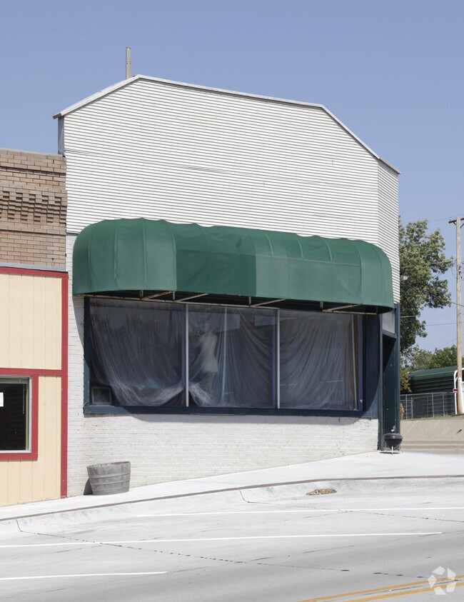
Property Record
192 Main St, Springfield, NE 68059

Property Detail
192 Main St
Omaha, NE-IA
LOTS 19A & 20 BLOCK 5 SPRINGFIELD
010366954
Sarpy
Commercialnec
Nebraska
B and X Area of moderate flood hazard, usually the area between the limits of the 100-year and 500-year floods.
19a
2024
0.08 AC
2025
Sarpy West
010702
Omaha/Council Bluffs
768 SF
NEARBY LISTINGS FOR SALE OR LEASE
-
-
View all Springfield listings for sale on LoopNet.com
DEMOGRAPHICS near 192 Main St
1 mile
3 mile
5 mile
2025 Total Population
1,967
2,833
12,303
2030 Population
2,101
3,026
13,571
Pop Growth 2025-2030
+ 6.81%
+ 6.81%
+ 10.31%
Average Age
39
41
39
2025 Total Households
748
1,074
4,207
HH Growth 2025-2030
+ 6.95%
+ 6.98%
+ 10.20%
Median Household Inc
$99,341
$104,696
$127,608
Avg Household Size
2.60
2.60
2.90
2025 Avg HH Vehicles
2.00
2.00
2.00
Median Home Value
$331,366
$385,571
$436,887
Median Year Built
1975
1978
2005
Nearby Places
Map Layers
Map Styles
 Street
 Aerial
Transit
 Traffic
 Biking
Places
Listings with unknown addresses are not visible on the map
- Restaurants
- Banks
- Shops
- Fitness
- Groceries
PUBLIC TRANSPORTATION
AIRPORT
Eppley Airfield
Drive
Walk
Distance
Eppley Airfield
37 min
24.9 mi
Lincoln
Drive
Walk
Distance
Lincoln
49 min
42.3 mi
Nearby Properties
Address
Land Use
TOTAL SIZE
Lot Size
Zoning
Address
Land Use
TOTAL SIZE
Lot Size
Zoning
181,712 SF
131.75 AC
Address
Land Use
TOTAL SIZE
Lot Size
Zoning
1,831 SF
173.14 AC
Address
Land Use
TOTAL SIZE
Lot Size
Zoning
51.65 AC
Address
Land Use
TOTAL SIZE
Lot Size
Zoning
Address
Land Use
TOTAL SIZE
Lot Size
Zoning
9.76 AC
Address
Land Use
TOTAL SIZE
Lot Size
Zoning
2,125 SF
142.25 AC
Address
Land Use
TOTAL SIZE
Lot Size
Zoning
11.43 AC
Address
Land Use
TOTAL SIZE
Lot Size
Zoning
11.40 AC
Address
Land Use
TOTAL SIZE
Lot Size
Zoning
Address
Land Use
TOTAL SIZE
Lot Size
Zoning
2,240 SF
60.20 AC
AG
Address
Land Use
TOTAL SIZE
Lot Size
Zoning
18,046 SF
6.94 AC
LI
Address
Land Use
TOTAL SIZE
Lot Size
Zoning
11,340 SF
35.46 AC
Address
Land Use
TOTAL SIZE
Lot Size
Zoning
116.77 AC
Address
Land Use
TOTAL SIZE
Lot Size
Zoning
2,866 SF
36.76 AC
Address
Land Use
TOTAL SIZE
Lot Size
Zoning
1.84 AC
Address
Land Use
TOTAL SIZE
Lot Size
Zoning
2.30 AC
Address
Land Use
TOTAL SIZE
Lot Size
Zoning
8.66 AC
Address
Land Use
TOTAL SIZE
Lot Size
Zoning
3,782 SF
314.41 AC
AG
Address
Land Use
TOTAL SIZE
Lot Size
Zoning
4,710 SF
185.15 AC
Address
Land Use
TOTAL SIZE
Lot Size
Zoning
39.96 AC
AG
Address
Land Use
TOTAL SIZE
Lot Size
Zoning
11,910 SF
1.63 AC
Address
Land Use
TOTAL SIZE
Lot Size
Zoning
17,565 SF
0.74 AC
Address
Land Use
TOTAL SIZE
Lot Size
Zoning
5,507 SF
242.24 AC
AG
Address
Land Use
TOTAL SIZE
Lot Size
Zoning
8.95 AC
Address
Land Use
TOTAL SIZE
Lot Size
Zoning
14,492 SF
20.06 AC
ILFP
Address
Land Use
TOTAL SIZE
Lot Size
Zoning
1,512 SF
221.13 AC
IL
Address
Land Use
TOTAL SIZE
Lot Size
Zoning
6,790 SF
59.66 AC
AG
Address
Land Use
TOTAL SIZE
Lot Size
Zoning
7,547 SF
73.48 AC
A
Address
Land Use
TOTAL SIZE
Lot Size
Zoning
19.67 AC
AG
Address
Land Use
TOTAL SIZE
Lot Size
Zoning
4,536 SF
1.03 AC
A
The World's #1 Commercial Real Estate Marketplace
Connect with us
© 2026 CoStar Group
The information above has been obtained from sources believed reliable. While we do not doubt its accuracy we have not verified it and make no guarantee, warranty or representation about it. It is your responsibility to independently confirm its accuracy and completeness. Any projections, opinions, assumptions, or estimates used are for example only and do not represent the current or future performance of the property. The value of this transaction to you depends on tax and other factors which should be evaluated by your tax, financial, and legal advisors. You and your advisors should conduct a careful, independent investigation of the property to determine to your satisfaction the suitability of the property for your needs.