Property Record
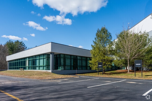
192 Mansfield Ave, Norton, MA 02766


Property Detail
192 Mansfield Ave
NORT-000009-000000-000293
Bristol
Warehouse
Massachusetts
B and X Area of moderate flood hazard, usually the area between the limits of the 100-year and 500-year floods.
31.45 AC
2025
Attleboro/New Bedford
2025
Boston
611202
Providence-Warwick, RI-MA
351,950 SF
NEARBY LISTINGS FOR SALE OR LEASE
DEMOGRAPHICS near 192 Mansfield Ave
1 mile
3 mile
5 mile
2025 Total Population
1,513
24,007
85,832
2030 Population
1,556
24,477
87,711
Pop Growth 2025-2030
+ 2.84%
+ 1.96%
+ 2.19%
Average Age
50
41
41
2025 Total Households
674
8,503
32,156
HH Growth 2025-2030
+ 2.97%
+ 2.16%
+ 2.28%
Median Household Inc
$111,052
$133,421
$114,404
Avg Household Size
2.00
2.60
2.60
2025 Avg HH Vehicles
2.00
2.00
2.00
Median Home Value
$481,679
$585,575
$570,283
Median Year Built
1986
1981
1978
Nearby Places
Map Layers
Map Styles
 Street
 Aerial
Layers
 Traffic
 Biking
Places
Listings with unknown addresses are not visible on the map
- Restaurants
- Banks
- Shops
- Fitness
- Groceries
PUBLIC TRANSPORTATION
COMMUTER RAIL
Mansfield (Foxboro Line (Special Events Only) - Massachusetts Bay Transportation Authority Commuter Rail (Purple Line), Providence/Stoughton Line - Massachusetts Bay Transportation Authority Commuter Rail (Purple Line))
Drive
Walk
Distance
Mansfield (Foxboro Line (Special Events Only) - Massachusetts Bay Transportation Authority Commuter Rail (Purple Line), Providence/Stoughton Line - Massachusetts Bay Transportation Authority Commuter Rail (Purple Line))
11 min
4.8 mi
Attleboro (Foxboro Event Service - MBTA, Providence/Stoughton Line - MBTA)
Drive
Walk
Distance
Attleboro (Foxboro Event Service - MBTA, Providence/Stoughton Line - MBTA)
15 min
8.0 mi
AIRPORT
Rhode Island Tf Green International
Drive
Walk
Distance
Rhode Island Tf Green International
49 min
31.1 mi
General Edward Lawrence Logan International
Drive
Walk
Distance
General Edward Lawrence Logan International
55 min
37.6 mi
Freight Ports
Port of Boston
Drive
Walk
Distance
Port of Boston
52 min
32.2 mi
Nearby Properties
Address
Land Use
TOTAL SIZE
Lot Size
Zoning
Address
Land Use
TOTAL SIZE
Lot Size
Zoning
Address
Land Use
TOTAL SIZE
Lot Size
Zoning
177,218 SF
50.82 AC
Address
Land Use
TOTAL SIZE
Lot Size
Zoning
Address
Land Use
TOTAL SIZE
Lot Size
Zoning
205,400 SF
10 AC
Address
Land Use
TOTAL SIZE
Lot Size
Zoning
24.50 AC
Address
Land Use
TOTAL SIZE
Lot Size
Zoning
26.70 AC
Address
Land Use
TOTAL SIZE
Lot Size
Zoning
82,828 SF
15.45 AC
Address
Land Use
TOTAL SIZE
Lot Size
Zoning
230,394 SF
19.77 AC
Address
Land Use
TOTAL SIZE
Lot Size
Zoning
186,200 SF
20.27 AC
Address
Land Use
TOTAL SIZE
Lot Size
Zoning
82,946 SF
25.50 AC
Address
Land Use
TOTAL SIZE
Lot Size
Zoning
358.70 AC
Address
Land Use
TOTAL SIZE
Lot Size
Zoning
203,520 SF
13.50 AC
Address
Land Use
TOTAL SIZE
Lot Size
Zoning
201,232 SF
11.10 AC
Address
Land Use
TOTAL SIZE
Lot Size
Zoning
177,186 SF
20.46 AC
Address
Land Use
TOTAL SIZE
Lot Size
Zoning
6.30 AC
Address
Land Use
TOTAL SIZE
Lot Size
Zoning
57.90 AC
Address
Land Use
TOTAL SIZE
Lot Size
Zoning
106.27 AC
Address
Land Use
TOTAL SIZE
Lot Size
Zoning
190,100 SF
14.50 AC
Address
Land Use
TOTAL SIZE
Lot Size
Zoning
3,153 SF
53 AC
Address
Land Use
TOTAL SIZE
Lot Size
Zoning
203,949 SF
12.20 AC
Address
Land Use
TOTAL SIZE
Lot Size
Zoning
70,452 SF
6.70 AC
Address
Land Use
TOTAL SIZE
Lot Size
Zoning
168,884 SF
10.50 AC
Address
Land Use
TOTAL SIZE
Lot Size
Zoning
64.80 AC
Address
Land Use
TOTAL SIZE
Lot Size
Zoning
113,173 SF
4.52 AC
R60
Address
Land Use
TOTAL SIZE
Lot Size
Zoning
6.26 AC
Address
Land Use
TOTAL SIZE
Lot Size
Zoning
113,671 SF
13.13 AC
Address
Land Use
TOTAL SIZE
Lot Size
Zoning
53,326 SF
5.90 AC
Address
Land Use
TOTAL SIZE
Lot Size
Zoning
124,012 SF
9.90 AC
Address
Land Use
TOTAL SIZE
Lot Size
Zoning
44,372 SF
36 AC
The World's #1 Commercial Real Estate Marketplace
Connect with us
© 2026 CoStar Group
The information above has been obtained from sources believed reliable. While we do not doubt its accuracy we have not verified it and make no guarantee, warranty or representation about it. It is your responsibility to independently confirm its accuracy and completeness. Any projections, opinions, assumptions, or estimates used are for example only and do not represent the current or future performance of the property. The value of this transaction to you depends on tax and other factors which should be evaluated by your tax, financial, and legal advisors. You and your advisors should conduct a careful, independent investigation of the property to determine to your satisfaction the suitability of the property for your needs.