Property Record
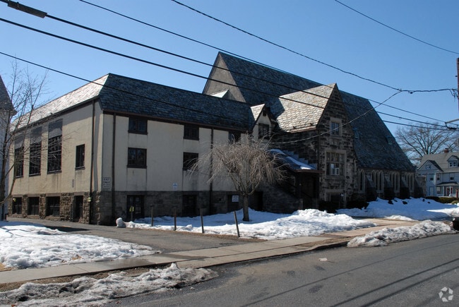
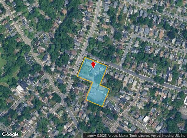
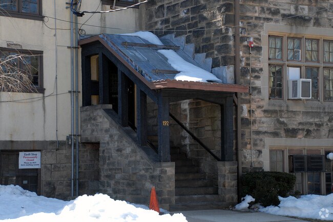
192 W Demarest Ave, Englewood, NJ 07631
NEARBY LISTINGS FOR SALE OR LEASE
-
-
View all Englewood listings for sale on LoopNet.com
Property Detail
192 W Demarest Ave
15-00606-0000-00028
1.7 AC CHURCH & PARSONAGE
Religious
Bergen
X
New Jersey
34003C0213H
28
0
1.70 AC
2025
GW Bridge
015401
Northern New Jersey
20,130 SF
New York-Jersey City-White Plains, NY-NJ
DEMOGRAPHICS near 192 W Demarest Ave
1 Mile
3 Mile
5 Mile
2024 Total Population
25,287
164,334
802,932
2029 Population
25,222
163,910
776,517
Pop Growth 2024-2029
(0.26%)
(0.26%)
(3.29%)
Average Age
41
41
41
2024 Total Households
8,772
57,723
300,953
HH Growth 2024-2029
(0.22%)
(0.27%)
(3.48%)
Median Household Inc
$77,625
$109,507
$73,356
Avg Household Size
2.70
2.70
2.50
2024 Avg HH Vehicles
2.00
2.00
1.00
Median Home Value
$404,039
$489,196
$485,692
Median Year Built
1950
1955
1953
Nearby Places
Map Layers
Map Styles
 Street
 Aerial
- Restaurants
- Banks
- Shops
- Fitness
- Groceries
PUBLIC TRANSPORTATION
COMMUTER RAIL
New Bridge Landing (Pascack Valley Line - NJ Transit Commuter Rail (NJ Transit))
DRIVE
WALK
Distance
New Bridge Landing (Pascack Valley Line - NJ Transit Commuter Rail (NJ Transit))
6 min
3.8 mi
Anderson Street (Pascack Valley Line - NJ Transit Commuter Rail (NJ Transit))
DRIVE
WALK
Distance
Anderson Street (Pascack Valley Line - NJ Transit Commuter Rail (NJ Transit))
9 min
5.4 mi
AIRPORT
LaGuardia
DRIVE
WALK
Distance
LaGuardia
28 min
15.6 mi
Newark Liberty International
DRIVE
WALK
Distance
Newark Liberty International
25 min
20.4 mi
Westchester County
DRIVE
WALK
Distance
Westchester County
47 min
31.7 mi
Freight Ports
NY - Red Hook Container Terminal
DRIVE
WALK
Distance
NY - Red Hook Container Terminal
39 min
22.7 mi
Nearby Properties
Address
Land Use
TOTAL SIZE
Lot Size
Zoning
Address
Land Use
TOTAL SIZE
Lot Size
Zoning
111.37 AC
P1
Address
Land Use
TOTAL SIZE
Lot Size
Zoning
24.08 AC
B2-A
Address
Land Use
TOTAL SIZE
Lot Size
Zoning
512,862 SF
14.16 AC
Address
Land Use
TOTAL SIZE
Lot Size
Zoning
72 AC
P1
Address
Land Use
TOTAL SIZE
Lot Size
Zoning
572,137 SF
14.11 AC
R-D
Address
Land Use
TOTAL SIZE
Lot Size
Zoning
20.07 AC
H
Address
Land Use
TOTAL SIZE
Lot Size
Zoning
74,550 SF
11.28 AC
OI
Address
Land Use
TOTAL SIZE
Lot Size
Zoning
219.71 AC
O
Address
Land Use
TOTAL SIZE
Lot Size
Zoning
42.68 AC
P1
Address
Land Use
TOTAL SIZE
Lot Size
Zoning
13.09 AC
C3
Address
Land Use
TOTAL SIZE
Lot Size
Zoning
100,151 SF
22.13 AC
B2
Address
Land Use
TOTAL SIZE
Lot Size
Zoning
39 AC
P1
Address
Land Use
TOTAL SIZE
Lot Size
Zoning
25,620 SF
21.37 AC
Address
Land Use
TOTAL SIZE
Lot Size
Zoning
5.22 AC
APT
Address
Land Use
TOTAL SIZE
Lot Size
Zoning
4.54 AC
R-M3
Address
Land Use
TOTAL SIZE
Lot Size
Zoning
2.55 AC
RC-1
Address
Land Use
TOTAL SIZE
Lot Size
Zoning
32 AC
P1
Address
Land Use
TOTAL SIZE
Lot Size
Zoning
303,434 SF
13.34 AC
Address
Land Use
TOTAL SIZE
Lot Size
Zoning
15.76 AC
B2
Address
Land Use
TOTAL SIZE
Lot Size
Zoning
Address
Land Use
TOTAL SIZE
Lot Size
Zoning
2.92 AC
RC-2
Address
Land Use
TOTAL SIZE
Lot Size
Zoning
5.53 AC
RS
Address
Land Use
TOTAL SIZE
Lot Size
Zoning
Address
Land Use
TOTAL SIZE
Lot Size
Zoning
1.22 AC
RC3
Address
Land Use
TOTAL SIZE
Lot Size
Zoning
65,087 SF
4 AC
Address
Land Use
TOTAL SIZE
Lot Size
Zoning
140 AC
RS
Address
Land Use
TOTAL SIZE
Lot Size
Zoning
12.68 AC
P1
Address
Land Use
TOTAL SIZE
Lot Size
Zoning
135.51 AC
RR
Address
Land Use
TOTAL SIZE
Lot Size
Zoning
25 AC
P1
Address
Land Use
TOTAL SIZE
Lot Size
Zoning
367,715 SF
8.28 AC
C3
The World's #1 Commercial Real Estate Marketplace
Connect with us
© 2025 CoStar Group
The information above has been obtained from sources believed reliable. While we do not doubt its accuracy we have not verified it and make no guarantee, warranty or representation about it. It is your responsibility to independently confirm its accuracy and completeness. Any projections, opinions, assumptions, or estimates used are for example only and do not represent the current or future performance of the property. The value of this transaction to you depends on tax and other factors which should be evaluated by your tax, financial, and legal advisors. You and your advisors should conduct a careful, independent investigation of the property to determine to your satisfaction the suitability of the property for your needs.