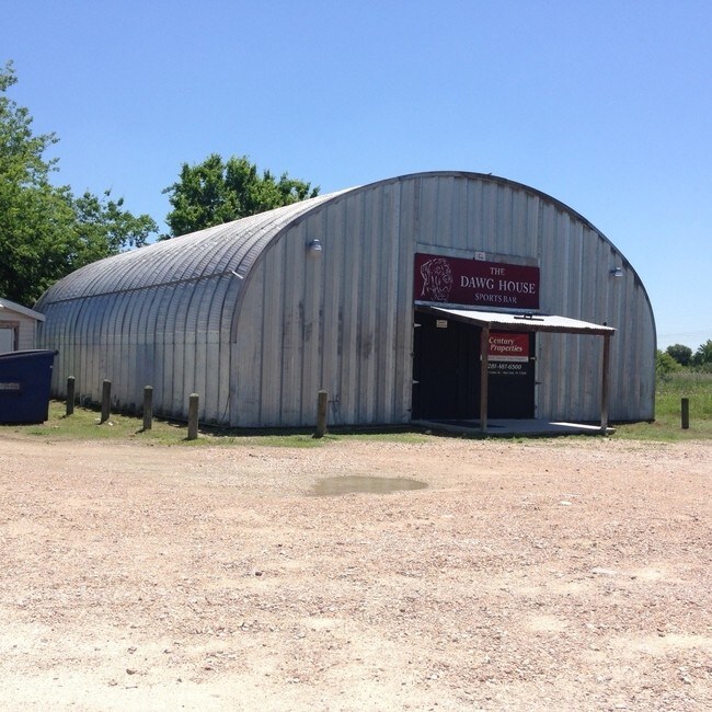
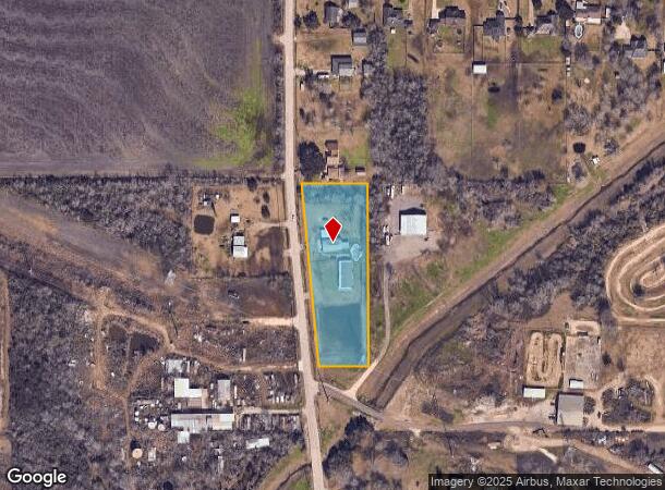
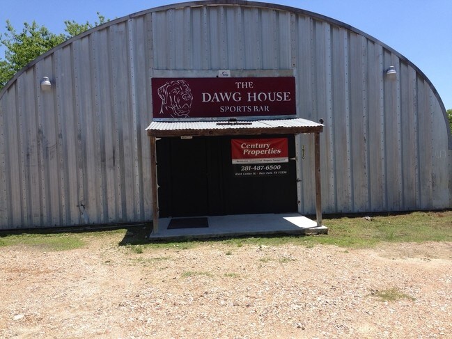
Property Record
1920 Algoa Friendswood Rd, Alvin, TX 77511
NEARBY LISTINGS FOR SALE OR LEASE
Property Detail
1920 Algoa Friendswood Rd
Houston-The Woodlands-Sugar Land, TX
601 Subd
4143-0000-0008-004
ABST 601 I & G N RR SUR SEC 13 PT OF LOT 8 (8-4) I & G N RR SUR SUB
Farms
Galveston
X
Texas
48039C0170K
8
2024
2.44 AC
2025
Southeast Outlier
723401
Houston
DEMOGRAPHICS near 1920 Algoa Friendswood Rd
1 Mile
3 Mile
5 Mile
2024 Total Population
624
4,645
69,695
2029 Population
657
4,966
73,971
Pop Growth 2024-2029
+ 5.29%
+ 6.91%
+ 6.14%
Average Age
42
42
37
2024 Total Households
232
1,667
23,969
HH Growth 2024-2029
+ 5.17%
+ 7.08%
+ 6.59%
Median Household Inc
$109,375
$105,316
$93,764
Avg Household Size
2.60
2.70
2.80
2024 Avg HH Vehicles
3.00
3.00
2.00
Median Home Value
$265,384
$255,641
$272,722
Median Year Built
1989
1989
1998
Nearby Places
Map Layers
Map Styles
 Street
 Aerial
- Restaurants
- Banks
- Shops
- Fitness
- Groceries
PUBLIC TRANSPORTATION
AIRPORT
William P Hobby
DRIVE
WALK
Distance
William P Hobby
37 min
20.1 mi
Freight Ports
Port of Houston
DRIVE
WALK
Distance
Port of Houston
48 min
32.2 mi
SALE & LEASE HISTORY
LISTING DATE
SALE/LEASE

Sep 23, 2016
For Sale
Nearby Properties
Address
Land Use
TOTAL SIZE
Lot Size
Zoning
Address
Land Use
TOTAL SIZE
Lot Size
Zoning
Address
Land Use
TOTAL SIZE
Lot Size
Zoning
46,543 SF
30.89 AC
Address
Land Use
TOTAL SIZE
Lot Size
Zoning
110,165 SF
12.32 AC
Address
Land Use
TOTAL SIZE
Lot Size
Zoning
276,750 SF
35.24 AC
Address
Land Use
TOTAL SIZE
Lot Size
Zoning
74,406 SF
11.99 AC
Address
Land Use
TOTAL SIZE
Lot Size
Zoning
10,160 SF
1.57 AC
Address
Land Use
TOTAL SIZE
Lot Size
Zoning
16,620 SF
1.59 AC
Address
Land Use
TOTAL SIZE
Lot Size
Zoning
49,392 SF
5.44 AC
Address
Land Use
TOTAL SIZE
Lot Size
Zoning
249.43 AC
Address
Land Use
TOTAL SIZE
Lot Size
Zoning
99,200 SF
58.93 AC
Address
Land Use
TOTAL SIZE
Lot Size
Zoning
4,559 SF
0.92 AC
Address
Land Use
TOTAL SIZE
Lot Size
Zoning
29,590 SF
4.51 AC
0139
Address
Land Use
TOTAL SIZE
Lot Size
Zoning
3,654 SF
31.95 AC
Address
Land Use
TOTAL SIZE
Lot Size
Zoning
10,594 SF
9.34 AC
Address
Land Use
TOTAL SIZE
Lot Size
Zoning
11,200 SF
1 AC
Address
Land Use
TOTAL SIZE
Lot Size
Zoning
37,000 SF
2 AC
Address
Land Use
TOTAL SIZE
Lot Size
Zoning
5,076 SF
1.74 AC
Address
Land Use
TOTAL SIZE
Lot Size
Zoning
15,568 SF
4.71 AC
0015
Address
Land Use
TOTAL SIZE
Lot Size
Zoning
22.82 AC
Address
Land Use
TOTAL SIZE
Lot Size
Zoning
40.75 AC
Address
Land Use
TOTAL SIZE
Lot Size
Zoning
17,500 SF
4.69 AC
0138
Address
Land Use
TOTAL SIZE
Lot Size
Zoning
49,346 SF
4.93 AC
Address
Land Use
TOTAL SIZE
Lot Size
Zoning
3,770 SF
23.81 AC
0041
Address
Land Use
TOTAL SIZE
Lot Size
Zoning
6,155 SF
26.17 AC
Address
Land Use
TOTAL SIZE
Lot Size
Zoning
15,000 SF
4.33 AC
Address
Land Use
TOTAL SIZE
Lot Size
Zoning
20 AC
0027
Address
Land Use
TOTAL SIZE
Lot Size
Zoning
25,900 SF
9.98 AC
Address
Land Use
TOTAL SIZE
Lot Size
Zoning
55.65 AC
The World's #1 Commercial Real Estate Marketplace
Connect with us
© 2025 CoStar Group
The information above has been obtained from sources believed reliable. While we do not doubt its accuracy we have not verified it and make no guarantee, warranty or representation about it. It is your responsibility to independently confirm its accuracy and completeness. Any projections, opinions, assumptions, or estimates used are for example only and do not represent the current or future performance of the property. The value of this transaction to you depends on tax and other factors which should be evaluated by your tax, financial, and legal advisors. You and your advisors should conduct a careful, independent investigation of the property to determine to your satisfaction the suitability of the property for your needs.