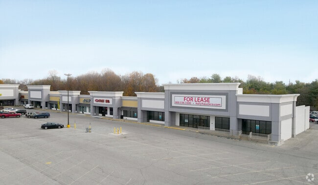
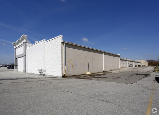
Property Record
1920 E Markland Ave, Kokomo, IN 46901
NEARBY LISTINGS FOR SALE OR LEASE
Property Detail
1920 E Markland Ave
34-04-32-352-032.000-002
PT SW4 32-24-4 3.94 AC
Departmentstore
Howard
X
Indiana
18067C0226C
87 SF
2023
Lafayette/Kokomo
2024
Other Market Areas
001300
Kokomo, IN
227,171 SF
DEMOGRAPHICS near 1920 E Markland Ave
1 Mile
3 Mile
5 Mile
2024 Total Population
4,276
43,324
66,231
2029 Population
4,301
43,713
66,312
Pop Growth 2024-2029
+ 0.58%
+ 0.90%
+ 0.12%
Average Age
41
40
42
2024 Total Households
1,993
19,246
28,901
HH Growth 2024-2029
+ 0.45%
+ 0.85%
+ 0.08%
Median Household Inc
$41,394
$44,494
$52,100
Avg Household Size
2.10
2.20
2.20
2024 Avg HH Vehicles
2.00
2.00
2.00
Median Home Value
$89,892
$97,781
$130,888
Median Year Built
1960
1959
1966
Nearby Places
Map Layers
Map Styles
 Street
 Aerial
- Restaurants
- Banks
- Shops
- Fitness
- Groceries
Nearby Properties
Address
Land Use
TOTAL SIZE
Lot Size
Zoning
Address
Land Use
TOTAL SIZE
Lot Size
Zoning
11,490,970 SF
0.02 AC
Address
Land Use
TOTAL SIZE
Lot Size
Zoning
3,633,252 SF
0.02 AC
Address
Land Use
TOTAL SIZE
Lot Size
Zoning
377,850 SF
87 SF
Address
Land Use
TOTAL SIZE
Lot Size
Zoning
399,910 SF
131 SF
Address
Land Use
TOTAL SIZE
Lot Size
Zoning
417,744 SF
174 SF
Address
Land Use
TOTAL SIZE
Lot Size
Zoning
414,424 SF
87 SF
Address
Land Use
TOTAL SIZE
Lot Size
Zoning
254,213 SF
87 SF
Address
Land Use
TOTAL SIZE
Lot Size
Zoning
2,639,746 SF
0.02 AC
Address
Land Use
TOTAL SIZE
Lot Size
Zoning
165,418 SF
1.97 AC
Address
Land Use
TOTAL SIZE
Lot Size
Zoning
212,590 SF
87 SF
Address
Land Use
TOTAL SIZE
Lot Size
Zoning
74,096 SF
1.18 AC
Address
Land Use
TOTAL SIZE
Lot Size
Zoning
104,910 SF
44 SF
Address
Land Use
TOTAL SIZE
Lot Size
Zoning
240,144 SF
131 SF
Address
Land Use
TOTAL SIZE
Lot Size
Zoning
188,016 SF
44 SF
Address
Land Use
TOTAL SIZE
Lot Size
Zoning
116,821 SF
44 SF
Address
Land Use
TOTAL SIZE
Lot Size
Zoning
101,088 SF
44 SF
Address
Land Use
TOTAL SIZE
Lot Size
Zoning
0.01 AC
Address
Land Use
TOTAL SIZE
Lot Size
Zoning
188,114 SF
87 SF
Address
Land Use
TOTAL SIZE
Lot Size
Zoning
109,429 SF
44 SF
Address
Land Use
TOTAL SIZE
Lot Size
Zoning
158,656 SF
44 SF
Address
Land Use
TOTAL SIZE
Lot Size
Zoning
89,717 SF
87 SF
Address
Land Use
TOTAL SIZE
Lot Size
Zoning
4,976 SF
131 SF
Address
Land Use
TOTAL SIZE
Lot Size
Zoning
133,817 SF
87 SF
Address
Land Use
TOTAL SIZE
Lot Size
Zoning
239,259 SF
87 SF
Address
Land Use
TOTAL SIZE
Lot Size
Zoning
133,851 SF
87 SF
Address
Land Use
TOTAL SIZE
Lot Size
Zoning
63,336 SF
3.73 AC
Address
Land Use
TOTAL SIZE
Lot Size
Zoning
150,196 SF
87 SF
Address
Land Use
TOTAL SIZE
Lot Size
Zoning
71,832 SF
1.48 AC
Address
Land Use
TOTAL SIZE
Lot Size
Zoning
59,843 SF
2.80 AC
The World's #1 Commercial Real Estate Marketplace
Connect with us
© 2025 CoStar Group
The information above has been obtained from sources believed reliable. While we do not doubt its accuracy we have not verified it and make no guarantee, warranty or representation about it. It is your responsibility to independently confirm its accuracy and completeness. Any projections, opinions, assumptions, or estimates used are for example only and do not represent the current or future performance of the property. The value of this transaction to you depends on tax and other factors which should be evaluated by your tax, financial, and legal advisors. You and your advisors should conduct a careful, independent investigation of the property to determine to your satisfaction the suitability of the property for your needs.