Property Record
1920 High Ridge Rd, Boynton Beach, FL 33426

NEARBY LISTINGS FOR SALE OR LEASE
Property Detail
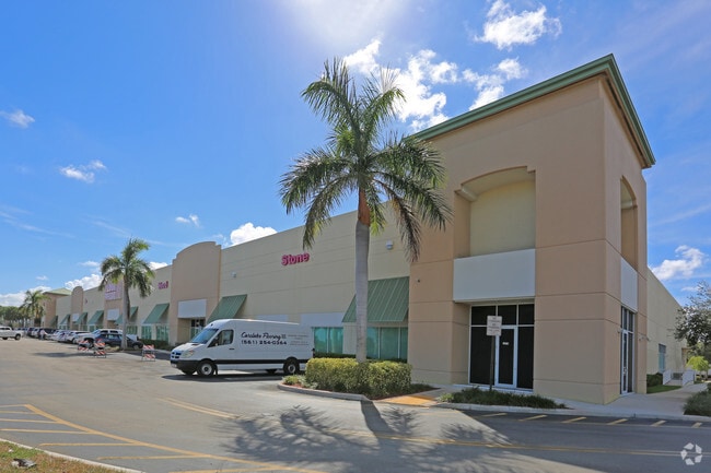
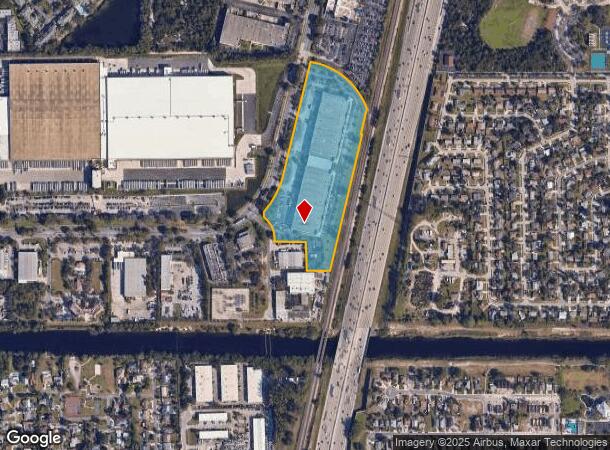
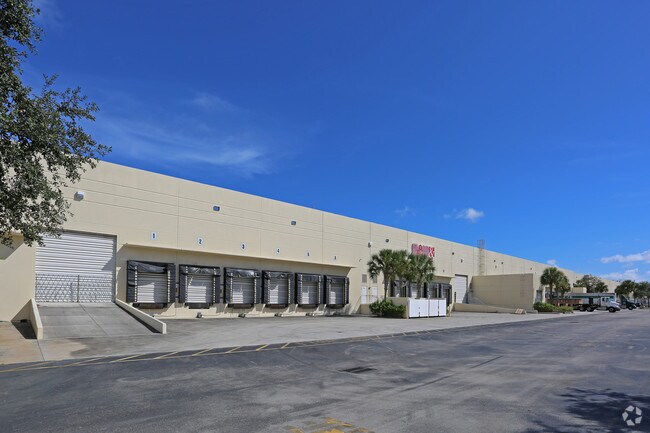
1920 High Ridge Rd
West Palm Beach-Boca Raton-Delray Beach, FL
Quantum Pk At Boynton
08-43-45-16-31-000-0740
QUANTUM PK AT BOYNTON BCH PL 7 LTS 74~ 75 & 76 & QUANTUM PARK AT BOYNTON BEACH PL 11
Warehouse
Palm Beach
X
Florida
12099C0787F
74
2024
13.75 AC
2025
Boynton Beach
006012
South Florida
198,114 SF
DEMOGRAPHICS near 1920 High Ridge Rd
1 Mile
3 Mile
5 Mile
2024 Total Population
18,189
117,096
237,953
2029 Population
19,098
121,764
247,858
Pop Growth 2024-2029
+ 5.00%
+ 3.99%
+ 4.16%
Average Age
40
44
45
2024 Total Households
7,288
48,968
98,423
HH Growth 2024-2029
+ 5.28%
+ 3.97%
+ 4.20%
Median Household Inc
$50,242
$63,105
$67,912
Avg Household Size
2.30
2.20
2.30
2024 Avg HH Vehicles
2.00
2.00
2.00
Median Home Value
$225,982
$273,281
$317,032
Median Year Built
1996
1984
1985
Nearby Places
Map Layers
Map Styles
 Street
 Aerial
- Restaurants
- Banks
- Shops
- Fitness
- Groceries
PUBLIC TRANSPORTATION
COMMUTER RAIL
Boynton Beach (Mangonia Park - Miami Airport - Tri-Rail, Tri-County Commuter - Tri-Rail)
DRIVE
WALK
Distance
Boynton Beach (Mangonia Park - Miami Airport - Tri-Rail, Tri-County Commuter - Tri-Rail)
5 min
1.1 mi
Lake Worth (Mangonia Park - Miami Airport - Tri-Rail, Tri-County Commuter - Tri-Rail)
DRIVE
WALK
Distance
Lake Worth (Mangonia Park - Miami Airport - Tri-Rail, Tri-County Commuter - Tri-Rail)
12 min
5.9 mi
AIRPORT
Palm Beach International
DRIVE
WALK
Distance
Palm Beach International
20 min
12.5 mi
Freight Ports
Port of Palm Beach
DRIVE
WALK
Distance
Port of Palm Beach
30 min
17.9 mi
Nearby Properties
Address
Land Use
TOTAL SIZE
Lot Size
Zoning
Address
Land Use
TOTAL SIZE
Lot Size
Zoning
822,044 SF
11.62 AC
MU-4
Address
Land Use
TOTAL SIZE
Lot Size
Zoning
980,025 SF
23.48 AC
PU
Address
Land Use
TOTAL SIZE
Lot Size
Zoning
437,883 SF
3.69 AC
MU-4
Address
Land Use
TOTAL SIZE
Lot Size
Zoning
514,687 SF
19.38 AC
SMU
Address
Land Use
TOTAL SIZE
Lot Size
Zoning
525,037 SF
25.65 AC
PUD
Address
Land Use
TOTAL SIZE
Lot Size
Zoning
1,028,686 SF
63.78 AC
PID
Address
Land Use
TOTAL SIZE
Lot Size
Zoning
391,475 SF
13.19 AC
SMU
Address
Land Use
TOTAL SIZE
Lot Size
Zoning
579,116 SF
4.52 AC
MU-C
Address
Land Use
TOTAL SIZE
Lot Size
Zoning
441,081 SF
20.08 AC
PUD
Address
Land Use
TOTAL SIZE
Lot Size
Zoning
440,818 SF
47.57 AC
RS
Address
Land Use
TOTAL SIZE
Lot Size
Zoning
403,863 SF
24.14 AC
PUD
Address
Land Use
TOTAL SIZE
Lot Size
Zoning
327,864 SF
9.21 AC
MW
Address
Land Use
TOTAL SIZE
Lot Size
Zoning
340,811 SF
49.49 AC
PID
Address
Land Use
TOTAL SIZE
Lot Size
Zoning
443,576 SF
92.86 AC
PO
Address
Land Use
TOTAL SIZE
Lot Size
Zoning
437,380 SF
18.05 AC
PID
Address
Land Use
TOTAL SIZE
Lot Size
Zoning
303,078 SF
19.62 AC
PUD
Address
Land Use
TOTAL SIZE
Lot Size
Zoning
276,168 SF
17.42 AC
AR
Address
Land Use
TOTAL SIZE
Lot Size
Zoning
259,857 SF
14.18 AC
PUD
Address
Land Use
TOTAL SIZE
Lot Size
Zoning
346,777 SF
15.91 AC
PUD
Address
Land Use
TOTAL SIZE
Lot Size
Zoning
278,460 SF
21.24 AC
PUD
Address
Land Use
TOTAL SIZE
Lot Size
Zoning
381,807 SF
3.98 AC
SMU
Address
Land Use
TOTAL SIZE
Lot Size
Zoning
334,014 SF
3.35 AC
SMU
Address
Land Use
TOTAL SIZE
Lot Size
Zoning
285,837 SF
14.86 AC
PUD
Address
Land Use
TOTAL SIZE
Lot Size
Zoning
214,095 SF
7.67 AC
PUD
Address
Land Use
TOTAL SIZE
Lot Size
Zoning
211,944 SF
22.76 AC
PCD
Address
Land Use
TOTAL SIZE
Lot Size
Zoning
240,786 SF
10.63 AC
R3
Address
Land Use
TOTAL SIZE
Lot Size
Zoning
476,774 SF
38.76 AC
RM
Address
Land Use
TOTAL SIZE
Lot Size
Zoning
181,150 SF
4.27 AC
SMU
Address
Land Use
TOTAL SIZE
Lot Size
Zoning
182,859 SF
4.89 AC
SMU
Address
Land Use
TOTAL SIZE
Lot Size
Zoning
291,589 SF
11.63 AC
PID
The World's #1 Commercial Real Estate Marketplace
Connect with us
© 2026 CoStar Group
The information above has been obtained from sources believed reliable. While we do not doubt its accuracy we have not verified it and make no guarantee, warranty or representation about it. It is your responsibility to independently confirm its accuracy and completeness. Any projections, opinions, assumptions, or estimates used are for example only and do not represent the current or future performance of the property. The value of this transaction to you depends on tax and other factors which should be evaluated by your tax, financial, and legal advisors. You and your advisors should conduct a careful, independent investigation of the property to determine to your satisfaction the suitability of the property for your needs.