Property Record
1920 Mel Browning St, Bowling Green, KY 42104

NEARBY LISTINGS FOR SALE OR LEASE
Property Detail
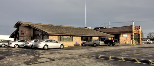
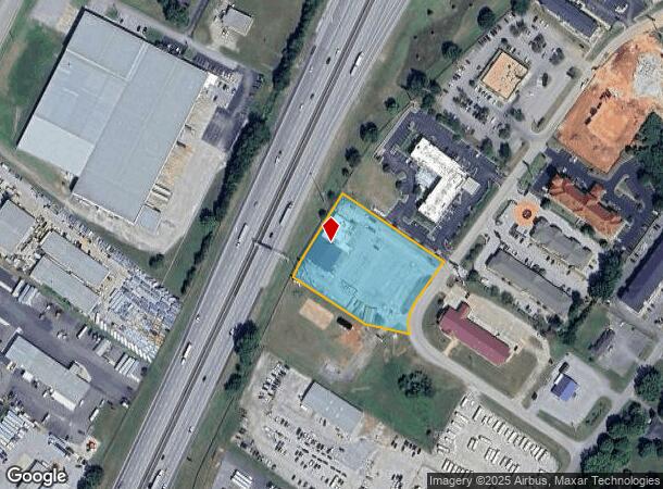
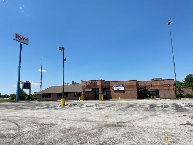
1920 Mel Browning St
053B-01-007
Browning Center
Restaurantbuilding
Warren
X
Kentucky
21227C0320E
7
2025
2.18 AC
2025
Bowling Green Area
010801
Other Market Areas
11,088 SF
Bowling Green, KY
DEMOGRAPHICS near 1920 Mel Browning St
1 Mile
3 Mile
5 Mile
2024 Total Population
6,887
37,094
85,018
2029 Population
7,633
41,059
93,553
Pop Growth 2024-2029
+ 10.83%
+ 10.69%
+ 10.04%
Average Age
35
38
36
2024 Total Households
2,731
15,082
33,038
HH Growth 2024-2029
+ 11.39%
+ 11.15%
+ 10.75%
Median Household Inc
$52,093
$65,360
$60,456
Avg Household Size
2.50
2.40
2.40
2024 Avg HH Vehicles
2.00
2.00
2.00
Median Home Value
$241,712
$265,398
$258,019
Median Year Built
2002
1998
1992
Nearby Places
Map Layers
Map Styles
 Street
 Aerial
- Restaurants
- Banks
- Shops
- Fitness
- Groceries
SALE & LEASE HISTORY
LISTING DATE
SALE/LEASE

Jul 07, 2021
For Lease
Nearby Properties
Address
Land Use
TOTAL SIZE
Lot Size
Zoning
Address
Land Use
TOTAL SIZE
Lot Size
Zoning
Address
Land Use
TOTAL SIZE
Lot Size
Zoning
26,586 SF
17.19 AC
Address
Land Use
TOTAL SIZE
Lot Size
Zoning
7,399 SF
57.89 AC
Address
Land Use
TOTAL SIZE
Lot Size
Zoning
15,440 SF
16.52 AC
Address
Land Use
TOTAL SIZE
Lot Size
Zoning
12.29 AC
Address
Land Use
TOTAL SIZE
Lot Size
Zoning
261,579 SF
17.71 AC
Address
Land Use
TOTAL SIZE
Lot Size
Zoning
Address
Land Use
TOTAL SIZE
Lot Size
Zoning
173,947 SF
11.53 AC
Address
Land Use
TOTAL SIZE
Lot Size
Zoning
59,812 SF
21.30 AC
Address
Land Use
TOTAL SIZE
Lot Size
Zoning
175,830 SF
8 AC
Address
Land Use
TOTAL SIZE
Lot Size
Zoning
39,504 SF
19.74 AC
Address
Land Use
TOTAL SIZE
Lot Size
Zoning
86.84 AC
Address
Land Use
TOTAL SIZE
Lot Size
Zoning
105,987 SF
7.98 AC
Address
Land Use
TOTAL SIZE
Lot Size
Zoning
261,196 SF
13.01 AC
Address
Land Use
TOTAL SIZE
Lot Size
Zoning
100,193 SF
9.82 AC
Address
Land Use
TOTAL SIZE
Lot Size
Zoning
40.04 AC
Address
Land Use
TOTAL SIZE
Lot Size
Zoning
142,199 SF
12.95 AC
Address
Land Use
TOTAL SIZE
Lot Size
Zoning
192,994 SF
22.55 AC
Address
Land Use
TOTAL SIZE
Lot Size
Zoning
6.55 AC
Address
Land Use
TOTAL SIZE
Lot Size
Zoning
54.74 AC
Address
Land Use
TOTAL SIZE
Lot Size
Zoning
96,696 SF
9.69 AC
Address
Land Use
TOTAL SIZE
Lot Size
Zoning
208,264 SF
26.05 AC
Address
Land Use
TOTAL SIZE
Lot Size
Zoning
43,144 SF
18.61 AC
Address
Land Use
TOTAL SIZE
Lot Size
Zoning
15,392 SF
8.50 AC
Address
Land Use
TOTAL SIZE
Lot Size
Zoning
77,160 SF
3.05 AC
Address
Land Use
TOTAL SIZE
Lot Size
Zoning
62,904 SF
2.04 AC
Address
Land Use
TOTAL SIZE
Lot Size
Zoning
140,965 SF
16.37 AC
Address
Land Use
TOTAL SIZE
Lot Size
Zoning
2.48 AC
Address
Land Use
TOTAL SIZE
Lot Size
Zoning
41,192 SF
6 AC
Address
Land Use
TOTAL SIZE
Lot Size
Zoning
73,660 SF
2 AC
The World's #1 Commercial Real Estate Marketplace
Connect with us
© 2026 CoStar Group
The information above has been obtained from sources believed reliable. While we do not doubt its accuracy we have not verified it and make no guarantee, warranty or representation about it. It is your responsibility to independently confirm its accuracy and completeness. Any projections, opinions, assumptions, or estimates used are for example only and do not represent the current or future performance of the property. The value of this transaction to you depends on tax and other factors which should be evaluated by your tax, financial, and legal advisors. You and your advisors should conduct a careful, independent investigation of the property to determine to your satisfaction the suitability of the property for your needs.