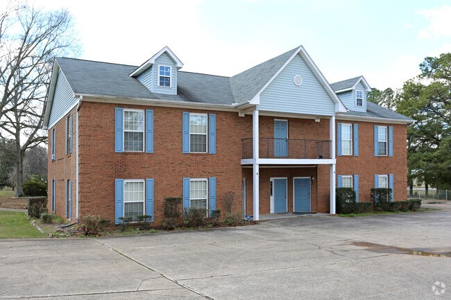
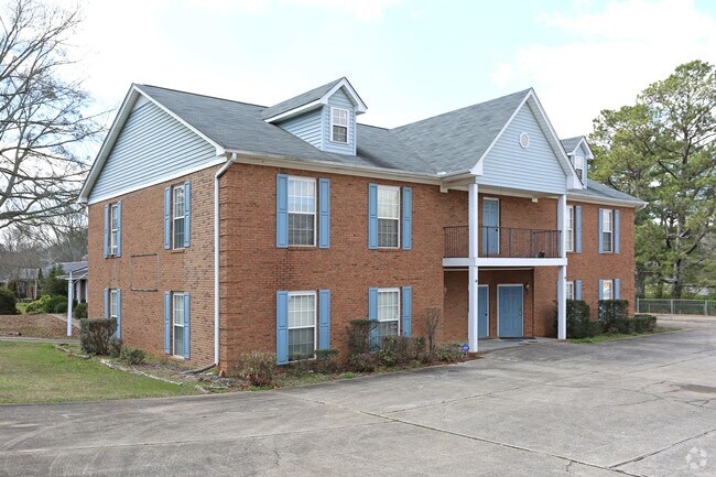
Property Record
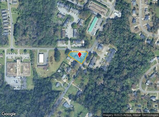
1920 Old Springville Rd, Center Point, AL 35215
NEARBY LISTINGS FOR SALE OR LEASE
Property Detail
1920 Old Springville Rd
Birmingham-Hoover, AL
Vann Joe Sub 12-20-1
12-00-20-1-003-011.000
LOT 4 JOE VANN SUBDIV 75/22
Officebuilding
Jefferson
X
Alabama
01073C0243J
4
2023
0.49 AC
2024
Center Point
011805
Birmingham
5,548 SF
DEMOGRAPHICS near 1920 Old Springville Rd
1 Mile
3 Mile
5 Mile
2024 Total Population
8,784
56,306
93,652
2029 Population
8,595
55,014
91,433
Pop Growth 2024-2029
(2.15%)
(2.29%)
(2.37%)
Average Age
37
37
38
2024 Total Households
3,315
21,259
35,319
HH Growth 2024-2029
(2.20%)
(2.35%)
(2.44%)
Median Household Inc
$46,708
$50,950
$55,989
Avg Household Size
2.50
2.60
2.60
2024 Avg HH Vehicles
2.00
2.00
2.00
Median Home Value
$143,924
$150,660
$164,605
Median Year Built
1977
1977
1977
Nearby Places
Map Layers
Map Styles
 Street
 Aerial
- Restaurants
- Banks
- Shops
- Fitness
- Groceries
PUBLIC TRANSPORTATION
AIRPORT
Birmingham-Shuttlesworth International
DRIVE
WALK
Distance
Birmingham-Shuttlesworth International
16 min
9.5 mi
SALE & LEASE HISTORY
LISTING DATE
SALE/LEASE

Apr 05, 2017
For Lease
Apr 04, 2019
For Sale
Nearby Properties
Address
Land Use
TOTAL SIZE
Lot Size
Zoning
Address
Land Use
TOTAL SIZE
Lot Size
Zoning
152,664 SF
12.44 AC
CO&I
Address
Land Use
TOTAL SIZE
Lot Size
Zoning
326,294 SF
25.99 AC
R4&U
Address
Land Use
TOTAL SIZE
Lot Size
Zoning
346,184 SF
21.75 AC
I2
Address
Land Use
TOTAL SIZE
Lot Size
Zoning
128,233 SF
CO&I
Address
Land Use
TOTAL SIZE
Lot Size
Zoning
155,845 SF
17 AC
C2
Address
Land Use
TOTAL SIZE
Lot Size
Zoning
204,463 SF
32.90 AC
PUD
Address
Land Use
TOTAL SIZE
Lot Size
Zoning
150,160 SF
12 AC
INST
Address
Land Use
TOTAL SIZE
Lot Size
Zoning
87,863 SF
13.20 AC
PUD
Address
Land Use
TOTAL SIZE
Lot Size
Zoning
1 SF
7.08 AC
CB2
Address
Land Use
TOTAL SIZE
Lot Size
Zoning
204,269 SF
17.94 AC
PUD
Address
Land Use
TOTAL SIZE
Lot Size
Zoning
94,262 SF
17.30 AC
C-2
Address
Land Use
TOTAL SIZE
Lot Size
Zoning
58,509 SF
CO&I
Address
Land Use
TOTAL SIZE
Lot Size
Zoning
207,383 SF
17 AC
CR5
Address
Land Use
TOTAL SIZE
Lot Size
Zoning
39,890 SF
7.10 AC
R8
Address
Land Use
TOTAL SIZE
Lot Size
Zoning
57,296 SF
CO&I
Address
Land Use
TOTAL SIZE
Lot Size
Zoning
112,806 SF
2.04 AC
R2
Address
Land Use
TOTAL SIZE
Lot Size
Zoning
134,442 SF
26 AC
PUD
Address
Land Use
TOTAL SIZE
Lot Size
Zoning
192,596 SF
13.79 AC
CR5
Address
Land Use
TOTAL SIZE
Lot Size
Zoning
147,200 SF
7.93 AC
CR5
Address
Land Use
TOTAL SIZE
Lot Size
Zoning
176,232 SF
5.20 AC
C2
Address
Land Use
TOTAL SIZE
Lot Size
Zoning
110,776 SF
11.10 AC
C2
Address
Land Use
TOTAL SIZE
Lot Size
Zoning
95,172 SF
6.40 AC
R2
Address
Land Use
TOTAL SIZE
Lot Size
Zoning
53,864 SF
6.58 AC
C2
Address
Land Use
TOTAL SIZE
Lot Size
Zoning
49,858 SF
7.30 AC
C4
Address
Land Use
TOTAL SIZE
Lot Size
Zoning
125,252 SF
8.07 AC
R4
Address
Land Use
TOTAL SIZE
Lot Size
Zoning
74,218 SF
4.50 AC
C2
Address
Land Use
TOTAL SIZE
Lot Size
Zoning
97,652 SF
6.20 AC
C2
Address
Land Use
TOTAL SIZE
Lot Size
Zoning
89,761 SF
11 AC
PUD
Address
Land Use
TOTAL SIZE
Lot Size
Zoning
122,397 SF
13.13 AC
C1
Address
Land Use
TOTAL SIZE
Lot Size
Zoning
40,011 SF
2.05 AC
C1
The World's #1 Commercial Real Estate Marketplace
Connect with us
© 2025 CoStar Group
The information above has been obtained from sources believed reliable. While we do not doubt its accuracy we have not verified it and make no guarantee, warranty or representation about it. It is your responsibility to independently confirm its accuracy and completeness. Any projections, opinions, assumptions, or estimates used are for example only and do not represent the current or future performance of the property. The value of this transaction to you depends on tax and other factors which should be evaluated by your tax, financial, and legal advisors. You and your advisors should conduct a careful, independent investigation of the property to determine to your satisfaction the suitability of the property for your needs.