No Photo
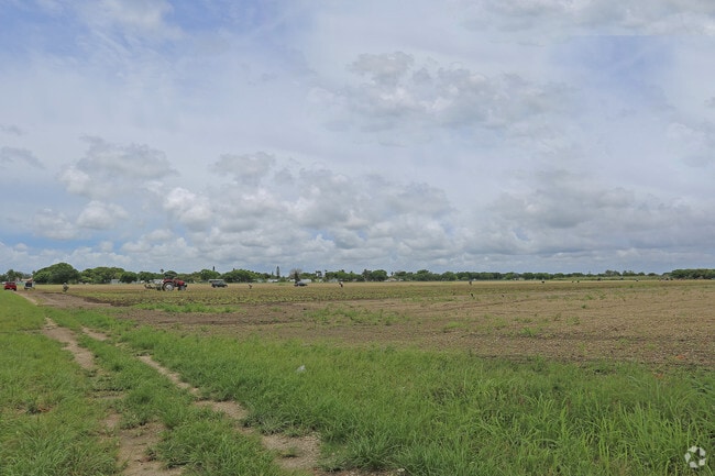
Property Record
19200 Sw 177Th Ave, Miami, FL 33187


NEARBY LISTINGS FOR SALE OR LEASE
-
-
-
-
-
No Photo
-
-
-
View all Miami listings for sale on LoopNet.com
Property Detail
19200 Sw 177Th Ave
30-6801-000-0200
Acreage
Horticulturegrowinghousesagricultural
1 56 38 9.258 AC +/- N1/2 OF N1/2 OF NE1/4 OF SE1/4 LESS E50FT & LESS N45FT OF E280FT & LESS N13FT OF W1052.8FT FOR R/W LESS NE PORT FOR R/W COC 21460-3933 0503 5
AH
Miami/Dade
12086C0580L
Florida
2024
9.26 AC
2025
South Dade
019801
South Florida
23,704 SF
Miami-Miami Beach-Kendall, FL
DEMOGRAPHICS near 19200 Sw 177Th Ave
1 Mile
3 Mile
5 Mile
2024 Total Population
1,817
11,531
64,408
2029 Population
1,872
11,153
62,201
Pop Growth 2024-2029
+ 3.03%
(3.28%)
(3.43%)
Average Age
42
41
41
2024 Total Households
565
3,319
18,774
HH Growth 2024-2029
+ 2.83%
(3.71%)
(3.95%)
Median Household Inc
$54,937
$89,492
$86,705
Avg Household Size
3.10
3.30
3.30
2024 Avg HH Vehicles
2.00
2.00
2.00
Median Home Value
$194,185
$424,130
$400,475
Median Year Built
1997
1994
1995
Nearby Places
Map Layers
Map Styles
 Street
 Aerial
- Restaurants
- Banks
- Shops
- Fitness
- Groceries
PUBLIC TRANSPORTATION
AIRPORT
Miami International
DRIVE
WALK
Distance
Miami International
42 min
24.9 mi
Nearby Properties
Address
Land Use
TOTAL SIZE
Lot Size
Zoning
Address
Land Use
TOTAL SIZE
Lot Size
Zoning
33,067 SF
14.04 AC
9000
Address
Land Use
TOTAL SIZE
Lot Size
Zoning
12,194 SF
24 AC
9000
Address
Land Use
TOTAL SIZE
Lot Size
Zoning
55,130 SF
8.65 AC
9000
Address
Land Use
TOTAL SIZE
Lot Size
Zoning
42,585 SF
15 AC
9000
Address
Land Use
TOTAL SIZE
Lot Size
Zoning
693 SF
91.97 AC
9000
Address
Land Use
TOTAL SIZE
Lot Size
Zoning
2,425 SF
9.11 AC
9000
Address
Land Use
TOTAL SIZE
Lot Size
Zoning
40 AC
9000
Address
Land Use
TOTAL SIZE
Lot Size
Zoning
30,063 SF
2.39 AC
6100
Address
Land Use
TOTAL SIZE
Lot Size
Zoning
868 SF
9.13 AC
9000
Address
Land Use
TOTAL SIZE
Lot Size
Zoning
22.81 AC
7700
Address
Land Use
TOTAL SIZE
Lot Size
Zoning
13,942 SF
2.70 AC
6200
Address
Land Use
TOTAL SIZE
Lot Size
Zoning
24,772 SF
4.38 AC
6200
Address
Land Use
TOTAL SIZE
Lot Size
Zoning
44,216 SF
4.36 AC
7700
Address
Land Use
TOTAL SIZE
Lot Size
Zoning
22,570 SF
4.36 AC
7700
Address
Land Use
TOTAL SIZE
Lot Size
Zoning
38,060 SF
8.76 AC
9000
Address
Land Use
TOTAL SIZE
Lot Size
Zoning
15,391 SF
5.07 AC
8900
Address
Land Use
TOTAL SIZE
Lot Size
Zoning
12,396 SF
4.77 AC
8900
Address
Land Use
TOTAL SIZE
Lot Size
Zoning
55,681 SF
16.89 AC
8900
Address
Land Use
TOTAL SIZE
Lot Size
Zoning
8,232 SF
5.03 AC
8900
Address
Land Use
TOTAL SIZE
Lot Size
Zoning
1,980 SF
29.86 AC
8900
Address
Land Use
TOTAL SIZE
Lot Size
Zoning
6,946 SF
2.10 AC
6200
Address
Land Use
TOTAL SIZE
Lot Size
Zoning
51,854 SF
4.92 AC
9000
Address
Land Use
TOTAL SIZE
Lot Size
Zoning
18,596 SF
4.70 AC
2300
Address
Land Use
TOTAL SIZE
Lot Size
Zoning
5,800 SF
2.33 AC
6100
Address
Land Use
TOTAL SIZE
Lot Size
Zoning
10,895 SF
5 AC
8900
Address
Land Use
TOTAL SIZE
Lot Size
Zoning
13,452 SF
2.33 AC
8900
Address
Land Use
TOTAL SIZE
Lot Size
Zoning
9,621 SF
5 AC
8900
Address
Land Use
TOTAL SIZE
Lot Size
Zoning
9,164 SF
4.14 AC
9000
Address
Land Use
TOTAL SIZE
Lot Size
Zoning
13,903 SF
4.29 AC
9000
The World's #1 Commercial Real Estate Marketplace
Connect with us
© 2025 CoStar Group
The information above has been obtained from sources believed reliable. While we do not doubt its accuracy we have not verified it and make no guarantee, warranty or representation about it. It is your responsibility to independently confirm its accuracy and completeness. Any projections, opinions, assumptions, or estimates used are for example only and do not represent the current or future performance of the property. The value of this transaction to you depends on tax and other factors which should be evaluated by your tax, financial, and legal advisors. You and your advisors should conduct a careful, independent investigation of the property to determine to your satisfaction the suitability of the property for your needs.