Property Record
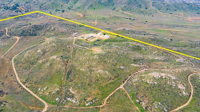
19207 Cajalco Rd, Perris, CA 92570


Property Detail
19207 Cajalco Rd
321-150-018
80.00 ACRES M/L IN POR NW 1/4 OF SEC 17 T4S R4W FOR TOTAL DESCRIPTION SEE ASSESSORS MAPS
Agriculturalland
RIVERSIDE
CBOOK
California
B and X Area of moderate flood hazard, usually the area between the limits of the 100-year and 500-year floods.
80 AC
2024
Moreno Valley/Perris
2025
Inland Empire (California)
042903
Riverside-San Bernardino-Ontario, CA
2,310 SF
NEARBY LISTINGS FOR SALE OR LEASE
DEMOGRAPHICS near 19207 Cajalco Rd
1 mile
3 mile
5 mile
2025 Total Population
489
19,822
60,096
2030 Population
497
20,294
61,525
Pop Growth 2025-2030
+ 1.64%
+ 2.38%
+ 2.38%
Average Age
37
37
37
2025 Total Households
126
4,947
15,942
HH Growth 2025-2030
+ 0.79%
+ 2.04%
+ 2.18%
Median Household Inc
$113,888
$95,254
$111,772
Avg Household Size
3.60
3.70
3.60
2025 Avg HH Vehicles
3.00
3.00
3.00
Median Home Value
$791,044
$630,440
$690,624
Median Year Built
1999
1986
1988
Nearby Places
Map Layers
Map Styles
 Street
 Aerial
Layers
 Traffic
 Biking
Places
Listings with unknown addresses are not visible on the map
- Restaurants
- Banks
- Shops
- Fitness
- Groceries
PUBLIC TRANSPORTATION
COMMUTER RAIL
Perris Downtown (Metrolink 91-Perris Valley Line - Metrolink Trains)
Drive
Walk
Distance
Perris Downtown (Metrolink 91-Perris Valley Line - Metrolink Trains)
16 min
9.1 mi
AIRPORT
Ontario International
Drive
Walk
Distance
Ontario International
46 min
26.9 mi
Freight Ports
Port of Long Beach
Drive
Walk
Distance
Port of Long Beach
84 min
61.4 mi
SALE & LEASE HISTORY
LISTING DATE
SALE/LEASE

Sep 24, 2016
For Sale
Jun 17, 2019
For Sale
Jan 31, 2020
For Sale
Nearby Properties
Address
Land Use
TOTAL SIZE
Lot Size
Zoning
Address
Land Use
TOTAL SIZE
Lot Size
Zoning
57.73 AC
RA12
Address
Land Use
TOTAL SIZE
Lot Size
Zoning
4,841 SF
1.14 AC
Address
Land Use
TOTAL SIZE
Lot Size
Zoning
4,629 SF
10.05 AC
RA
Address
Land Use
TOTAL SIZE
Lot Size
Zoning
1,152 SF
203 AC
RR12
Address
Land Use
TOTAL SIZE
Lot Size
Zoning
7,641 SF
2.41 AC
Address
Land Use
TOTAL SIZE
Lot Size
Zoning
1,300 SF
22.33 AC
RA12
Address
Land Use
TOTAL SIZE
Lot Size
Zoning
65 AC
RA1
Address
Land Use
TOTAL SIZE
Lot Size
Zoning
150 AC
RR
Address
Land Use
TOTAL SIZE
Lot Size
Zoning
2,529 SF
15.15 AC
AP
Address
Land Use
TOTAL SIZE
Lot Size
Zoning
3,170 SF
0.76 AC
CPS
Address
Land Use
TOTAL SIZE
Lot Size
Zoning
5,467 SF
4.29 AC
Address
Land Use
TOTAL SIZE
Lot Size
Zoning
5,880 SF
1.38 AC
Address
Land Use
TOTAL SIZE
Lot Size
Zoning
6,143 SF
1.74 AC
CPS
Address
Land Use
TOTAL SIZE
Lot Size
Zoning
3,822 SF
10 AC
RT
Address
Land Use
TOTAL SIZE
Lot Size
Zoning
8.23 AC
RA212
Address
Land Use
TOTAL SIZE
Lot Size
Zoning
31.14 AC
A15
Address
Land Use
TOTAL SIZE
Lot Size
Zoning
45.28 AC
MIX
Address
Land Use
TOTAL SIZE
Lot Size
Zoning
3 AC
RR
Address
Land Use
TOTAL SIZE
Lot Size
Zoning
29.51 AC
RA1
Address
Land Use
TOTAL SIZE
Lot Size
Zoning
4,415 SF
27 AC
RA212
Address
Land Use
TOTAL SIZE
Lot Size
Zoning
20.85 AC
A11
The World's #1 Commercial Real Estate Marketplace
Connect with us
© 2026 CoStar Group
The information above has been obtained from sources believed reliable. While we do not doubt its accuracy we have not verified it and make no guarantee, warranty or representation about it. It is your responsibility to independently confirm its accuracy and completeness. Any projections, opinions, assumptions, or estimates used are for example only and do not represent the current or future performance of the property. The value of this transaction to you depends on tax and other factors which should be evaluated by your tax, financial, and legal advisors. You and your advisors should conduct a careful, independent investigation of the property to determine to your satisfaction the suitability of the property for your needs.