Property Record
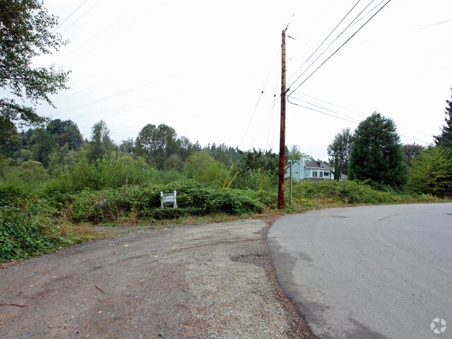
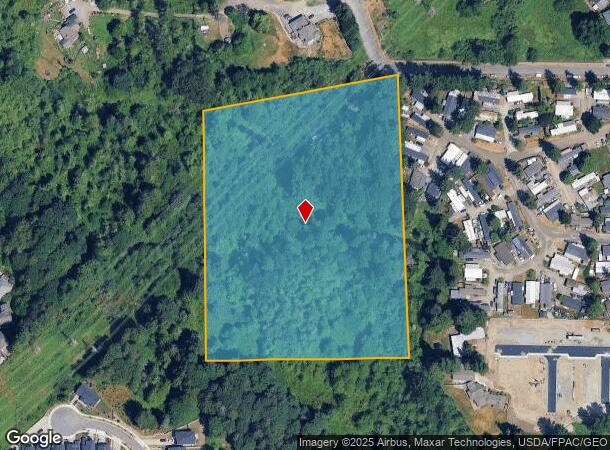
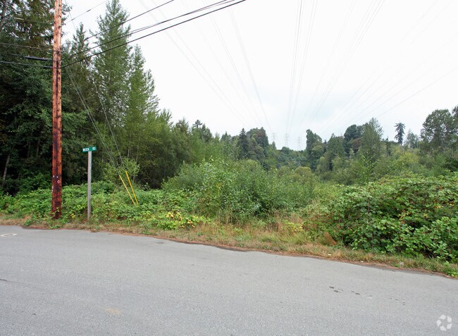
19208 Waxen Rd, Bothell, WA 98012
NEARBY LISTINGS FOR SALE OR LEASE
Property Detail
19208 Waxen Rd
Seattle-Tacoma-Bellevue, WA
Alderwood Manor
003730-011-009-00
ALDERWOOD MANOR 05 BLK 011 D-00 - LOTS 9 & 10 SUBJ ESE SEATTLE CITY LIFGT LESS QCD 403/12 TO SNO CO FOR RD
Vacantlandnec
Snohomish
A
Washington
53061C1330F
9,10
2024
8.58 AC
2025
Mill Creek/Woodinville
052006
Seattle/Puget Sound
DEMOGRAPHICS near 19208 Waxen Rd
1 Mile
3 Mile
5 Mile
2024 Total Population
19,941
125,009
349,569
2029 Population
20,840
130,618
364,664
Pop Growth 2024-2029
+ 4.51%
+ 4.49%
+ 4.32%
Average Age
36
37
39
2024 Total Households
7,417
44,725
130,947
HH Growth 2024-2029
+ 4.57%
+ 4.57%
+ 4.39%
Median Household Inc
$118,417
$133,228
$111,175
Avg Household Size
2.60
2.70
2.60
2024 Avg HH Vehicles
2.00
2.00
2.00
Median Home Value
$701,072
$751,962
$717,179
Median Year Built
1995
1996
1992
Nearby Places
Map Layers
Map Styles
 Street
 Aerial
- Restaurants
- Banks
- Shops
- Fitness
- Groceries
PUBLIC TRANSPORTATION
AIRPORT
Seattle Paine Field International
DRIVE
WALK
Distance
Seattle Paine Field International
20 min
9.1 mi
Seattle-Tacoma International
DRIVE
WALK
Distance
Seattle-Tacoma International
49 min
33.1 mi
Freight Ports
Port of Everett
DRIVE
WALK
Distance
Port of Everett
25 min
13.2 mi
Nearby Properties
Address
Land Use
TOTAL SIZE
Lot Size
Zoning
Address
Land Use
TOTAL SIZE
Lot Size
Zoning
813,456 SF
30.76 AC
PRC
Address
Land Use
TOTAL SIZE
Lot Size
Zoning
581,232 SF
43.22 AC
UC
Address
Land Use
TOTAL SIZE
Lot Size
Zoning
329,964 SF
20.07 AC
MR
Address
Land Use
TOTAL SIZE
Lot Size
Zoning
426,238 SF
9.84 AC
UC
Address
Land Use
TOTAL SIZE
Lot Size
Zoning
619,673 SF
0.34 AC
UC
Address
Land Use
TOTAL SIZE
Lot Size
Zoning
524,803 SF
PRC
Address
Land Use
TOTAL SIZE
Lot Size
Zoning
372,073 SF
9.11 AC
UC
Address
Land Use
TOTAL SIZE
Lot Size
Zoning
217,071 SF
36.47 AC
R-9,600
Address
Land Use
TOTAL SIZE
Lot Size
Zoning
233,025 SF
3.97 AC
R-9,600
Address
Land Use
TOTAL SIZE
Lot Size
Zoning
264,253 SF
29.11 AC
R 4,000
Address
Land Use
TOTAL SIZE
Lot Size
Zoning
285,554 SF
15 AC
HDR
Address
Land Use
TOTAL SIZE
Lot Size
Zoning
262,618 SF
7.05 AC
MU/HDR
Address
Land Use
TOTAL SIZE
Lot Size
Zoning
241,956 SF
20 AC
HDR
Address
Land Use
TOTAL SIZE
Lot Size
Zoning
421,873 SF
9.06 AC
PCD
Address
Land Use
TOTAL SIZE
Lot Size
Zoning
394,152 SF
18 AC
E-M
Address
Land Use
TOTAL SIZE
Lot Size
Zoning
386,535 SF
2.21 AC
UC
Address
Land Use
TOTAL SIZE
Lot Size
Zoning
181,008 SF
9.76 AC
E-L
Address
Land Use
TOTAL SIZE
Lot Size
Zoning
250,800 SF
11.69 AC
UC
Address
Land Use
TOTAL SIZE
Lot Size
Zoning
217,877 SF
17.03 AC
R 2,800
Address
Land Use
TOTAL SIZE
Lot Size
Zoning
47,176 SF
38.88 AC
R 9,600
Address
Land Use
TOTAL SIZE
Lot Size
Zoning
177,325 SF
20.54 AC
R-9,600
Address
Land Use
TOTAL SIZE
Lot Size
Zoning
213,689 SF
7.46 AC
UC
Address
Land Use
TOTAL SIZE
Lot Size
Zoning
236,844 SF
9.02 AC
CB
Address
Land Use
TOTAL SIZE
Lot Size
Zoning
189,700 SF
18.85 AC
OR-L
Address
Land Use
TOTAL SIZE
Lot Size
Zoning
210,072 SF
13.89 AC
E-L
Address
Land Use
TOTAL SIZE
Lot Size
Zoning
173,130 SF
10.27 AC
E-L
Address
Land Use
TOTAL SIZE
Lot Size
Zoning
283,224 SF
16.87 AC
MR
Address
Land Use
TOTAL SIZE
Lot Size
Zoning
243,504 SF
13.84 AC
CB
Address
Land Use
TOTAL SIZE
Lot Size
Zoning
165,456 SF
8.70 AC
UC
Address
Land Use
TOTAL SIZE
Lot Size
Zoning
222,333 SF
36.10 AC
E-M
The World's #1 Commercial Real Estate Marketplace
Connect with us
© 2025 CoStar Group
The information above has been obtained from sources believed reliable. While we do not doubt its accuracy we have not verified it and make no guarantee, warranty or representation about it. It is your responsibility to independently confirm its accuracy and completeness. Any projections, opinions, assumptions, or estimates used are for example only and do not represent the current or future performance of the property. The value of this transaction to you depends on tax and other factors which should be evaluated by your tax, financial, and legal advisors. You and your advisors should conduct a careful, independent investigation of the property to determine to your satisfaction the suitability of the property for your needs.